South Side Trail - TRHT
Distance:
9.8 Miles / 15.8 kmType:
Out-and-BackDifficulty:
EasyTime to Hike:
4 hours, ~54 minutesFeatures:
Surface Type:
Semi-PavedLoading...
Loading...
The South Side Three Rivers Heritage Trail in Pittsburgh, Pennsylvania is a flat and easy 9.8 mile out-and-back hike that starts at the end of the TRHT Station Square Trail and runs all the way to the Glenwood Bridge in Pittsburgh, PA.
This is the longest southern section of the TRHT and runs entirely along the Monongahela River until it reaches the Glenwood Bridge where it technically turns into the Great Allegheny Passageway.
The trail cuts through the South Side Riverfront Park where the trail generally splits into two, but both branches head the same way. Just after the dog park, there's a large parking lot where the trail either runs next to the river or runs just above the river with access to the South Side Works - an outdoor shopping area. Just before you reach the Hot Metal Bridge, these two sections of trail meet up once again before crossing Hot Metal Street and continuing on along the river.
Sights: Along the trail you'll find views of downtown, Oakland, the Cathedral of Learning, and the Hot Metal Bridge. Further down the trail, within the Baldwin Borough section, lies some old coal barges rotting away on the river banks. Just before the Hot Metal Bridge is a large old slag pot that was used to carry slag to the Nine Mile Run back when that area was a slag dumping ground.
Bald Eagles: Around miles 4.4 (heading east), there's a spot along the trail where Bald Eagles have decided to build nests in the trees. During the colder months, you can see the large nests in the trees closer to the river. There are signs here that basically ask you to not disturb the rare birds.
Parking: There are various places to park along this trail; however, the easiest and free parking area can be found at the Get Directions coordinates provided. You can also park near the Hot Metal Bridge, but you'll need to pay for parking meters or garages, where prices vary. If you plan to park near the Hot Metal Bridge and plan to hike about 6 miles, $3 should get you enough time.
-
Parking
40.431189, -79.992344 -
Main Trailhead
40.431174, -79.991457 -
Hot Metal Bridge
40.429222, -79.963989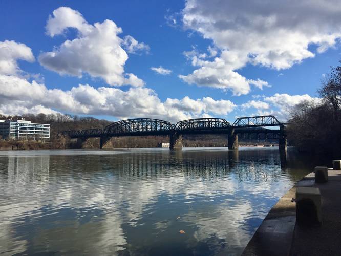
-
Slag pot
40.428378, -79.963439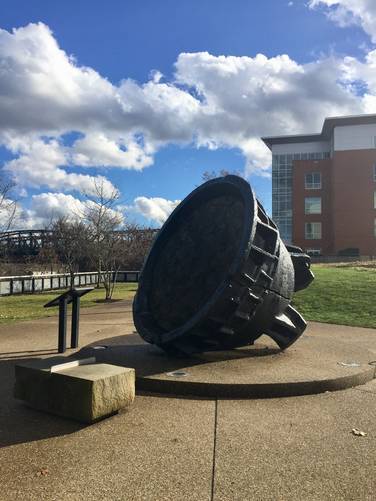
-
Old coal barges
40.405425, -79.953111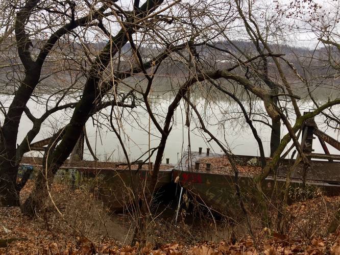
-
Balde eagle viewing area
40.395608, -79.942711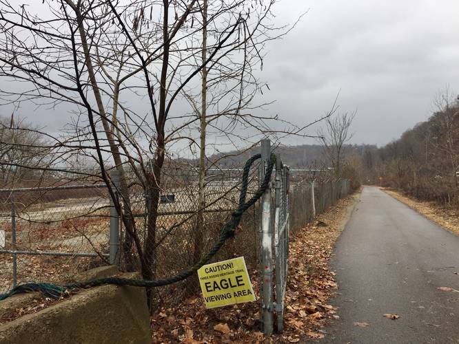
Hazards
Seasons
All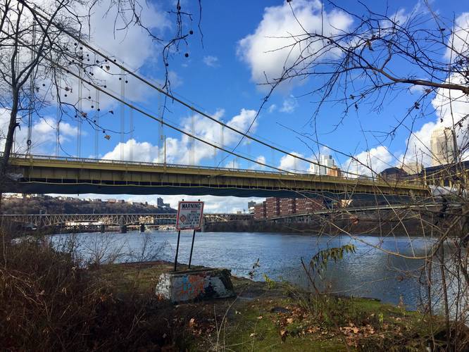
2 Trip Reports


Helpful Links
Find Hiking Trails Near Me:


Before you leave...
MyHikes is an indie web platform aimed to make exploring public trails easier for everyone. The site has no investors and is owned and operated by one person, Dave Miller (Founder & Admin). As the Founder, main contributor, and doer-of-all-things for MyHikes, I share my trips with over-detailed write-ups for fun on a volunteer basis and I believe that public trail information should be available to everyone.
It takes a lot of time 🕦, money 💰, and effort (including espresso shots ☕) to run MyHikes, including hiking , mapping , writing , and publishing new trails with high-quality content... along with building new features, moderating, site maintainance, and app development for iOS and Android . I simply ask that if you find MyHikes' trail guides helpful to please consider becoming a Supporter to help keep the site, iOS, and Android apps available to everyone.
Supporters unlock website and in-app perks with a one-time payment of $25 (you renew) 😎👍. Or you can simply make a Donation of your choice without a MyHikes user account. Otherwise, telling your friends about MyHikes is the next-best thing - both quick and free 🎉
Thanks for visiting MyHikes and have a great hike!️

Dave Miller
MyHikes Founder & Admin

