Sugar Hill Pond and Twin Lean-Tos Hike
Distance:
2.3 Miles / 3.7 kmType:
Out-and-BackDifficulty:
ModerateTime to Hike:
1 hour, ~9 minutesFeatures:
Surface Type:
DirtLoading...
Loading...
The Sugar Hill Pond and Twin Lean-Tos Hike at Sugar Hill State Forest near Tyrone, New York is a moderate 2.3-mile out-and-back hike that features views of the Sugar Hill Fire Tower, Sugar Hill Pond, and leads to two lean-to campsites (aka Twin Lean-Tos).
If planning to just explore the Sugar Hill Fire Tower, hikers can read our guide on that short, easy hike; however, this hike passes a view of the fire tower and does not lead to its base.
Hike
This hike begins at the main trailhead for Sugar Hill State Forest located on the south side of Tower Hill Road near Tyrone, NY. Hikers will head-in along the dirt service road that leads up to the top of Sugar Hill. The hike to the top is easy, but is uphill the entire way. At the top of Sugar Hill, hikers will pass a view of the Sugar Hill Fire Tower near mile 0.3. At the top of Sugar Hill are seasonal restrooms and first-come first-serve campsites that line the boundaries of the forest - mainly located to the south.
Summit to Onondaga Trail - Mile 0.3 to 0.55
From the summit, located near the restrooms, hikers will head due-south - passing campsites - to reach a trail that runs east and west, located behind the horse stables - this is the Onondaga Trail. Take a right-hand turn onto the Onondaga Trail and follow it for approximately 300-feet before taking a left-hand turn onto a trail that leads to the Seneca Trail.
Seneca Trail to Sugar Hill Pond - Mile 0.55 to 0.7
At mile 0.55, hikers will take a left-hand turn onto the Seneca Trail as it heads southward toward the Twin Lean-Tos. Along the way is an off-shoot trail that leads to the Sugar Hill Pond. Hike down this short spur trail to reach a small but scenic view of the tiny Sugar Hill Pond that sits on the slopes of the mountain/hill.
After visiting Sugar Hill Pond, hikers will continue heading south toward the Twin Lean-Tos. Around mile 0.95, hikers will reach a junction in the Seneca Trail -- keep left here to find the Twin Lean-Tos.
Campsite - Mile 0.6
Around mile 0.6, along the Seneca Trail, is a designated campsite that sits on the west side of the trail. Note that this campsite can collect filterable water from the nearby Sugar Hill Pond.
Twin Lean-Tos - Mile 1
At 1 mile into the hike, you'll reach the Twin Lean-Tos that sit along the Seneca Trail just east of the Mohawk Trail junction. The twin lean-tos are separated by ~200-feet of forest, with a privy that sits in between them. Campers can setup here for the night. Note that this trail continues downhill along the Mohawk Trail to reach a creek that can be used for water collection (and filtration).
Mohawk Trail to Creek - Mile 1.1 to 1.3
The hike data included here adds extra mileage to a creek located 0.2-miles downhill from the Twin Lean-Tos. For most hikers, they can skip this portion, but it's included in the mileage for backpackers who wish to collect and filter water from the creek. To get to the creek, backtrack to the trail junction west of the lean-tos and hike down the blue-blazed Mohawk Trail for 0.2-miles or so.
Hiking Out - Mile 1.3 to 2.3
The hike out from the creek and back to parking is mostly all downhill, with the exception of the descent from the old fire tower. The steepest section of the hike is from the Seneca to Onondaga connection as it ascends back to the summit of Sugar Hill. Once back at the top of Sugar Hill, follow the service road back down to the parking lot to complete this 2.3-mile out-and-back hike.
Parking
Hikers will find the closest parking lot located on
the south side of Tower Hill Road near Tyrone, NY at the coordinates
provided. The lot is large enough to fit a couple dozen vehicles at
most. Note that the road that leads up to the fire tower is closed to
the general public for vehicles and exists only as a foot path.
Camping
Backpackers and campers will be happy to find several different places to camp along this trail. At the very top of Sugar Hill, just south of the Sugar Hill Fire Tower (bordering the forest) are a couple dozen campsites with picnic tables and fire pits. Further down the trail are the Twin Lean-Tos which are tucked away in the forest, but provide additional spots to camp. These campsites and lean-tos appear to be first-come
first-serve, have picnic tables, and more. Please follow all state
forest rules and regulations if camping.
Restrooms
During warmer months, there's a restroom facility near the fire tower at the top of Sugar Hill.
Water Sources
Warm months: There's a water source in the western section of the campsites atop Sugar Hill. Turned-off during cold months.
Colder months: Sugar Hill Pond or the creek below the Twin Lean-Tos can be filtered. Always filter and treat the water before drinking water collected in the backcountry. Note that moving water is always preferable and it's best to avoid stagnant water if in-need.
-
Parking
42.39048, -77.003203 -
Main Trailhead
42.3904, -77.003149 -
Many campsites atop Sugar Hill
42.38615, -77.002311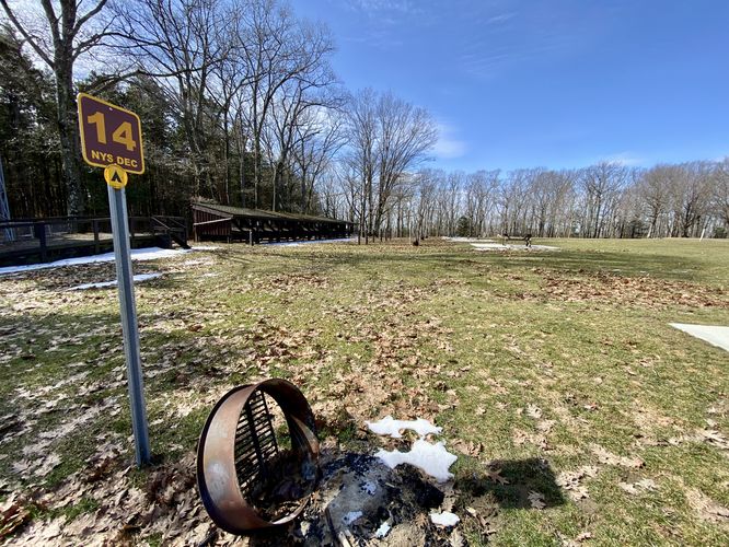
-
Campsite
42.384811, -77.004944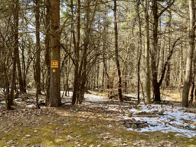
-
Sugar Hill (Twin) Lean-To #1
42.382194, -77.002708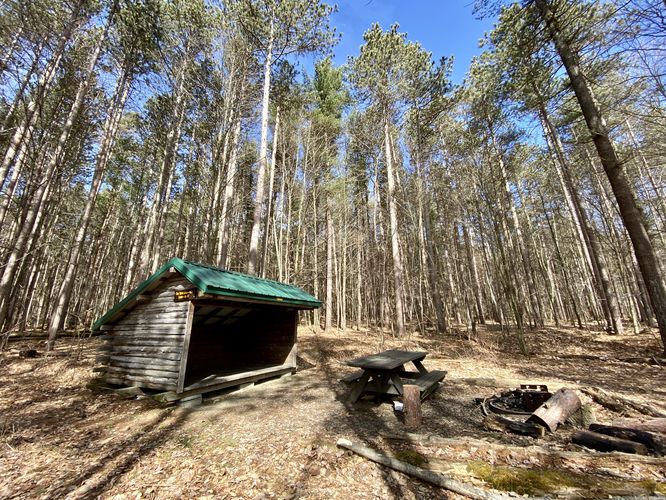
-
Privy
42.382044, -77.002503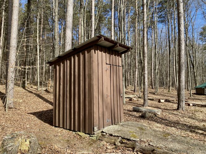
-
Sugar Hill (Twin) Lean-To #2
42.382092, -77.002053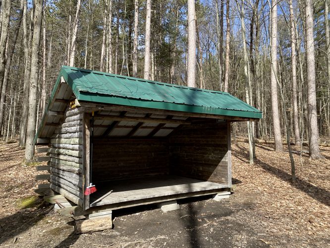
-
View of Sugar Hill Pond
42.384269, -77.005806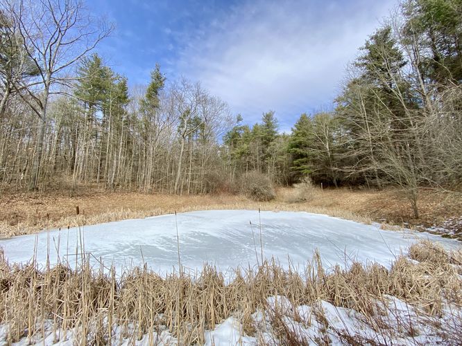
-
Water source (seasonal)
42.386344, -77.002906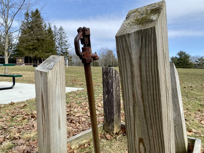
-
View of the Sugar Hill Fire Tower
42.387044, -77.003447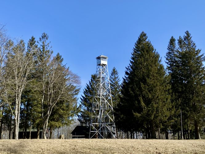
Hazards
Seasons
All
2 Trip Reports


")


Before you leave...
MyHikes is an indie web platform aimed to make exploring public trails easier for everyone. The site has no investors and is owned and operated by one person, Dave Miller (Founder & Admin). As the Founder, main contributor, and doer-of-all-things for MyHikes, I share my trips with over-detailed write-ups for fun on a volunteer basis and I believe that public trail information should be available to everyone.
It takes a lot of time 🕦, money 💰, and effort (including espresso shots ☕) to run MyHikes, including hiking , mapping , writing , and publishing new trails with high-quality content... along with building new features, moderating, site maintainance, and app development for iOS and Android . I simply ask that if you find MyHikes' trail guides helpful to please consider becoming a Supporter to help keep the site, iOS, and Android apps available to everyone.
Supporters unlock website and in-app perks with a one-time payment of $25 (you renew) 😎👍. Or you can simply make a Donation of your choice without a MyHikes user account. Otherwise, telling your friends about MyHikes is the next-best thing - both quick and free 🎉
Thanks for visiting MyHikes and have a great hike!️

Dave Miller
MyHikes Founder & Admin

