Sam Graham Trees Trail
Distance:
1.0 Mile / 1.6 kmType:
One-WayDifficulty:
EasyTime to Hike:
~30 minutesFeatures:
Surface Type:
DirtLoading...
Loading...
The Sam Graham Trees Trail at the Matthaei Botanical Gardens in Ann Arbor, Michigan is an easy 1-mile one-way hike that features a grove of labeled trees and a nice walk alongside Fleming Creek.
Hike Description
This hike begins along the northeast corner of the Sue Reichert Discovery Trail, located adjacent to the entrance road, and heads northwest through the Sam Graham Trees.
Sam Graham Trees - Mile 0 to 0.25
From the trailhead through mile 0.25, hikers will pass by dozens of different species of trees. Almost all of them have labels, though, some trees are a bit difficult to identify if the trees are bare of leaves.
Pine-Aspen Loop - Mile 0.25 to 0.5
After passing through the loop of the Sam Graham Trees, hikers will cross the road to continue following the trail as it leads through a mostly-open field, through the Pine-Aspen Loop. This track heads in a clockwise direction which leads through a grove of Bigtooth Aspen trees. The track then doubles back to map the trail's loop and then exits the field as it slowly goes back into a more timber-filled forest before reaching Fleming Creek.
Fleming Creek Walk - Mile 0.6 to 0.9
From miles 0.6 to mile 0.9, hikers will walk adjacent to Fleming Creek, which provides some scenic views of the creek as it meanders through the forest. Along the way are a couple of wooden viewing platforms to see the creek and there's a trail information kiosk close to mile 0.9.
Keeping right, after the information kiosk / hut, will send hikers out to the southern trailhead, which exists the trail right at the main parking lot.
Parking & Fees
Hikers will find parking at the coordinates
provided at the main lot for the Matthaei Botanical Garden. There's a
small fee of $5 for the day or $1.50/hour to park - rates may change,
please check their website before visiting. Note that there are
technically no fees to walk the grounds or enter the botanical garden.
Pets
Dogs are not allowed on any trails at the Matthaei Botanical Garden.
Water Source
The botanical garden has a free water fountain inside the main building that hikers can use to refill their water bottles.
Restrooms
There are restrooms inside the botanical garden's main building.
Warning
Rattlesnakes: This area is known to inhabit
rattlesnakes. They tend to sun themselves on trails, rocky spots, or
bare areas with gravel or rocks. These rattlesnakes could be anywhere
during warm months (April - October), so be on the lookout and give any
rattlers you find plenty of space.
-
Parking
42.299932, -83.661706 -
Main Trailhead
42.301409, -83.661914 -
View of Fleming Creek
42.303939, -83.660217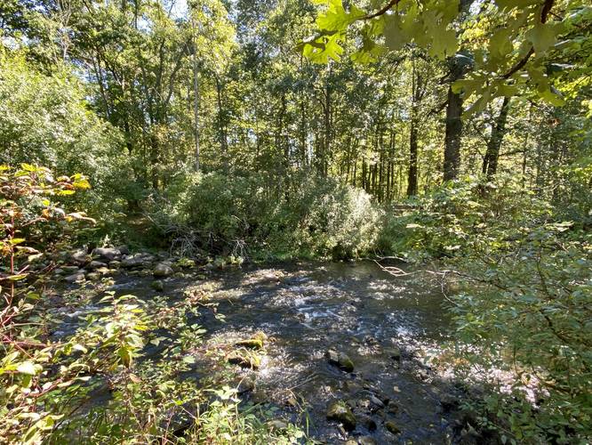
-
Fleming Creek viewing platform
42.300647, -83.659875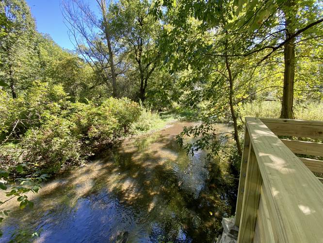
-
Trail kiosk / hut
42.300189, -83.660119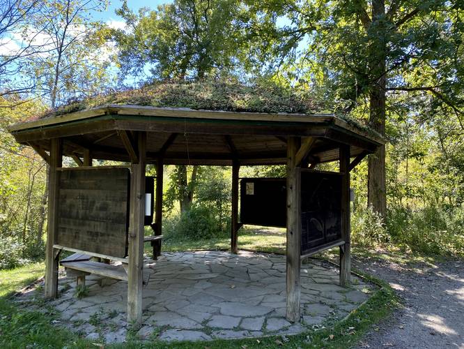
Hazards
Seasons
All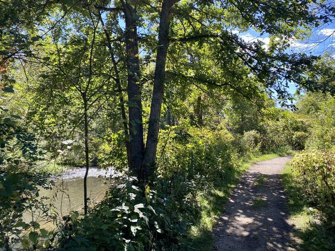
2 Trip Reports


Before you leave...
MyHikes is an indie web platform aimed to make exploring public trails easier for everyone. The site has no investors and is owned and operated by one person, Dave Miller (Founder & Admin). As the Founder, main contributor, and doer-of-all-things for MyHikes, I share my trips with over-detailed write-ups for fun on a volunteer basis and I believe that public trail information should be available to everyone.
It takes a lot of time 🕦, money 💰, and effort (including espresso shots ☕) to run MyHikes, including hiking , mapping , writing , and publishing new trails with high-quality content... along with building new features, moderating, site maintainance, and app development for iOS and Android . I simply ask that if you find MyHikes' trail guides helpful to please consider becoming a Supporter to help keep the site, iOS, and Android apps available to everyone.
Supporters unlock website and in-app perks with a one-time payment of $25 (you renew) 😎👍. Or you can simply make a Donation of your choice without a MyHikes user account. Otherwise, telling your friends about MyHikes is the next-best thing - both quick and free 🎉
Thanks for visiting MyHikes and have a great hike!️

Dave Miller
MyHikes Founder & Admin

