Battery Warren Trail
Distance:
1.0 Mile / 1.6 kmType:
Out-and-BackDifficulty:
EasyTime to Hike:
~30 minutesFeatures:
Surface Type:
DirtLoading...
Loading...
The Battery Warren Trail at Francis Marion National Forest in Berkeley County, South Carolina is an easy 1-mile out-and-back hike that leads to a Civil War era artillery battery.
This trail leads from the Battery Warren trailhead, passing through a primarily-evergreen and pine forest, out to the edge of the Santee River. Along the way, hikers may find flooded or muddy sections of trail, especially during wet months, Carolina Jasmine wildflowers, and hanging spanish moss that grow along the trail.
Battery Warren - Mile 0.4 to 0.5
At mile 0.4, hikers will reach an interpretive sign at the southern end of Battery Warren. You'll notice the artillery battery's hills immediately. As of March 2024, the vegetation around Battery Warren was killed-off so visitors can see the topography of the hills that the civil war soldiers built. The Battery is about 0.1-miles long (~500-feet) so you can walk the length of the outpost either along the very-top of it or in between the multi-tiered levels. On the far side of Battery Warren, around mile 0.5, hikers will find a view of the Santee River along with additional historical interpretive signs. As of March 2024, there's also a staircase that leads down from Battery Warren to reach a steep embankment along the Santee River -- possibly for fishing access.
After exploring Battery Warren, hikers will head back to parking for a 1-mile out-and-back hike.
Parking
Hikers should be aware that they must drive several miles through backcountry dirt roads to reach this trailhead. Some of the roads are filled with potholes, so watch out. The parking situation at the trailhead is easy - plenty of parking spaces that can fit over a dozen vehicles as of March 2024.
Camping & Backpacking
Camping is permitted within the national forest and near the trailhead is a wide-open grassy space that provides enough room to setup a campsite. No defined fire pits were found here as of March 2024, but backpackers or short-term campers will find plenty of space. Please follow all national forest rules & regulations when dispersed / primitive / backcountry camping.
Pets
Dogs are allowed only if leashed and must be cleaned up after.
-
Parking
33.243504, -79.536756 -
Main Trailhead
33.243573, -79.536619 -
Battery Warren (south end)
33.248622, -79.536681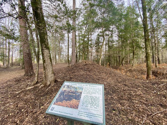
-
Battery Warren
33.249414, -79.536203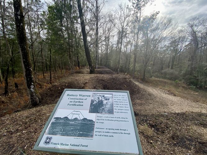
-
View of the Santee River
33.249503, -79.536064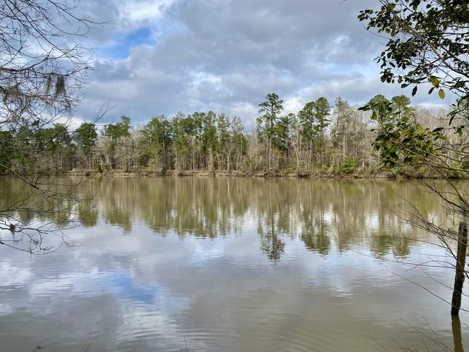
-
Camping area
33.244258, -79.536019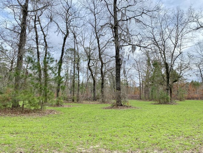
Hazards
Seasons
All
1 Trip Report


Helpful Links
Find Hiking Trails Near Me:


Before you leave...
MyHikes is an indie web platform aimed to make exploring public trails easier for everyone. The site has no investors and is owned and operated by one person, Dave Miller (Founder & Admin). As the Founder, main contributor, and doer-of-all-things for MyHikes, I share my trips with over-detailed write-ups for fun on a volunteer basis and I believe that public trail information should be available to everyone.
It takes a lot of time 🕦, money 💰, and effort (including espresso shots ☕) to run MyHikes, including hiking , mapping , writing , and publishing new trails with high-quality content... along with building new features, moderating, site maintainance, and app development for iOS and Android . I simply ask that if you find MyHikes' trail guides helpful to please consider becoming a Supporter to help keep the site, iOS, and Android apps available to everyone.
Supporters unlock website and in-app perks with a one-time payment of $25 (you renew) 😎👍. Or you can simply make a Donation of your choice without a MyHikes user account. Otherwise, telling your friends about MyHikes is the next-best thing - both quick and free 🎉
Thanks for visiting MyHikes and have a great hike!️

Dave Miller
MyHikes Founder & Admin

