Heath Trail
Distance:
0.6 Miles / 1.0 kmType:
LoopDifficulty:
EasyTime to Hike:
~18 minutesFeatures:
Surface Type:
DirtLoading...
Loading...
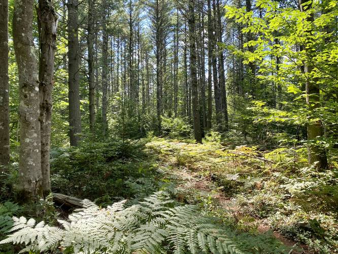
The Heath Trail at Grant's Meadow Preserve in North Berwick, Maine is an easy 0.6-mile loop that leads through a most-flat fern-filled forest during the Summer and also provides access to a Beaver Dam Heath during the Winter where hikers can find a rare stand of White Atlantic Cedar trees.
Hike Description
This trail begins at the parking lot for Grant's Meadow Preserve and follows orange blazes as it meanders its way through a mixed forest of deciduous and conifer trees. During the Summer, this trail is full of tall ferns, which makes for a neat short hike that feels almost jungle-like.
Parking
Hikers will find a large parking lot at the coordinates provided, large enough to fit a dozen vehicles.
Pets
Dogs are allowed if leashed and their waste should be carried out by the hiker.
Hazards
Seasons
AllBlaze Color
2 Trip Reports


Helpful Links
Find Hiking Trails Near Me:


Before you leave...
MyHikes is an indie web platform aimed to make exploring public trails easier for everyone. The site has no investors and is owned and operated by one person, Dave Miller (Founder & Admin). As the Founder, main contributor, and doer-of-all-things for MyHikes, I share my trips with over-detailed write-ups for fun on a volunteer basis and I believe that public trail information should be available to everyone.
It takes a lot of time 🕦, money 💰, and effort (including espresso shots ☕) to run MyHikes, including hiking , mapping , writing , and publishing new trails with high-quality content... along with building new features, moderating, site maintainance, and app development for iOS and Android . I simply ask that if you find MyHikes' trail guides helpful to please consider becoming a Supporter to help keep the site, iOS, and Android apps available to everyone.
Supporters unlock website and in-app perks with a one-time payment of $25 (you renew) 😎👍. Or you can simply make a Donation of your choice without a MyHikes user account. Otherwise, telling your friends about MyHikes is the next-best thing - both quick and free 🎉
Thanks for visiting MyHikes and have a great hike!️

Dave Miller
MyHikes Founder & Admin

