Peters Mountain via Appalachian Trail
Distance:
3.9 Miles / 6.3 kmType:
LoopDifficulty:
ModerateTime to Hike:
1 hour, ~57 minutesFeatures:
Surface Type:
DirtLoading...
Loading...
Peters Mountain via Appalachian Trail in Reed, Pennsylvania is a moderate 3.9-mile loop hike that features views of the Susquehanna River valley.
Trails
This hike follows two named trails: Appalachian Trail (white blazes), Susquehanna Trail (blue blazes).
Hike
This loop hike begins at the Clarks Ferry Park & Ride at the junction of US-22 and PA-147 in Reed, PA. Hikers will walk eastbound on PA-147 to find an "Appalachian Trail" sign located on the south side of the road. Here, you'll cross the train tracks to reach the trailhead. Be careful at the road and train track crossings.
Spur to Loop - Mile 0 to 0.4
From the trailhead, hikers will begin their trek along the Appalachian Trail as it ascends from the northern base of Peters Mountain. The sloping grade of the mountain here is extremely steep, so it's smart to stay on-trail for this portion of the hike. The trail will hit a couple of switchbacks before continuing to skirt along the steep northern slopes of Peters Mountain, passing some small rock ledges along the way.
Susquehanna River View - Mile 0.4
At mile 0.4, hikers will first hit the junction with the blue-blazed Susquehanna Trail that leads up to Peters Mountain. This loop brings hikers the opposite way, by following the white blazes of the Appalachian Trail, first hitting a nice view of the Susquehanna River where the Juniata River meets. During colder months, this view is a bit better than when the leaves are on the trees.
After the first vista, the AT follows a mostly-flat route as it heads toward the switchbacks that lead up to the top of the mountain. During seasons with no leaves on the trees, hikers can spot Hawk Rock Mountain located across the river gap (which is another fun AT section hike).
Switchbacks to Rocky Outcropping Vista - Mile 0.95 to 1.4
Hikers will reach switchbacks that ascend the western slopes of Peters Mountain around mile 0.95. Here, the trail becomes more difficult, but the grade of the trail should not be considered much harder than "moderate" difficulty. Finally, hikers will reach the top of Peters Mountain along its western slopes, around mile 1.4. Here, you'll find a large rock outcropping that provides views of the Susquehanna River and obstructed views of Hawk Rock Mountain - the view here is better when there are no leaves on the trees.
Peters Mountain Ridge & Vistas - Mile 1.4 to 2.1
Once you reach the top ridge of Peters Mountain, hikers will trek along its rock-jutted terrain to reach several vista points. The most noteworthy view is located around mile 1.7 where you'll find sweeping south-facing views of the Susquehanna River valley located south of Duncannon, PA heading toward Harrisburg, PA. This view is probably what most hikers are after and the space is large enough on the sloping bedrock to sit and enjoy it for as long as you wish. Heading onward, the terrain includes some ascends and descents along the mountain's ridge but none are very steep or long. You'll also find more views from the ridge, like around 1.8 with a view of the Duncannon, PA area. Just beyond that view at mile 1.8 is a neat jutting rock that hikers can stand on for a neat photo-op. Then finally the last set of views is around mile 2.1 where you'll find views of the Susquehanna and Juniata River's confluence.
Scramble - Mile 2.15
Just beyond the last set of views is a ~10-foot tall rock ledge scramble that hiker should be aware of. It's not difficult or technical, but may be more difficult if you have a small dog that needs help in either direction.
Susquehanna Trail Junction - Mile 2.45
Around mile 2.45, hikers will find the blue-blazed Susquehanna Trail that runs back down Peters Mountain to reach the AT, completing the loop. Hike northward at this junction to follow the Susquehanna Trail down the mountain. Most of the trail follows a gradual but moderate grade. There's an old service road that cuts through the trail -- stay straight to connect back to the AT.
AT to Parking - Mile 3.5 to 3.95
Hikers will hit the AT around mile 3.5 to take this spur back to the parking lot, completing the loop for ~3.95 miles.
Parking
Hikers will find a large commuter parking lot located at the junction of US-22 and PA-147 at the coordinates provided in Reed, PA. The lot is large enough to fit a dozen vehicles or so with additional parking located nearby.
Warnings
Steep terrain: This hike follows steep terrain. It's best to stay on-trail during these sections.
Timber Rattlesnake: Pennsylvania is home to the Timber Rattlesnake and while this area of the state may have less rattlers than the northern section, there's a chance they could be roaming the forest between the end of April and early October each year. Rattlers love open, rocky spaces to sunbathe so be on the lookout. Give any rattlers you find plenty of space.
-
Parking
40.395912, -77.008379 -
Main Trailhead
40.395793, -77.007624 -
View of the Susquehanna and Juniata River confluence
40.392586, -77.013322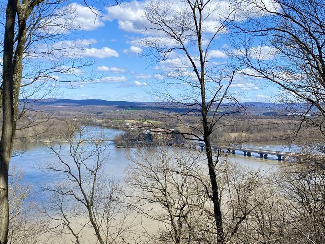
-
View of the Susquehanna River
40.385397, -77.0149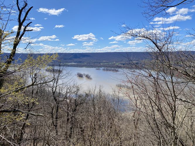
-
View of the Susquehanna River
40.385658, -77.014625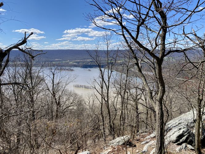
-
View of Duncannon, PA from Peters Mountain
40.385914, -77.014594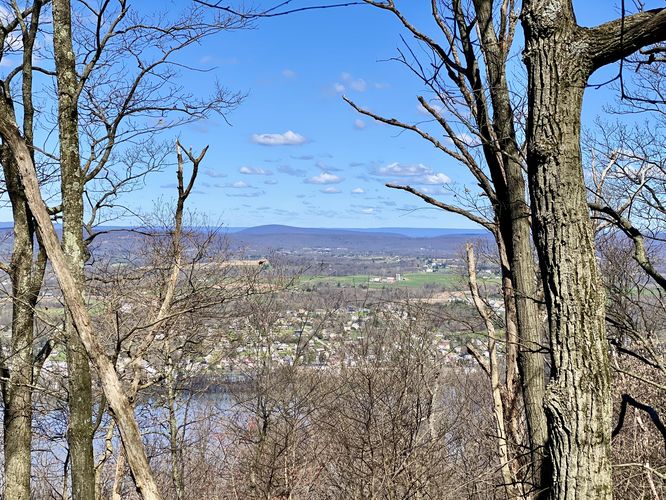
-
Susquehanna River valley vista
40.387189, -77.011056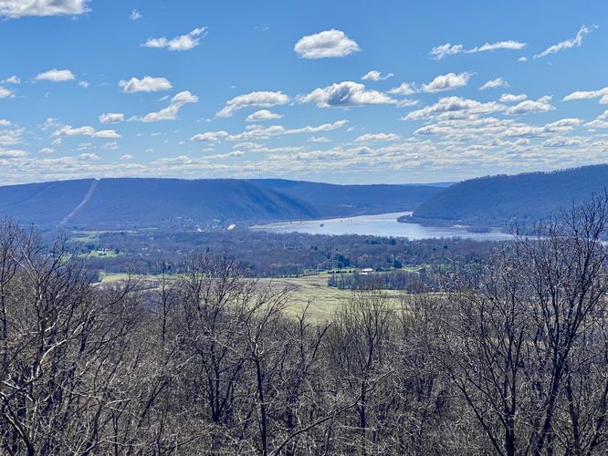
-
Susquehanna River valley vista
40.387181, -77.011056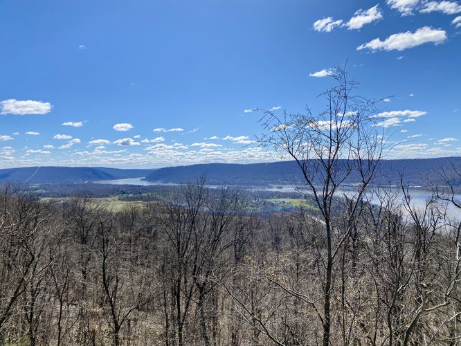
-
Susquehanna River valley vista
40.387339, -77.010597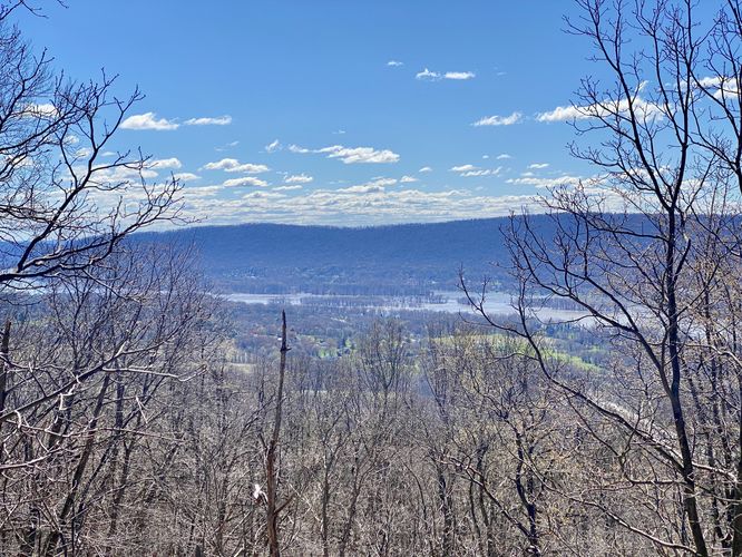
-
View of Duncannon, PA from Peters Mountain
40.387878, -77.009567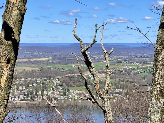
-
Jutting rock
40.387961, -77.009422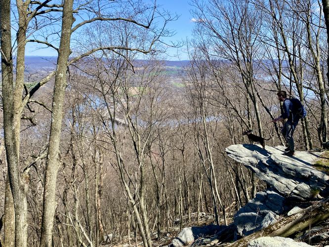
-
View of Duncan and Haldeman Islands
40.389894, -77.004411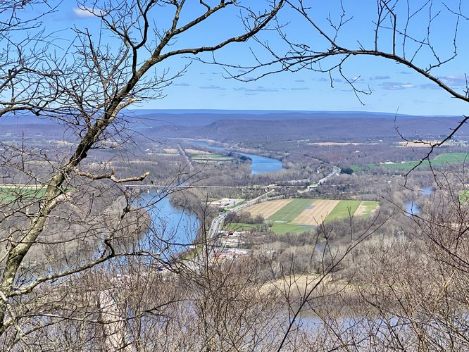
-
Northward view
40.389922, -77.004342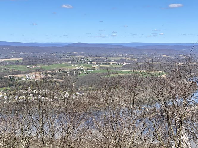
-
View of Duncannon, PA
40.389922, -77.004342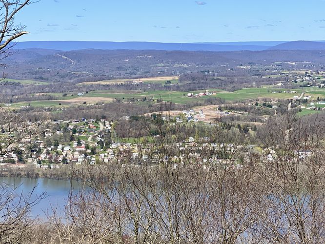
-
Scramble
40.390092, -77.003936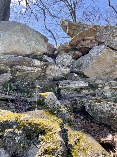
Hazards
Seasons
AllBlaze Color
1 Trip Report


Before you leave...
MyHikes is an indie web platform aimed to make exploring public trails easier for everyone. The site has no investors and is owned and operated by one person, Dave Miller (Founder & Admin). As the Founder, main contributor, and doer-of-all-things for MyHikes, I share my trips with over-detailed write-ups for fun on a volunteer basis and I believe that public trail information should be available to everyone.
It takes a lot of time 🕦, money 💰, and effort (including espresso shots ☕) to run MyHikes, including hiking , mapping , writing , and publishing new trails with high-quality content... along with building new features, moderating, site maintainance, and app development for iOS and Android . I simply ask that if you find MyHikes' trail guides helpful to please consider becoming a Supporter to help keep the site, iOS, and Android apps available to everyone.
Supporters unlock website and in-app perks with a one-time payment of $25 (you renew) 😎👍. Or you can simply make a Donation of your choice without a MyHikes user account. Otherwise, telling your friends about MyHikes is the next-best thing - both quick and free 🎉
Thanks for visiting MyHikes and have a great hike!️

Dave Miller
MyHikes Founder & Admin

