East Glenwood Open Space Entrance Trail
Distance:
0.8 Miles / 1.3 kmType:
Out-and-BackDifficulty:
EasyTime to Hike:
~24 minutesFeatures:
Surface Type:
DirtLoading...
Loading...
The East Glenwood Entrance Trail at the East Glenwood Open Space Preserve is an easy 0.8-mile out-and-back trail that connects the parking lot to the official entrance to the open space. Note that this trail actually passes through a public space referred to as Glenwood Meadows.
Parking
Hikers will find a medium-sized parking lot at the coordinates provided that can fit upwards of about 20-vehicles if not a bit less. Upon this visit I was the first person here on a Tuesday around 8AM, but when I left at 9AM, the lot was half-full, so it's fairly popular for morning walkers.
Pets
Dogs are allowed on this trail, but dogs are not allowed beyond this entrance trail and must be kept outside of the defined open space area. Note that dogs are not allowed due to the East Glenwood Open Space Preserve's use of cow grazing to keep rare wildlife (both plants and animals) flourishing here.
Warnings
Rattlesnakes, mountain lion, wasps, poison oak, and ticks may all be found within this park.
Prohibited
No camping, no plant/animal/mineral collecting, no motorized vehicles or horses. No smoking, no alcohol.
Hazards
Seasons
All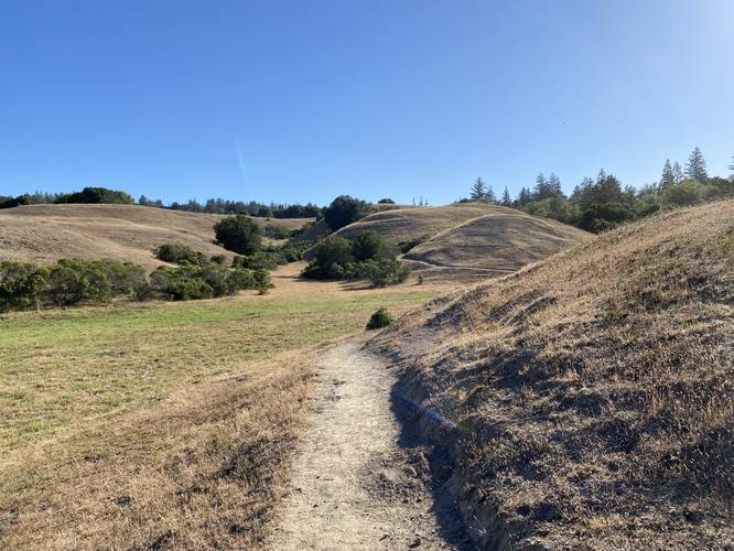
1 Trip Report


Helpful Links
Find Hiking Trails Near Me:


Before you leave...
MyHikes is an indie web platform aimed to make exploring public trails easier for everyone. The site has no investors and is owned and operated by one person, Dave Miller (Founder & Admin). As the Founder, main contributor, and doer-of-all-things for MyHikes, I share my trips with over-detailed write-ups for fun on a volunteer basis and I believe that public trail information should be available to everyone.
It takes a lot of time 🕦, money 💰, and effort (including espresso shots ☕) to run MyHikes, including hiking , mapping , writing , and publishing new trails with high-quality content... along with building new features, moderating, site maintainance, and app development for iOS and Android . I simply ask that if you find MyHikes' trail guides helpful to please consider becoming a Supporter to help keep the site, iOS, and Android apps available to everyone.
Supporters unlock website and in-app perks with a one-time payment of $25 (you renew) 😎👍. Or you can simply make a Donation of your choice without a MyHikes user account. Otherwise, telling your friends about MyHikes is the next-best thing - both quick and free 🎉
Thanks for visiting MyHikes and have a great hike!️

Dave Miller
MyHikes Founder & Admin

