Balanced Rock Trail
Distance:
0.3 Miles / 0.5 kmType:
LoopDifficulty:
EasyTime to Hike:
~9 minutesFeatures:
Surface Type:
Universal AccessLoading...
Loading...
The Balanced Rock Trail at Arches National Park near Moab, Utah is an easy 0.3-mile loop hike that features different views of Balanced Rock in addition to views of the La Sal Mountains.
Universal Access
Note that this trail is universally-accessible on the western side of Balanced Rock. The eastern portion of the trail is not universally-accessible.
Hike Description
This very short hike begins at the main parking lot for Balanced Rock and heads in along the Balanced Rock Trail as it meanders its way southward, passing the towering rock spire. On the hike, you'll encompass the rock spire, which provides new and different angles of Balanced Rock from several vantage points. Hikers will get views of Balanced Rock throughout the entire hike.
La Sal Mountains View - Mile 0.15
Around mile 0.15, before heading up the rock steps, hikers will find a nice view -- facing southwest -- of the La Sal Mountains in addition to the rock spires that appear to be scattered around the Arches National Park landscape.
Circling Balanced Rock - Mile 0.15 to 0.3
After passing the La Sal Mountains view, hikers will head up the rock steps to continue their loop hike around Balanced Rock. As promised, you'll get more and different views of the rock formation as you make your way around it and eventually back to parking.
How to Get Into Arches National Park
Note that Arches National
Park, as of September 2023 (and earlier) only allows vehicles to enter
the park during scheduled time slots. You can read all about Arches'
timed entry here and you can find reservation information here.
Reservations are grabbed quickly, so be sure to log onto the
reservation website when the date opens up to grab your timed entry
ticket. Note that vehicles can enter the park outside of the timed entry
slots (i.e. before 7AM or after 4PM each day, as of September 2023). If
you do not have a timed entry ticket between 7AM and 4PM, do not wait
in line to enter the park as you will be turned away and will slow
everyone else down. The vehicle line to enter the park is very long and wait-times to enter can be a pain so show up prepared.
Parking
Hikers
will find a large parking lot at the coordinates provided along Main Park Road in Arches National Park. The lot is
large enough to fit several dozen vehicles.
Popularity
This is a popular hike at Arches National Park, so you'll likely see plenty of other people on the trail.
Pets
Dogs are not allowed on any trails at Arches National Park. Please do not bring your dog here.
Fees
As of September 2023, there's a $30 fee per vehicle to enter Arches National Park.
Warnings
Sun exposure:
This trail has very little shade and no water sources. Pack-in all
water and wear sun screen and a hat to protect against sun exposure.
It's smart to hike either in the early morning or late afternoon to
avoid the intense desert sun.
No water: This trail has no
water sources so you must pack-in all water. A general rule of thumb in
the desert is 1 gallon of water per person per day.
Rattlesnakes: This is rattlesnake territory, so be on the lookout and give any rattlers you find plenty of space.
-
Parking
38.701686, -109.566199 -
Main Trailhead
38.701726, -109.566058 -
Balanced Rock
38.700731, -109.565086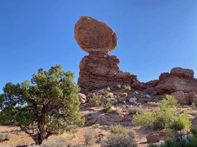
-
View of the rock spire landscape and La Sal Mountains
38.700358, -109.564675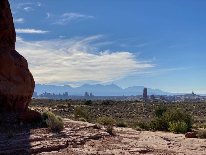
-
More angles of Balanced Rock
38.700711, -109.564383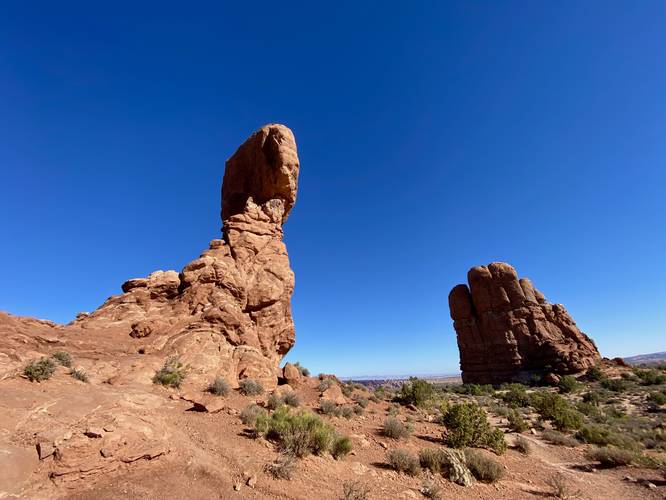
-
A mushroom-shaped angle of Balanced Rock
38.701122, -109.564261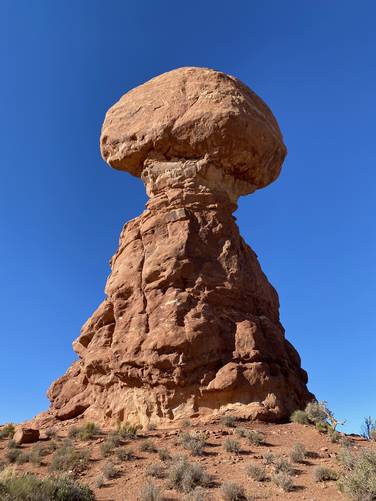
-
Balanced Rock
38.701339, -109.565431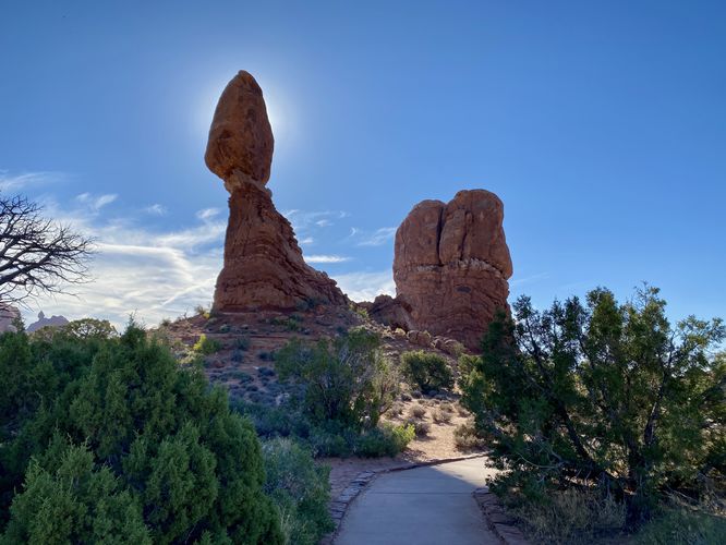
Hazards
Seasons
All
2 Trip Reports


Helpful Links
Find Hiking Trails Near Me:


Before you leave...
MyHikes is an indie web platform aimed to make exploring public trails easier for everyone. The site has no investors and is owned and operated by one person, Dave Miller (Founder & Admin). As the Founder, main contributor, and doer-of-all-things for MyHikes, I share my trips with over-detailed write-ups for fun on a volunteer basis and I believe that public trail information should be available to everyone.
It takes a lot of time 🕦, money 💰, and effort (including espresso shots ☕) to run MyHikes, including hiking , mapping , writing , and publishing new trails with high-quality content... along with building new features, moderating, site maintainance, and app development for iOS and Android . I simply ask that if you find MyHikes' trail guides helpful to please consider becoming a Supporter to help keep the site, iOS, and Android apps available to everyone.
Supporters unlock website and in-app perks with a one-time payment of $25 (you renew) 😎👍. Or you can simply make a Donation of your choice without a MyHikes user account. Otherwise, telling your friends about MyHikes is the next-best thing - both quick and free 🎉
Thanks for visiting MyHikes and have a great hike!️

Dave Miller
MyHikes Founder & Admin

