AT - Ridge Rd to Power Lines
Distance:
2.9 Miles / 4.7 kmType:
Out-and-BackDifficulty:
EasyTime to Hike:
1 hour, ~27 minutesFeatures:
Surface Type:
DirtLoading...
Loading...
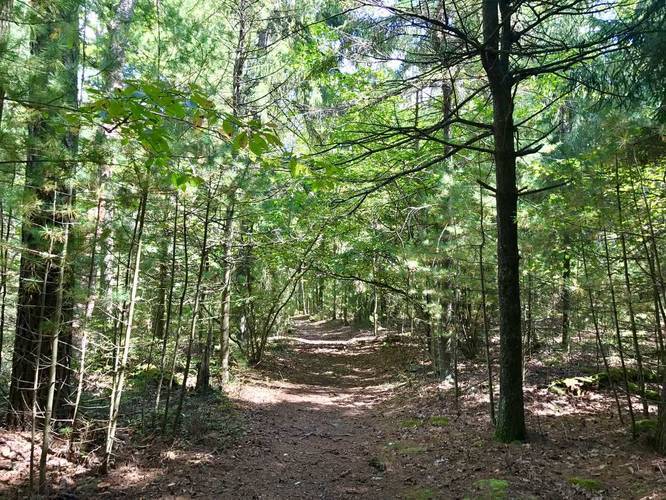
This small section of the Appalachian Trail at Michaux State Forest in Pennsylvania is a 2.9 mile out-and-back hike from Ridge Rd over to the power lines that cut through the park and the AT.
Follow the white blazes to remain on the AT.
We used the AT as an additional trail to hike into the Rocky Knob Trail. You can park at the trailhead on either side of the road in front of the AT; however, do not block all entrance to the trail.
Hazards
Seasons
AllBlaze Color
1 Trip Report


Helpful Links
Find Hiking Trails Near Me:


Before you leave...
MyHikes is an indie web platform aimed to make exploring public trails easier for everyone. The site has no investors and is owned and operated by one person, Dave Miller (Founder & Admin). As the Founder, main contributor, and doer-of-all-things for MyHikes, I share my trips with over-detailed write-ups for fun on a volunteer basis and I believe that public trail information should be available to everyone.
It takes a lot of time 🕦, money 💰, and effort (including espresso shots ☕) to run MyHikes, including hiking , mapping , writing , and publishing new trails with high-quality content... along with building new features, moderating, site maintainance, and app development for iOS and Android . I simply ask that if you find MyHikes' trail guides helpful to please consider becoming a Supporter to help keep the site, iOS, and Android apps available to everyone.
Supporters unlock website and in-app perks with a one-time payment of $25 (you renew) 😎👍. Or you can simply make a Donation of your choice without a MyHikes user account. Otherwise, telling your friends about MyHikes is the next-best thing - both quick and free 🎉
Thanks for visiting MyHikes and have a great hike!️

Dave Miller
MyHikes Founder & Admin

