ADA Trail
Distance:
0.2 Miles / 0.3 kmType:
Out-and-BackDifficulty:
EasyTime to Hike:
~6 minutesFeatures:
Surface Type:
Universal AccessLoading...
Loading...
The ADA Trail at the Highland Farm Preserve in York, Maine is an easy 0.1-mile out-and-bck universal access trail that leads down to a wildlife viewing platform that sits in the middle of a large open field.
This universal access trail begins at the parking lot and follows the sidewalk and gravel path down to the viewing platform. The elevation change is minimal, but the way back is a small uphill climb.
Parking
Hikers will find parking at the coordinates provided.
Pets
Dogs are allowed if leashed and their waste must be carried out by the hiker.
-
Parking
43.171944, -70.716681 -
Main Trailhead
43.171954, -70.716497 -
View from viewing platform
43.172614, -70.716125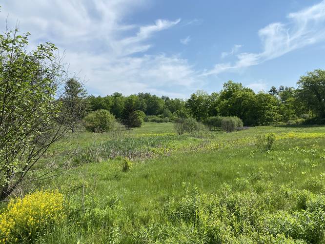
Hazards
Seasons
All
1 Trip Report


Helpful Links
Find Hiking Trails Near Me:


Before you leave...
MyHikes is an indie web platform aimed to make exploring public trails easier for everyone. The site has no investors and is owned and operated by one person, Dave Miller (Founder & Admin). As the Founder, main contributor, and doer-of-all-things for MyHikes, I share my trips with over-detailed write-ups for fun on a volunteer basis and I believe that public trail information should be available to everyone.
It takes a lot of time 🕦, money 💰, and effort (including espresso shots ☕) to run MyHikes, including hiking , mapping , writing , and publishing new trails with high-quality content... along with building new features, moderating, site maintainance, and app development for iOS and Android . I simply ask that if you find MyHikes' trail guides helpful to please consider becoming a Supporter to help keep the site, iOS, and Android apps available to everyone.
Supporters unlock website and in-app perks with a one-time payment of $25 (you renew) 😎👍. Or you can simply make a Donation of your choice without a MyHikes user account. Otherwise, telling your friends about MyHikes is the next-best thing - both quick and free 🎉
Thanks for visiting MyHikes and have a great hike!️

Dave Miller
MyHikes Founder & Admin

