Thunderbird Gardens Disc Golf Loop
Distance:
0.4 Miles / 0.6 kmType:
LoopDifficulty:
ModerateTime to Hike:
~12 minutesFeatures:
Surface Type:
DirtLoading...
Loading...
The Thunderbird Gardens Disc Golf Loop at Thunderbird Gardens in Cedar City, Utah is a moderate 0.4-mile loop hike that features natural rock formations and steep terrain that leads around the disc golf course.
Hike Description
This short hike begins at the large northern trailhead at Thunderbird Gardens, located at the main parking lot. This trail is technically the Valhalla Trail and hikers will follow this for a very short distance before veering off-trail and into the Disc Golf Course area. Once in the Disc Golf Course, hikers will be faced with several footpaths to take - this hike leads into the large rock formations, passing a neat little cave along the way, to then head off-trail and continue north. Once in the northern section of the disc golf course, hikers will be faced with some steep terrain where the trails weave in and out of dry washes. This is also where you'll find some neat views of the surrounding area, including the neighboring mountain named Red Hill, located to the south.
Finally, the hiker will head down the steep terrain - following some dry washes along the way - to reach a large rock outcropping that was visible along the hike in. This neat rock formation is ~30-feet tall and provides hikers with shade in addition to another small hill for views that sits adjacent.
While this is not a long hike and is rather a short walk, for folks who are not from this area, it's a really cool place to stop along a roadtrip, say on your way to Zion National Park, to explore a quiet and off-the-beaten path location.
Difficulty
This hike should be considered easy if you do not hike the steep sections of footpaths. Otherwise this is a moderate walk for sure.
Parking
Hikers will find a large parking lot at the coordinates provided, large enough to fit a couple dozen vehicles. Note that the road leading in is a bit rutted and has some potholes, but nothing too crazy.
Pets
Dogs are allowed only if leashed and must be cleaned up after.
Warnings
Rattlesnakes: This area is home to rattlesnakes, so be on the lookout and give any you find plenty of space.
Lack of water: This trail has no water access, so bring in at least 1 gallon per person per day if planing to hike. Plan to hike early in the day or later in the evening to prevent sun exposure.
-
Parking
37.69036, -113.043737 -
Main Trailhead
37.690472, -113.043669 -
View of the Thunderbird Gardens area
37.691989, -113.043883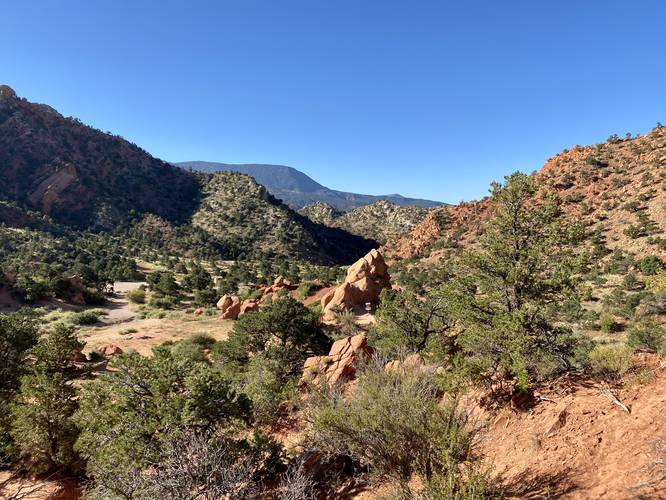
-
View of Red Hill from Thunderbird Gardens
37.691083, -113.044211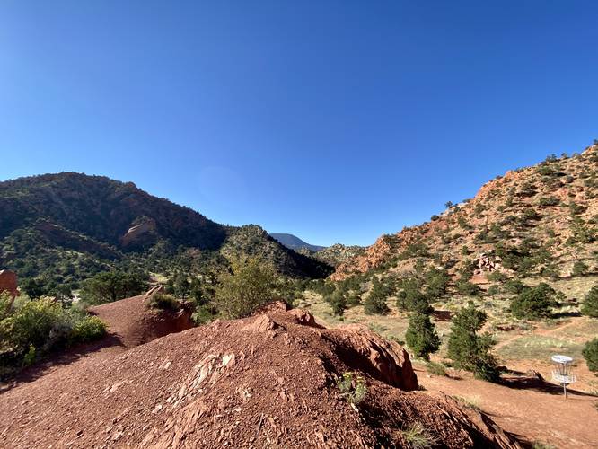
-
View of the Red Hill from Thunderbird Gardens
37.692261, -113.04415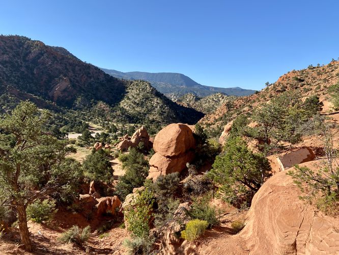
Hazards
Seasons
All
1 Trip Report


Helpful Links
Find Hiking Trails Near Me:


Before you leave...
MyHikes is an indie web platform aimed to make exploring public trails easier for everyone. The site has no investors and is owned and operated by one person, Dave Miller (Founder & Admin). As the Founder, main contributor, and doer-of-all-things for MyHikes, I share my trips with over-detailed write-ups for fun on a volunteer basis and I believe that public trail information should be available to everyone.
It takes a lot of time 🕦, money 💰, and effort (including espresso shots ☕) to run MyHikes, including hiking , mapping , writing , and publishing new trails with high-quality content... along with building new features, moderating, site maintainance, and app development for iOS and Android . I simply ask that if you find MyHikes' trail guides helpful to please consider becoming a Supporter to help keep the site, iOS, and Android apps available to everyone.
Supporters unlock website and in-app perks with a one-time payment of $25 (you renew) 😎👍. Or you can simply make a Donation of your choice without a MyHikes user account. Otherwise, telling your friends about MyHikes is the next-best thing - both quick and free 🎉
Thanks for visiting MyHikes and have a great hike!️

Dave Miller
MyHikes Founder & Admin

