The Y Trail
Distance:
2.2 Miles / 3.5 kmType:
Out-and-BackDifficulty:
HardTime to Hike:
1 hour, ~6 minutesFeatures:
Surface Type:
DirtLoading...
Loading...
The Y Trail in Provo, Utah is a difficult and popular 2.25-mile out-and-back hike that features stunning views of Provo, Mt. Timpanogos, West Mountain, Dry Mountain, and of course, the massive "Y" on the side of Y Mountain.
Location
Note that the trail itself sits on Y Mountain which is a part of the Uinta-Wasatch-Cache National Forest; however, the trailhead and part of the trail appear to be owned and maintained by Brigham Young University.
Hike Description
This hike begins at the main trailhead for the Y, located at the parking coordinates provided. The trail itself follows a similar elevation grade throughout the entire hike - which is pretty steep. The hike starts off difficult and does not let up until you reach the top of the Y. Along the way, hikers will get views along the entire trail, but for a lot of folks, the switchbacks in the trail will provide places to rest and take in the views as you slowly ascend the western slopes of Y Mountain.
Bottom of the "Y" - Mile 1.05
Around mile 1.05, hikers will reach a spur trail that leads to the bottom of the "Y". Here, the trail continues onward to reach the top.
Top of the "Y" - Mile 1.15
Around mile 1.15 hikers will reach the very-top of the "Y" where you'll find benches to sit, relax, and take in the views of Provo and beyond.
After visiting the top of the Y, hikers will head out, but on the way down you get to enjoy all of the views along the way without having to work for them.
Popularity
This is a very popular trail. Even during weekdays, the trailhead parking lot can fill up very early, around Sunrise. There are additional parking spaces along the road on the drive in, used for overflow parking.
Pets
Dogs are allowed only if leashed and must be cleaned up after.
Parking
Hikers will find a large parking lot at the coordinates provided. The lot is large enough to fit several dozen vehicles as of September, 2023.
-
Parking
40.244733, -111.627429 -
Main Trailhead
40.244743, -111.627342 -
View of Provo, Utah from the Y Trail
40.243903, -111.625436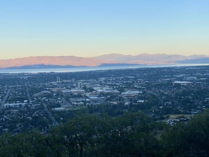
-
View of Mt. Timp from the Y Trail
40.245453, -111.624878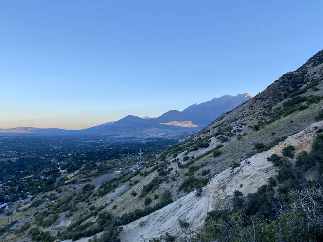
-
Massive "Y" dead ahead on the Y Trail
40.247197, -111.620544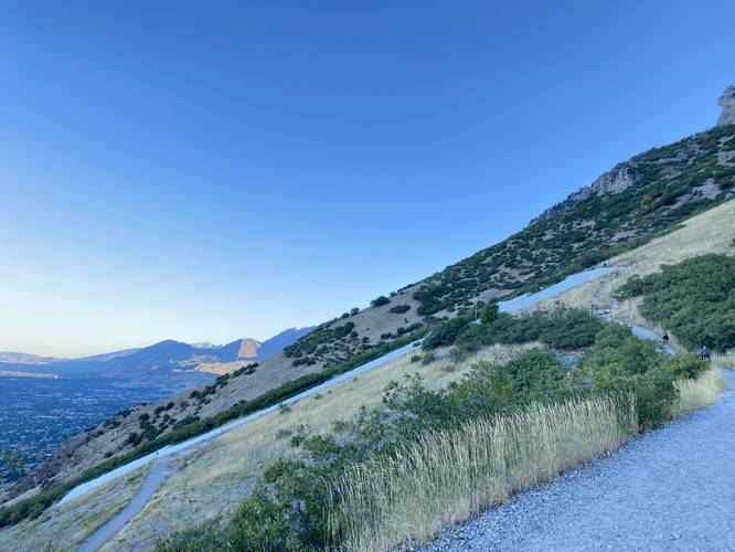
-
Above the "Y" on the Y Trail
40.2483, -111.620094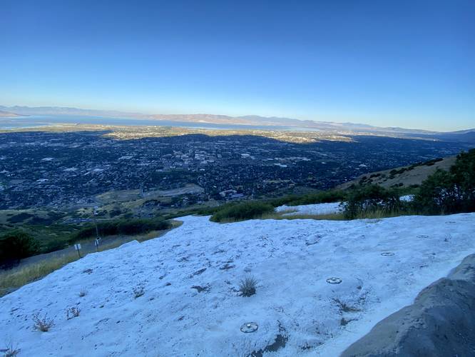
-
View from the top of the Y
40.2483, -111.620086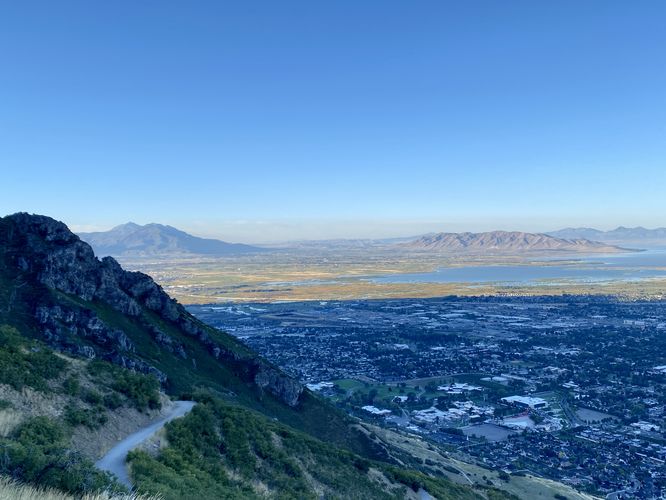
Hazards
Seasons
All
1 Trip Report


Helpful Links
Find Hiking Trails Near Me:


Before you leave...
MyHikes is an indie web platform aimed to make exploring public trails easier for everyone. The site has no investors and is owned and operated by one person, Dave Miller (Founder & Admin). As the Founder, main contributor, and doer-of-all-things for MyHikes, I share my trips with over-detailed write-ups for fun on a volunteer basis and I believe that public trail information should be available to everyone.
It takes a lot of time 🕦, money 💰, and effort (including espresso shots ☕) to run MyHikes, including hiking , mapping , writing , and publishing new trails with high-quality content... along with building new features, moderating, site maintainance, and app development for iOS and Android . I simply ask that if you find MyHikes' trail guides helpful to please consider becoming a Supporter to help keep the site, iOS, and Android apps available to everyone.
Supporters unlock website and in-app perks with a one-time payment of $25 (you renew) 😎👍. Or you can simply make a Donation of your choice without a MyHikes user account. Otherwise, telling your friends about MyHikes is the next-best thing - both quick and free 🎉
Thanks for visiting MyHikes and have a great hike!️

Dave Miller
MyHikes Founder & Admin

