Shingletown-Bald Knob-Maquire Loop
Distance:
4.1 Miles / 6.6 kmType:
LoopDifficulty:
HardTime to Hike:
2 hours, ~5 minutesFeatures:
Surface Type:
DirtLoading...
Loading...
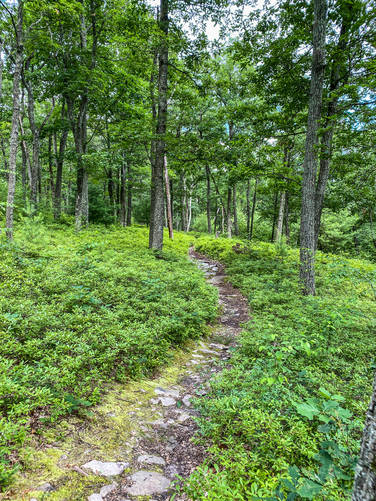
The Shingletown-Bald Knob-Maguire Loop at Rothrock State Forest near State College, Pennsylvania is a difficult 4.1-mile loop trail that encompasses three named trails and features a mountain ascent with scenic rhododendron.
Trails
This hike follows three named trails: Lower Trail (via Shingletown Gap), Bald Knob Ridge Trail, and the Maguire Trail.
Hike Description
This trail begins along Mountain Rd within Shingletown Gap and follows the Lower Trail heading south parallel to Roaring Run before the trail heads east along the same creek. Around mile 0.7, hikers will pass a point-of-interest labeled "Stone Shrine".
Mountain Climb - Mile 0.75
Around mile 0.75, hikers will reach the Bald Knob Ridge Trail which ascents Bold Knob Mountain at a fairly steep grade, hence to 'Hard' difficulty rating.
Hikers will reach the Bald Knob Mountain ridge around mile 1.2 as the trail's elevation grade becomes significantly easier.
Maguire Trail - Mile 1.65
Around mile 1.65, hikers will reach the trail junction with the Maguire Trail - take a right-hand turn here to head down Bald Knob Mountain, which leads back to the Lower Trail.
Lower Trail back to Parking - Mile 1.7
Around mile 1.7, hikers will reach a junction with the Lower Trail which again follows Roaring Run creek back to parking. The hike out from this junction is approximately 1.4-miles to complete this 4.1-mile loop hike.
Parking
Hikers will find parking near the coordinates provided.
Pets
Dogs are allowed if leashed and their waste must be carried out by the hiker.
Biking
Mountain biking is permitted along this trail.
Hazards
Seasons
AllBlaze Color
1 Trip Report


Helpful Links
Find Hiking Trails Near Me:


Before you leave...
MyHikes is an indie web platform aimed to make exploring public trails easier for everyone. The site has no investors and is owned and operated by one person, Dave Miller (Founder & Admin). As the Founder, main contributor, and doer-of-all-things for MyHikes, I share my trips with over-detailed write-ups for fun on a volunteer basis and I believe that public trail information should be available to everyone.
It takes a lot of time 🕦, money 💰, and effort (including espresso shots ☕) to run MyHikes, including hiking , mapping , writing , and publishing new trails with high-quality content... along with building new features, moderating, site maintainance, and app development for iOS and Android . I simply ask that if you find MyHikes' trail guides helpful to please consider becoming a Supporter to help keep the site, iOS, and Android apps available to everyone.
Supporters unlock website and in-app perks with a one-time payment of $25 (you renew) 😎👍. Or you can simply make a Donation of your choice without a MyHikes user account. Otherwise, telling your friends about MyHikes is the next-best thing - both quick and free 🎉
Thanks for visiting MyHikes and have a great hike!️

Dave Miller
MyHikes Founder & Admin

