Red Sand Beach (Kaihalulu) Trail - Maui
Distance:
0.6 Miles / 1.0 kmType:
Out-and-BackDifficulty:
ModerateTime to Hike:
~18 minutesFeatures:
Surface Type:
DirtLoading...
Loading...
The Red Sand Beach (a.k.a Kaihalulu) Trail in Hana, Maui, Hawaii, is a moderate 0.6 mile out-and-back hike over to the hidden cove of turquoise waters and red sand beach, Kaihalulu.
The trail itself is rated at moderate since there are plenty of steeper downhill cliff-side sections where the trail gets narrow; however, a lot of people still do this hike in their flip-flops and sandals. For the most part the trail is moderately trafficked and less popular than the Black Sand Beach Trail.
At the end of the trail, about 0.3 miles in, you'll reach the cove of the Red Sand Beach, Kaihalulu, with a large tidal area for snorkeling and swimming. A large natural breakwater sits about 60 feet offshore from the beach, which helps keep the waters in the tidal area stay calmer.
There are plenty of lookout points along this trail of the Red Sand Beach as well.
Trailhead: The trailhead can be found just east of the end of Uakea Rd in Hana; however, this GPS data starts near the corner of Hauoli Rd and Uakea Rd.
Parking: Parking can be found on the side of the road along Uakea Road. There's a parking capacity of about 10 cars, so you may need to wait for a parking space or show up early. Be respectful of the nearby "No Parking" signs and only park where public parking is available.
Beach attire / clothing options: This beach is apparently clothing-optional, which we did not know until after we visited; however, it may explain some people's choice of swim attire. Just a note if visiting with your family or kids.
Respecting the Land
Hawaiian land is considered sacred to native Hawaiians and many locals, so please stay on-trail, take nothing but photos, and leave nothing but footprints. Respect the locals - don't stay for long and have a backup hike planned in case the parking lot is full.
-
Parking
20.752881, -155.984173 -
Main Trailhead
20.752902, -155.984264 -
View toward Hana Maui Resort from the trail
20.752072, -155.982042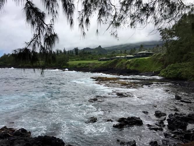
-
View / Overlook / Vista
20.752183, -155.981414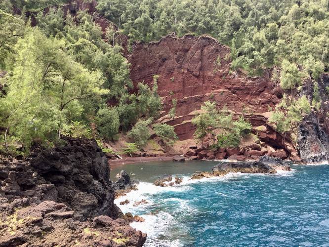
-
On the Red Sand beach
20.752575, -155.981567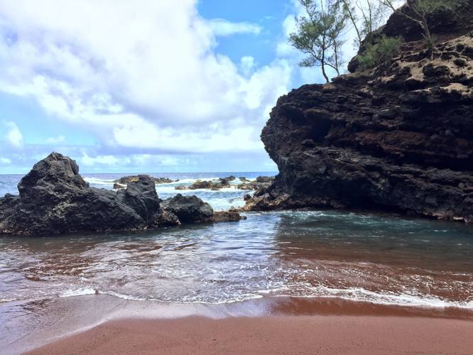
Seasons
All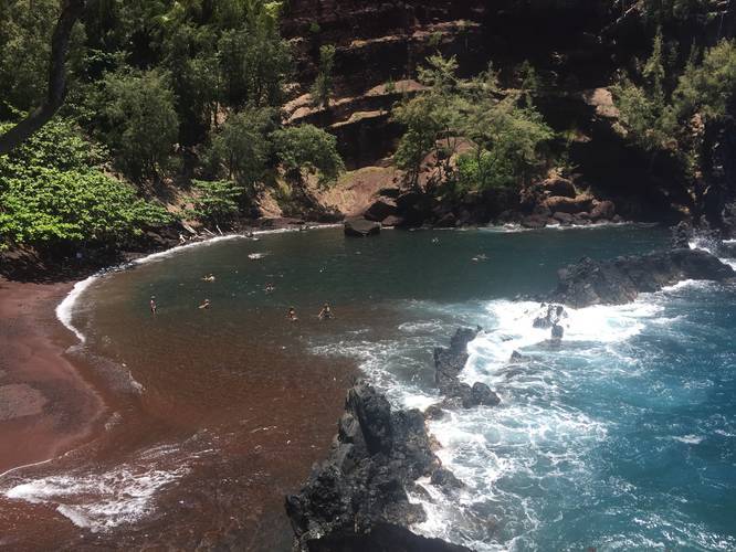
 Trail - Maui - Kaihalulu Red Sand Beach Trail album")
4 Trip Reports


Helpful Links
Find Hiking Trails Near Me:


Before you leave...
MyHikes is an indie web platform aimed to make exploring public trails easier for everyone. The site has no investors and is owned and operated by one person, Dave Miller (Founder & Admin). As the Founder, main contributor, and doer-of-all-things for MyHikes, I share my trips with over-detailed write-ups for fun on a volunteer basis and I believe that public trail information should be available to everyone.
It takes a lot of time 🕦, money 💰, and effort (including espresso shots ☕) to run MyHikes, including hiking , mapping , writing , and publishing new trails with high-quality content... along with building new features, moderating, site maintainance, and app development for iOS and Android . I simply ask that if you find MyHikes' trail guides helpful to please consider becoming a Supporter to help keep the site, iOS, and Android apps available to everyone.
Supporters unlock website and in-app perks with a one-time payment of $25 (you renew) 😎👍. Or you can simply make a Donation of your choice without a MyHikes user account. Otherwise, telling your friends about MyHikes is the next-best thing - both quick and free 🎉
Thanks for visiting MyHikes and have a great hike!️

Dave Miller
MyHikes Founder & Admin

