Pinnacle Hill Loop
Distance:
1.2 Miles / 1.9 kmType:
LoopDifficulty:
ModerateTime to Hike:
~36 minutesFeatures:
Surface Type:
DirtLoading...
Loading...
The Pinnacle Hill Loop at Wrentham State Forest in Wrentham, Massachusetts is a moderate 1.2-mile loop hike that features views of Boston, a mountain summit of bedrock outcroppings, and a climber's ledge.
Hike Description
This hike begins along Madison Street in Wrentham at a little-known trailhead located near the parking coordinates provided. The trailhead is a bit difficult to spot as it's not marked by anything official near the road - hikers can look for the telephone pole adjacent to the trail. Hike this in and follow the white blazes.
Junction, Straight - Mile 0.1
Shortly into this hike, you'll reach a junction around mile 0.1 - go straight here. The trail will continue heading uphill as it twists and winds its way through the forest.
View of Boston - Mile 0.2
Around mile 0.2, hikers will reach a rocky outcropping that provides views of downtown Boston's skyscrapers as they peek over the horizon. This is the best view on the entire hike, so take it in; however, you get to enjoy this view once again on the hike out around mile 1.
Junction, Left - Mile 0.3
After the view of Boston, hikers will head south along the trail - passing some short 4-foot tall rock scrambles - to reach another trail junction. Take a left-hand turn at this junction, located around mile 0.3.
Junction, Right - Mile 0.37
Around mile 0.37, hikers will take the next right-hand turn they find after the previous left-hand turn. This turn will lead straight to the summit of Pinnacle Hill and its bedrock outcroppings.
Pinnacle Hill Summit & Bedrock - Mile 0.45
At mile 0.45, hikers will reach the first of the "summit" bedrock outcroppings atop Pinnacle Hill. While there's no summit or survey markers on these outcroppings, they're a pretty interesting find tucked away in the woods. Again, no views from these rocks, but they're neat to explore. Pinnacle Hill's summit, according to USGS maps, is located between this bedrock outcropping and then next; however, the elevation between the two is lower, so the summit on maps is likely an approximation.
Pinnacle Bedrock - Mile 0.6
Around mile 0.6, after passing through the winding trail, hikers will reach the second mountain top bedrock outcropping. This time it has a massive boulder sitting on it, likely a glacial deposit, that previous hikers have used to make a campfire pit.
After passing the last of the mountain top bedrock outcroppings, hikers will head down from the summit - passing some rocky outcroppings in the trail - before reaching some trail junctions.
Keep Right - Mile 0.7 to 0.75
Between miles 0.7 and 0.75, hikers will want to keep right at both trail junctions. Be on the lookout for large rock ledges and hike the trail that runs alongside or between them - this is your trail out.
Pinnacle Ledges (climbing ledges) - Mile 0.78 to 0.9
From approximately miles 0.78 to 0.9, sit some very large rock ledges that jut out of the mountain and tower upwards of 25-feet above the trail. Located off-trail, these ledges appear to be a great spot for local climbers to practice or try out new routes.
Junction, Left - Mile 0.9
Around mile 0.9, hikers will reach the same turn they took on the way in, this time take a left-hand turn to head back to the view of Boston.
View of Boston - Mile 1
Around mile 1, or slightly after, hikers will reach the view of Boston on the bedrock outcropping they stopped at on the way in. Take in the views here once again before hiking out.
Remember to go straight at the next trail junction which will lead down to parking.
Hours
Wrentham State Forest is open from dawn to dusk each day.
Parking
Hikers will find small parking turnouts on the grass off of Madison Street near the parking coordinates provided. The turnouts are large enough to fit just a few vehicles, so do not overcrowd.
Pets
Dogs are allowed if leashed and must be cleaned up after.
-
Parking
42.058596, -71.314029 -
Main Trailhead
42.058574, -71.313965 -
Trail junction - straight
42.057694, -71.314858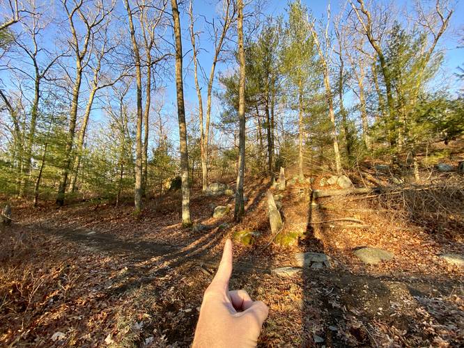
-
Easy 3-foot rock scramble
42.057494, -71.316261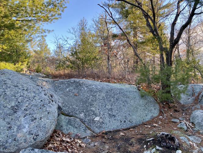
-
Pinnacle Hill summit bedrock outcropping
42.056861, -71.317147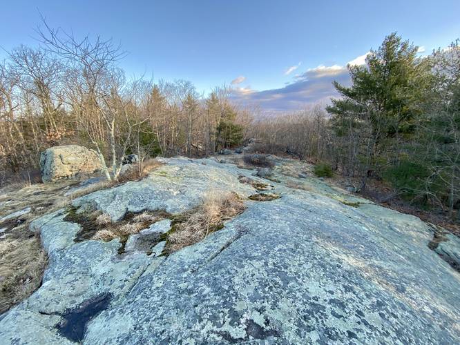
-
Pinnacle Hill summit bedrock outcropping
42.058047, -71.318078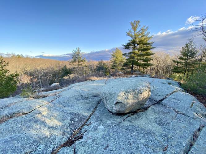
-
Smaller climbing ledge
42.058361, -71.317314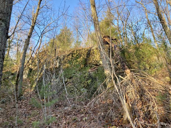
-
Pinnacle Ledge (climbing ledge)
42.057789, -71.316642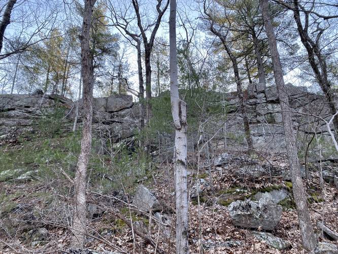
-
View of Boston
42.058086, -71.316322
Hazards
Seasons
AllBlaze Color
1 Trip Report


Helpful Links
Find Hiking Trails Near Me:


Before you leave...
MyHikes is an indie web platform aimed to make exploring public trails easier for everyone. The site has no investors and is owned and operated by one person, Dave Miller (Founder & Admin). As the Founder, main contributor, and doer-of-all-things for MyHikes, I share my trips with over-detailed write-ups for fun on a volunteer basis and I believe that public trail information should be available to everyone.
It takes a lot of time 🕦, money 💰, and effort (including espresso shots ☕) to run MyHikes, including hiking , mapping , writing , and publishing new trails with high-quality content... along with building new features, moderating, site maintainance, and app development for iOS and Android . I simply ask that if you find MyHikes' trail guides helpful to please consider becoming a Supporter to help keep the site, iOS, and Android apps available to everyone.
Supporters unlock website and in-app perks with a one-time payment of $25 (you renew) 😎👍. Or you can simply make a Donation of your choice without a MyHikes user account. Otherwise, telling your friends about MyHikes is the next-best thing - both quick and free 🎉
Thanks for visiting MyHikes and have a great hike!️

Dave Miller
MyHikes Founder & Admin

