Monument Falls
Distance:
0.1 Miles / 0.2 kmType:
Out-and-BackDifficulty:
EasyTime to Hike:
~5 minutesFeatures:
Surface Type:
DirtLoading...
Loading...
Monument Falls at Adirondack Park in Wilmington, New York is a quick roadside stop along NY-86.
This is not a hike but rather a roadside stop that features a view from above Monument Falls of the West Branch Ausable River. Unfortunately Monument Falls sits just north along NY-86 along a dangerous bend in the road where cars travel past at ~55MPH, so it's not very safe to walk around to view the downstream side of Monument Falls.
This write-up exists to try and help folks locate Monument Falls.
Monument Falls
Monument Falls, if viewed from the road, is ~20-feet wide and 5-feet tall that cascades down a series of bedrock steps. It's best viewed if driving south along NY-86.
Fishing
This is a popular fishing spot as it's easy to access.
Parking
There's a large parking turnout at the coordinates provided that can fit a dozen cars or more.
-
Parking
44.310682, -73.915617 -
Main Trailhead
44.310817, -73.915623 -
Upstream view of Monument Falls
44.31105, -73.915497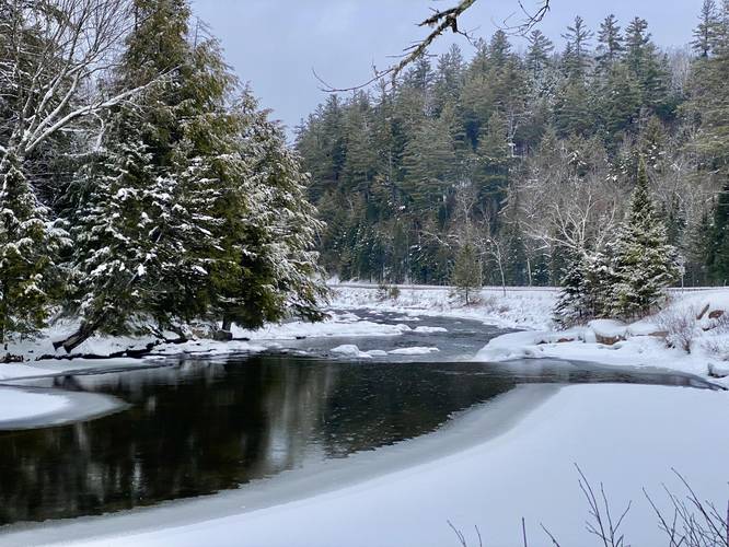
Hazards
Seasons
All
1 Trip Report


Helpful Links
Find Hiking Trails Near Me:


")


Before you leave...
MyHikes is an indie web platform aimed to make exploring public trails easier for everyone. The site has no investors and is owned and operated by one person, Dave Miller (Founder & Admin). As the Founder, main contributor, and doer-of-all-things for MyHikes, I share my trips with over-detailed write-ups for fun on a volunteer basis and I believe that public trail information should be available to everyone.
It takes a lot of time 🕦, money 💰, and effort (including espresso shots ☕) to run MyHikes, including hiking , mapping , writing , and publishing new trails with high-quality content... along with building new features, moderating, site maintainance, and app development for iOS and Android . I simply ask that if you find MyHikes' trail guides helpful to please consider becoming a Supporter to help keep the site, iOS, and Android apps available to everyone.
Supporters unlock website and in-app perks with a one-time payment of $25 (you renew) 😎👍. Or you can simply make a Donation of your choice without a MyHikes user account. Otherwise, telling your friends about MyHikes is the next-best thing - both quick and free 🎉
Thanks for visiting MyHikes and have a great hike!️

Dave Miller
MyHikes Founder & Admin

