Franconia Ridge Loop
Distance:
8.1 Miles / 13.0 kmType:
LoopDifficulty:
StrenuousTime to Hike:
4 hours, ~5 minutesFeatures:
Surface Type:
DirtLoading...
Loading...
The Franconia Ridge Loop at the White Mountain National Forest in Franconia, New Hampshire is a strenuous 8.1-mile loop hike featuring stunning views of the white mountains, mountain summits, and large waterfalls.
Trails: This hike follows three trails - Falling Waters Trail, Franconia Ridge Trail / Appalachian Trail, and Old Bridle Path in that order. I recommend you do this hike counter-clockwise, taking Falling Waters Trail up, and Old Bridle Path down. Falling Waters Trail tends to be quite wet, and can get slippery if you're coming down the steep terrain.
Falling Waters Trail features a number of beautiful waterfalls, which are best viewed at springtime. It's a very steep trail that leads up to the ridge, where it meets up with the Appalachian Trail. After approximately 2.8-miles along the Falling Waters Trail, you'll reach the Appalachian Trail / Franconia Ridge Trail. Here you'll traverse approximately 1.5-miles across the ridge and atop a few 4,000-foot peaks (Little Haystack and Mt. Lincoln) and make your final ascent up Mt. Lafayette. The views are unbelievable along the entire ridge, but it does leave you completely exposed. Remember to wear sunscreen and re-apply if needed.
Elevation: This trail ascends over 4,000-feet of elevation gain and is very strenuous. Only plan to hike this trail if you're an experienced hiker. Always know your limits before heading out to a trail like this.
Mountain Summits: Along this hike, you'll tackle Little Haystack, Mt. Lincoln, Mt. Lafayette.
Parking: In the summer you may need to park at the overfill lot, a few exits north of the trailhead parking, and take the hiker shuttle down. It gets very busy on the weekends. The shuttle is $5 per person. You can best avoid this by showing up early in the morning.
Warnings: Wear bugspray, and be aware of the biting black flies.
Remember to wear sunscreen and re-apply when necessary. Also, I would
bring
at least 2 liters of water, and refill at the Greenleaf hut (On the Old
Bridle path trail after you summit Lafayette). Greenleaf Hut is
displayed using the OpenStreetMap tiles in the trail map.
-
Parking
44.142113, -71.681444 -
Main Trailhead
44.142046, -71.681038 -
Stairs Falls
44.136772, -71.673419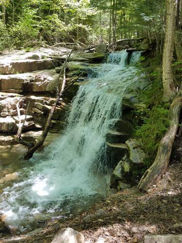
-
Cloudland Falls
44.138746, -71.664981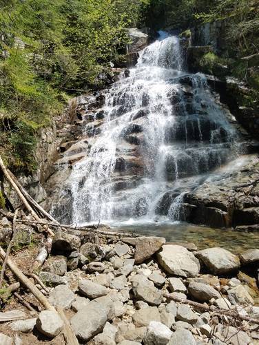
-
Upper Cloudland Falls
44.139034, -71.664606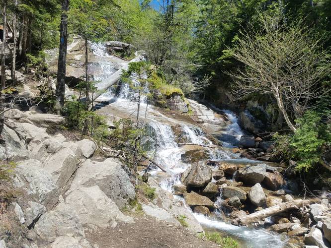
-
Rock steps
44.141461, -71.652027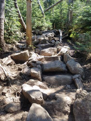
-
View from the slopes of Little Haystack Mountain
44.1404, -71.646524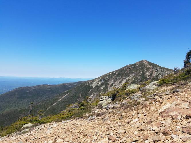
-
View of Mount Lincoln from Little Haystack Mountain
44.140566, -71.645869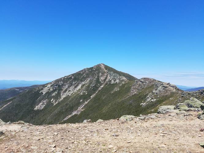
-
Little Haystack Mountain summit view
44.14056, -71.645878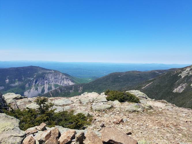
-
View from near Mount Lincoln summit
44.148474, -71.644677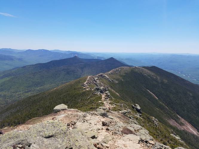
-
Stunning view from Franconia Ridge
44.150826, -71.644415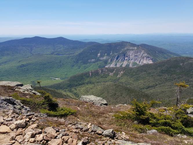
-
View from Franconia Ridge toward North Lincoln summit
44.153108, -71.644582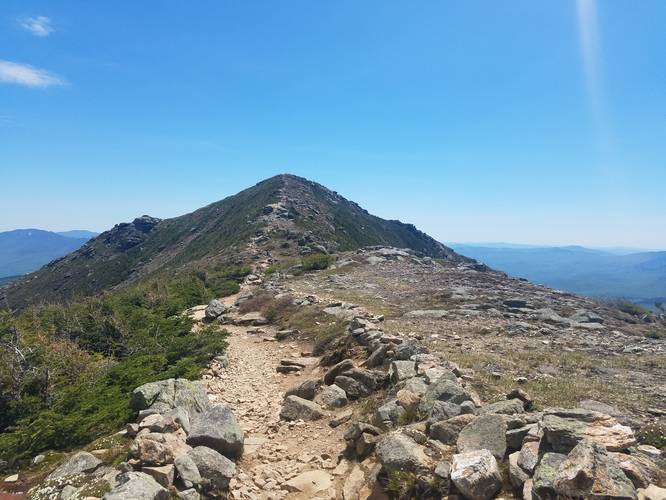
-
View from the slopes of Mount Lafayette
44.16115, -71.646323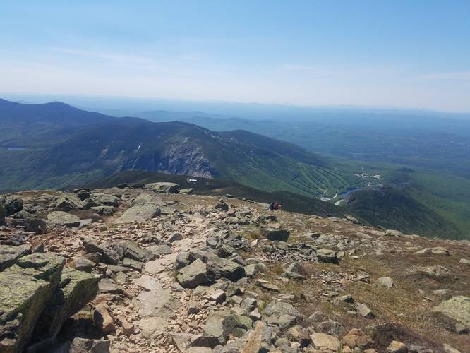
-
View of Mount Lincoln and the Franconia Ridge from the low slopes of Mount Lafayette
44.159838, -71.657862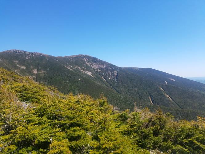
-
View of Franconia Ridge while descending Mount Lafayette
44.151459, -71.668329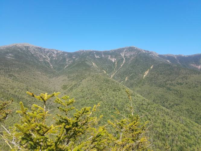
Hazards
Seasons
All
1 Trip Report


Helpful Links
Find Hiking Trails Near Me:


Before you leave...
MyHikes is an indie web platform aimed to make exploring public trails easier for everyone. The site has no investors and is owned and operated by one person, Dave Miller (Founder & Admin). As the Founder, main contributor, and doer-of-all-things for MyHikes, I share my trips with over-detailed write-ups for fun on a volunteer basis and I believe that public trail information should be available to everyone.
It takes a lot of time 🕦, money 💰, and effort (including espresso shots ☕) to run MyHikes, including hiking , mapping , writing , and publishing new trails with high-quality content... along with building new features, moderating, site maintainance, and app development for iOS and Android . I simply ask that if you find MyHikes' trail guides helpful to please consider becoming a Supporter to help keep the site, iOS, and Android apps available to everyone.
Supporters unlock website and in-app perks with a one-time payment of $25 (you renew) 😎👍. Or you can simply make a Donation of your choice without a MyHikes user account. Otherwise, telling your friends about MyHikes is the next-best thing - both quick and free 🎉
Thanks for visiting MyHikes and have a great hike!️

Dave Miller
MyHikes Founder & Admin

