Eyrie House Ruins Trail
Distance:
2.4 Miles / 3.9 kmType:
Out-and-BackDifficulty:
ModerateTime to Hike:
1 hour, ~12 minutesFeatures:
Surface Type:
DirtLoading...
Loading...
The Eyrie House Ruins Trail is a 2.4 mile out-and-back hike up to the hotel ruins of the Eyrie House and the summit of Mount Nonotuck in the Mount Tom Reservation in Massachusetts. Follow the M & M trail (white blazes) from the trailhead listed on the map to the access road. Once you reach the access road follow it up the mountain and it will lead to a lookout and the entrance the Eyrie House Ruins. Continue following the trail and it will bring you to the summit of Mount Nonotuck.
The Eyrie House was a hotel that burned to the ground in 1901, but was a popular destination in the 1880's up until the fire. All that's left now is the ruins of the old hotels, but this is a really awesome hike and a hidden gem in western Massachusetts.
Pets
Dogs are allowed if leashed and their waste must be carried out by the hiker.
Parking
Please note that this trailhead and parking area is located on a residential street. All hikers must respect the private owners and neighbors located next to the trailhead. If parking cannot be found at the trailhead due to a crowded day, please stay off of all private land and find a public place to park.
-
Parking
42.285291, -72.620277 -
Main Trailhead
42.285336, -72.62051 -
Vista near the summit
42.279747, -72.62167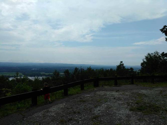
-
Eyrie House ruins
42.280348, -72.62037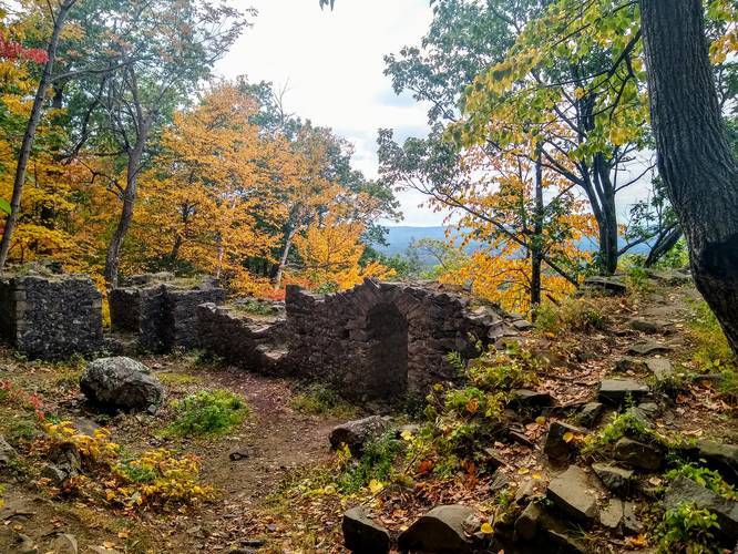
-
View / Overlook / Vista
42.279444, -72.621667
Hazards
Season
SummerBlaze Color

4 Trip Reports


Helpful Links
Find Hiking Trails Near Me:


")


Before you leave...
MyHikes is an indie web platform aimed to make exploring public trails easier for everyone. The site has no investors and is owned and operated by one person, Dave Miller (Founder & Admin). As the Founder, main contributor, and doer-of-all-things for MyHikes, I share my trips with over-detailed write-ups for fun on a volunteer basis and I believe that public trail information should be available to everyone.
It takes a lot of time 🕦, money 💰, and effort (including espresso shots ☕) to run MyHikes, including hiking , mapping , writing , and publishing new trails with high-quality content... along with building new features, moderating, site maintainance, and app development for iOS and Android . I simply ask that if you find MyHikes' trail guides helpful to please consider becoming a Supporter to help keep the site, iOS, and Android apps available to everyone.
Supporters unlock website and in-app perks with a one-time payment of $25 (you renew) 😎👍. Or you can simply make a Donation of your choice without a MyHikes user account. Otherwise, telling your friends about MyHikes is the next-best thing - both quick and free 🎉
Thanks for visiting MyHikes and have a great hike!️

Dave Miller
MyHikes Founder & Admin

