Dobbin Grade Trail
Distance:
4.5 Miles / 7.2 kmType:
One-WayDifficulty:
EasyTime to Hike:
2 hours, ~15 minutesFeatures:
Surface Type:
DirtLoading...
Loading...
The Dobbin Grade Trail within the Dolly Sods Wilderness at the Monongahela National Forest is an easy 4.5 mile one-way trail that connects the Bear Rocks Trail to the Rocky Ridge Trail and cuts across almost the entirety of the Sods.
Depending on where you start the hike, the trail will be easy, until you hit the wet portion of the trail near Red Creek where you can often sink knee-deep in mud. This recording starts at the trailhead along the Bear Rocks Trail where the trail is essentially flat for the next two miles until you reach the Raven Ridge Trail.
This trail is notorious for Red Creek flooding the trail or the trail just being overly saturated with water, so prepare to possibly get muddy, wet, or both. Also note that crossing Red Creek is usually a foot deep or so, but sometimes has some rocks you can use to cross without getting your feet wet.
Water Source: Red Creek runs along the trail until you cross it around mile 1.8. There's another creek, Left Fork Red Creek, at mile 3.5 as well.
Campsites: There are plenty of campsites along the trail and the most popular spots are close to the Red Creek crossing, about 1.8 miles in. There's a campsite near the northern terminus within a conifer grove and then another small campsite tucked away (near mile 0.8) in another conifer grove just before the trail leads into the open valley near Red Creek. After you pass the Raven Ridge Trail, there will be some campsites along the hillside before the trail passes into the trees again. Once you pass the Left Fork Red Creek, there will be at least two campsites along the trail before you get to the Rocky Ridge Trail.
Parking: Parking can be found at the Bear Rocks Trail or Beaver Dam Trail parking areas.
Warning: Dolly Sods was used for military bombing training during
WWII and there are still unexploded ordinances in the ground out in the
wilderness. Most of these trails and the areas around them have been
combed and searched, but not everything has been found. If you find any
strange metal objects, especially bomb-shaped, do not tamper with them.
Make a note of where you found it and alert the proper authorities. More
information can be found at the wilderness trailheads.
Dolly Sods trail map PDF
-
Parking
39.063557, -79.303172 -
Main Trailhead
39.064675, -79.321759 -
Beaver View Trail
39.054783, -79.348878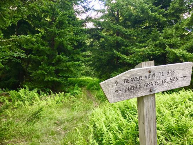
-
Campsite
39.051675, -79.355194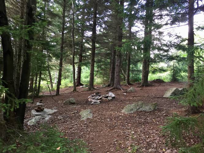
-
Left Fork Red Creek
39.051022, -79.356689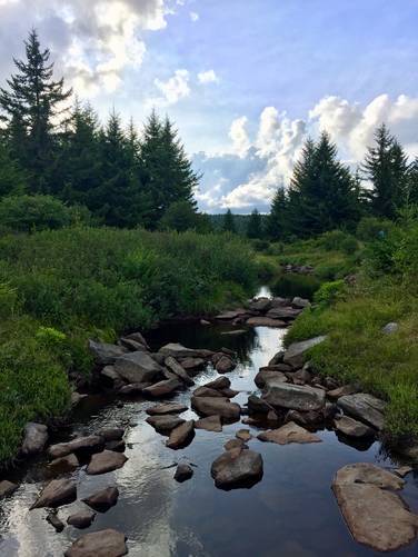
-
Campsite with a larger site directly next to it
39.050842, -79.366814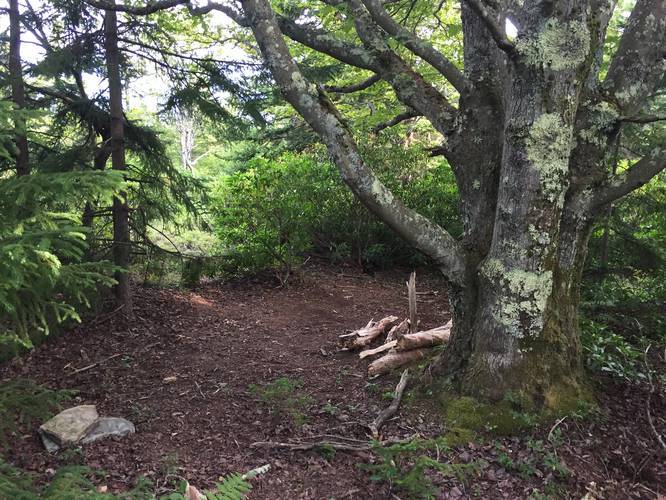
-
Facing east from the Raven Ridge trailhead
39.046622, -79.336508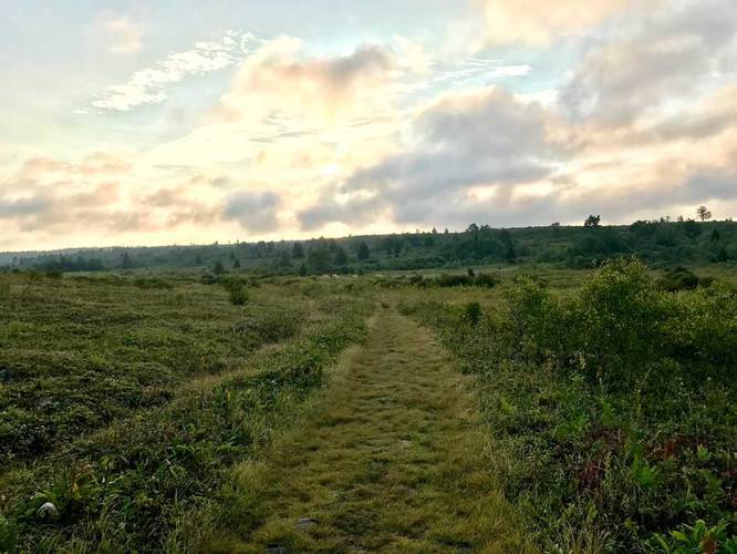
-
Red Creek crossing
39.046875, -79.335206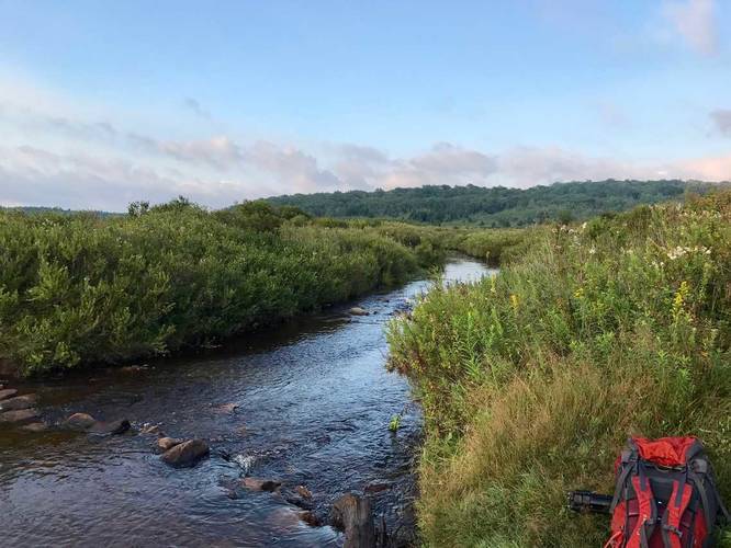
-
Red Creek
39.058431, -79.320525
Hazards
Seasons
All
2 Trip Reports


Before you leave...
MyHikes is an indie web platform aimed to make exploring public trails easier for everyone. The site has no investors and is owned and operated by one person, Dave Miller (Founder & Admin). As the Founder, main contributor, and doer-of-all-things for MyHikes, I share my trips with over-detailed write-ups for fun on a volunteer basis and I believe that public trail information should be available to everyone.
It takes a lot of time 🕦, money 💰, and effort (including espresso shots ☕) to run MyHikes, including hiking , mapping , writing , and publishing new trails with high-quality content... along with building new features, moderating, site maintainance, and app development for iOS and Android . I simply ask that if you find MyHikes' trail guides helpful to please consider becoming a Supporter to help keep the site, iOS, and Android apps available to everyone.
Supporters unlock website and in-app perks with a one-time payment of $25 (you renew) 😎👍. Or you can simply make a Donation of your choice without a MyHikes user account. Otherwise, telling your friends about MyHikes is the next-best thing - both quick and free 🎉
Thanks for visiting MyHikes and have a great hike!️

Dave Miller
MyHikes Founder & Admin

