Dipsea Trail
Distance:
13.4 Miles / 21.6 kmType:
Out-and-BackDifficulty:
HardTime to Hike:
6 hours, ~42 minutesFeatures:
Surface Type:
DirtLoading...
Loading...
The Dipsea Trail is a 13.4-mile out-and-back hike that passes through both Mount Tamalpais State Park and Muir Woods before reaching Stinson Beach and heading back. This 6.7-mile one-way trail can be completed in a shorter time and distance if you have two vehicles or a ride back to parking, but this recording will bring you out-and-back along the full 4,000-foot elevation gain hike.
This recording starts at the trailhead for the Dipsea Trail, which sits at the end of Cascade Way in Mill Valley, CA - just south of Old Mill Park.
Mile 0 to 0.8: From the Dipsea Trail trailhead, hike south along the Dipsea steps, crossing roads, and passing through neighborhood woods before reaching the Panoramic Highway around mile 0.75. After reaching the Panoramic Highway, you'll hike west along the road until you find the trail continues across the street.
Mile 0.8 to 1.54: After crossing the Panoramic Highway, the trail runs for another 0.75-miles before reaching the entrance to the Muir Woods National Monument. The trail will cross Muir Woods Rd a couple of times before reaching the entrance to the park. The trail does not pass through the paid-section of Muir Woods, however.
Mile 1.54 to 3.6: After reaching Muir Woods, you'll be a one of the lowest points along the trail. From here until mile-3.6 you'll be hiking a strenuous uphill hike towards the summit of Cardiac Hill. Hike at your own pace since this section of the Dipsea Trail is not easy in the least.
Mile 3.6 to 6.7: After reaching the top of Cardiac Hill, you'll next be following the Dipsea Trail downhill, over 1,300 feet down to Stinson Beach.
Mile 6.7 to 9.8: After visiting Stinson Beach and taking a break from the strenuous Dipsea Trail hike, you'll want to start heading back. This portion is just as rough as the initial climb to Cardiac Hill, but you'll be doing the opposite uphill hike you just took down. Take your time and pace your hike as you make your way back up Cardiac Hill.
Mile 9.8 to 11.8: After reaching the summit of Cardiac Hill, you'll be heading back down the steep-graded Dipsea Trail back to Muir Woods.
Mile 11.8 to 13.4: After reaching Muir Woods, you'll be hiking back uphill towards the Panoramic Highway and then downhill back to parking. Be sure to take a break and fill up water at Muir Woods since they have a free water station.
Parking: The easiest place to find parking is at the Old Mill Park in Mill Valley. Parking can be found easily and you'll just need to hike along the road down to the trailhead.
Water Source: You can find at least one free water fountain at the Muir Woods entrance. There are also creeks along the way you can use if you have a water filter system.
Pets: Dogs are allowed on this trail if they're leashed and their waste is carried out.
For more details, check out the Norcalhiker blog post on this trip.
Hazards
Season
Summer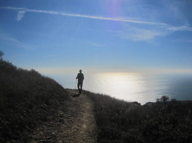
1 Trip Report


Helpful Links
Find Hiking Trails Near Me:


Before you leave...
MyHikes is an indie web platform aimed to make exploring public trails easier for everyone. The site has no investors and is owned and operated by one person, Dave Miller (Founder & Admin). As the Founder, main contributor, and doer-of-all-things for MyHikes, I share my trips with over-detailed write-ups for fun on a volunteer basis and I believe that public trail information should be available to everyone.
It takes a lot of time 🕦, money 💰, and effort (including espresso shots ☕) to run MyHikes, including hiking , mapping , writing , and publishing new trails with high-quality content... along with building new features, moderating, site maintainance, and app development for iOS and Android . I simply ask that if you find MyHikes' trail guides helpful to please consider becoming a Supporter to help keep the site, iOS, and Android apps available to everyone.
Supporters unlock website and in-app perks with a one-time payment of $25 (you renew) 😎👍. Or you can simply make a Donation of your choice without a MyHikes user account. Otherwise, telling your friends about MyHikes is the next-best thing - both quick and free 🎉
Thanks for visiting MyHikes and have a great hike!️

Dave Miller
MyHikes Founder & Admin

