Connor Bayou West Loop
Distance:
1.1 Miles / 1.8 kmType:
LoopDifficulty:
EasyTime to Hike:
~33 minutesFeatures:
Surface Type:
DirtLoading...
Loading...
The Connor Bayou West Loop at Connor Bayou in Grand Haven, Michigan is an easy 1.1-mile loop trail that features views of Michigan's Grand River.
This trail encompasses the western side of Connor Bayou and includes an short access trail that connects to 132nd Ave (not shown in this GPS track). The trailhead can be found behind the buildings located next to the parking lot. The trail runs along Grand River before heading south and looping back to the parking lot for a 1.1-mile loop hike.
Pets
Dogs are allowed if leashed and their waste must be carried out by the hiker.
Parking
Hikers can find parking at the coordinates provided. The lot is large enough to fit about a dozen vehicles.
-
Parking
43.037947, -86.109771 -
Main Trailhead
43.037977, -86.110715 -
View of Grand River
43.03825, -86.111417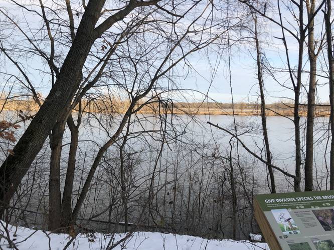
-
View of Grand River
43.038858, -86.112686
Hazards
Seasons
All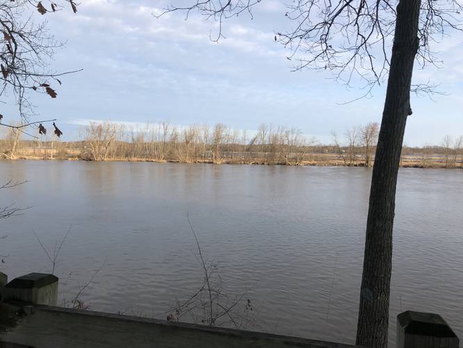
1 Trip Report


Helpful Links
Find Hiking Trails Near Me:


Before you leave...
MyHikes is an indie web platform aimed to make exploring public trails easier for everyone. The site has no investors and is owned and operated by one person, Dave Miller (Founder & Admin). As the Founder, main contributor, and doer-of-all-things for MyHikes, I share my trips with over-detailed write-ups for fun on a volunteer basis and I believe that public trail information should be available to everyone.
It takes a lot of time 🕦, money 💰, and effort (including espresso shots ☕) to run MyHikes, including hiking , mapping , writing , and publishing new trails with high-quality content... along with building new features, moderating, site maintainance, and app development for iOS and Android . I simply ask that if you find MyHikes' trail guides helpful to please consider becoming a Supporter to help keep the site, iOS, and Android apps available to everyone.
Supporters unlock website and in-app perks with a one-time payment of $25 (you renew) 😎👍. Or you can simply make a Donation of your choice without a MyHikes user account. Otherwise, telling your friends about MyHikes is the next-best thing - both quick and free 🎉
Thanks for visiting MyHikes and have a great hike!️

Dave Miller
MyHikes Founder & Admin

