Chimney Rocks Trail
Distance:
5.4 Miles / 8.7 kmType:
Out-and-BackDifficulty:
ModerateTime to Hike:
2 hours, ~42 minutesFeatures:
Surface Type:
DirtLoading...
Loading...
The Chimney Rocks Trail at Michaux State Forest in South Mountain, Pennsylvania is a moderate 5.4 out-and-back hike that leads out to the summit of Snowy Mountain and the vista point Chimney Rocks (aka Buzzard Peak).
The trail begins at the yellow gate along Biesecker Gap Rd (on google maps) / Snowy Mountain Tower Road (on opentopo maps) and follows the road until reaching the spur trail for Chimney Rocks/Buzzard Peak, 2.5 miles from the trailhead. Parking can be found just in front of the gate, but do not block it.
The trail slowly ascends the summit of Snowy Mountain, which is about a half-mile into the hike. The summit of Snowy Mountain does not have much other than a fire tower and some radio towers, but there are great views from the trail just below the summit.
Continuing on from Snowy Mountain, the trail passes through mostly deciduous forests and some small patches of conifers. There are off-shoots along this trail, so just stay on the main road-like trail.
Eventually you'll reach a gas pipeline crossing - this your 2/3 marker for getting to Chimney Rocks. From here you'll hike uphill and then down a long slope before the trail finally reaches a trail junction with a wooden sign labeled 'Chimney Rocks Lookout'. Take this short blue-blazed spur trail all the way to Chimney Rocks, or Buzzard Peak. The Appalachian Trail also crosses this spur trail about half-way through, but there are signs for it so it should not be confusing.
At Chimeny Rocks, you get views of the surrounding mountain sides of Michaux State Forest. The rock formation also has a massive cave in the middle, so watch your step while climbing the rocks.
The hike out is much more difficult as you'll have two main ascents before reaching Snowy Mountain again, but it's not too bad. Plan to bring plenty of water as there are no creeks or streams to filter water along this trail.
Road conditions: Please note that most of Michaux State Forest, including this trailhead, are on dirt roads. Most of Michaux's roads are well maintained, but there is little-to-no cell service so offline road maps are helpful here.
-
Parking
39.827699, -77.502405 -
Main Trailhead
39.827699, -77.502405 -
Vista facing south near the fire tower
39.833319, -77.496475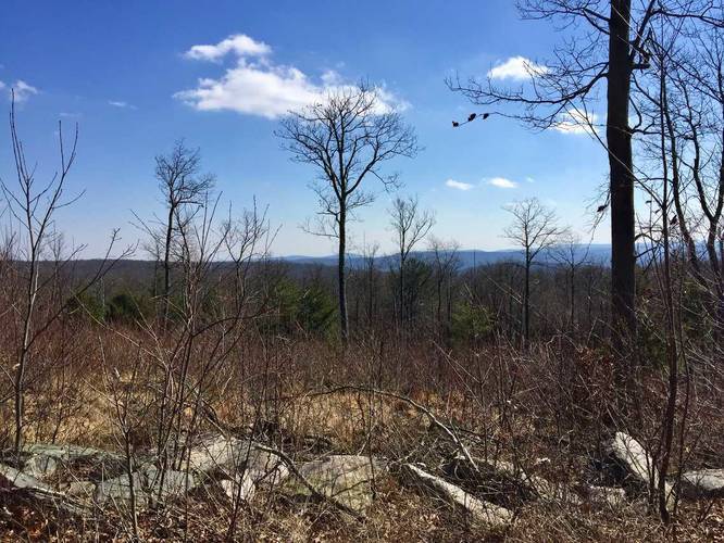
-
Snowy Mountain fire tower
39.834214, -77.495422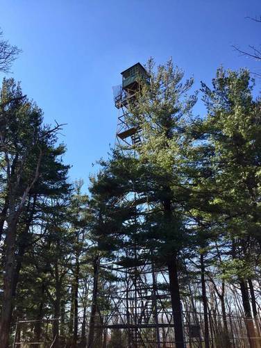
-
Snowy Mountain Summit
39.834008, -77.495681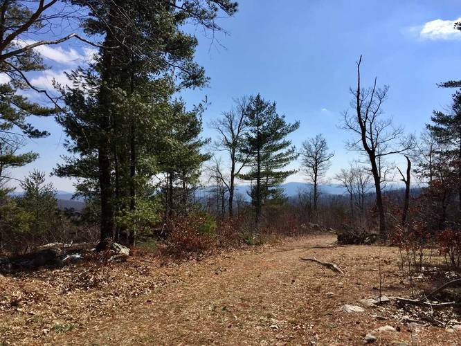
-
Pipeline
39.827092, -77.482933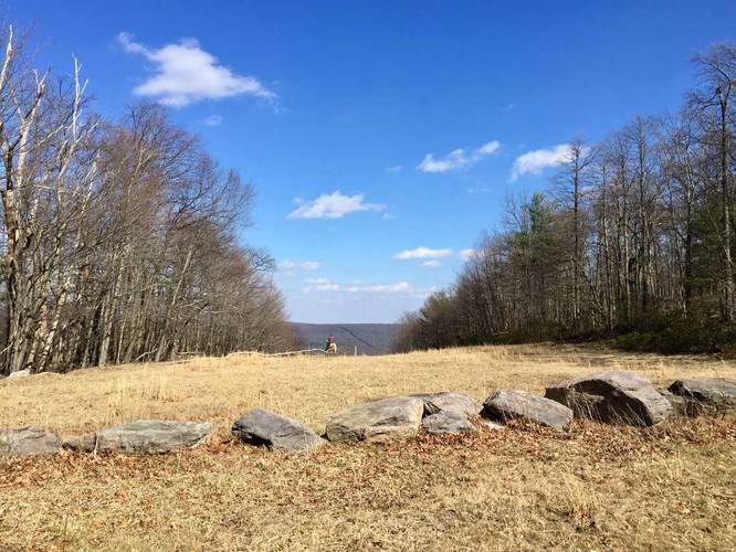
-
Chimney Rocks Spur Trail
39.820419, -77.474808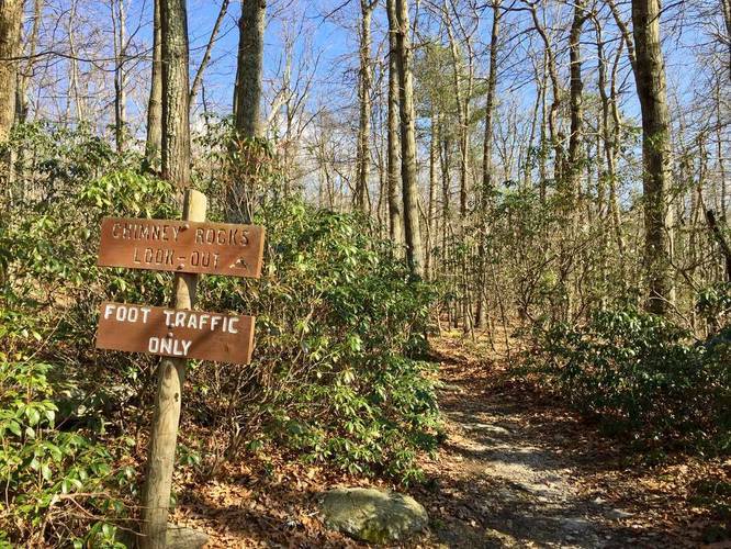
-
Just below Chimney Rocks
39.819267, -77.471969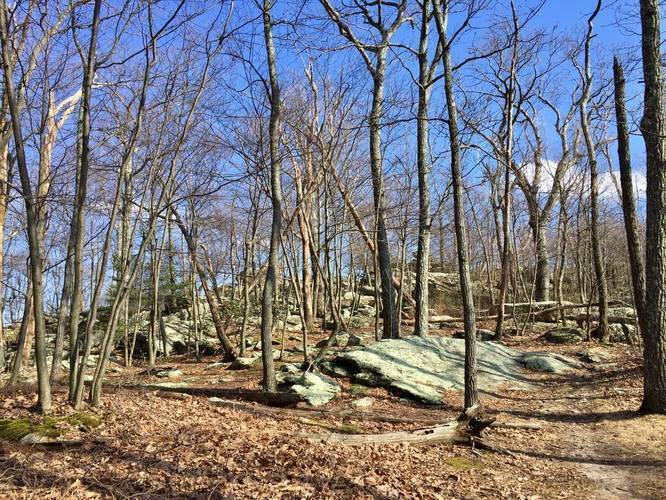
-
Chimney Rocks view
39.818972, -77.471022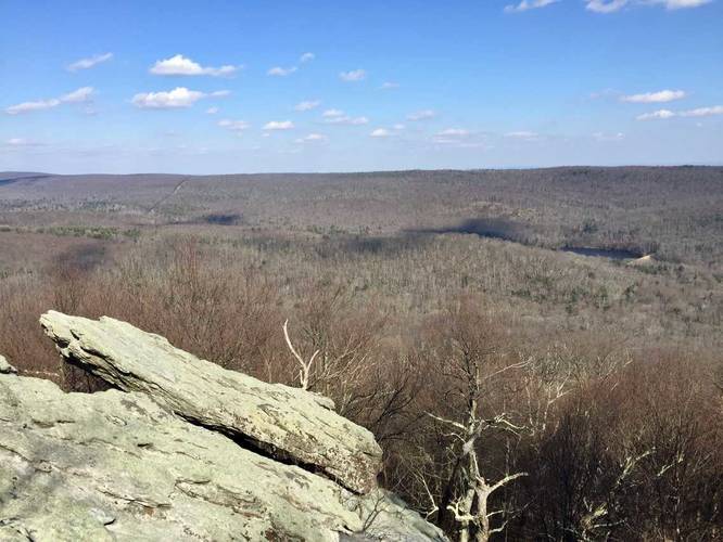
-
Chimney Rocks view
39.818947, -77.471153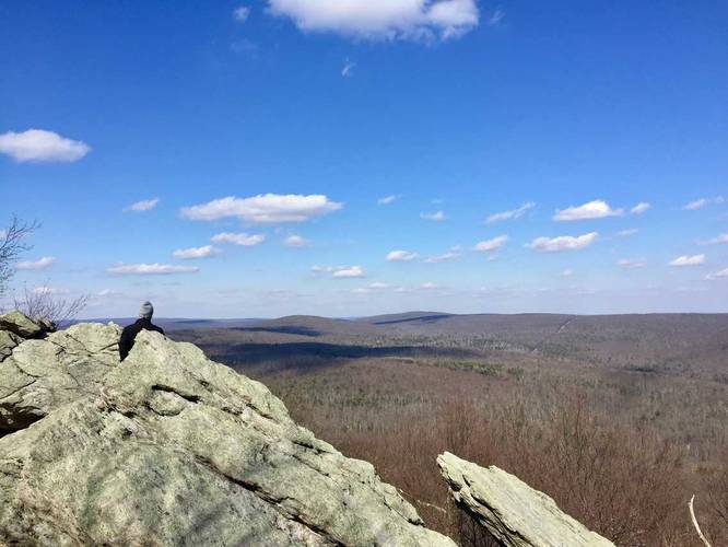
-
Chimney Rocks view with porcupine in tree
39.819064, -77.470969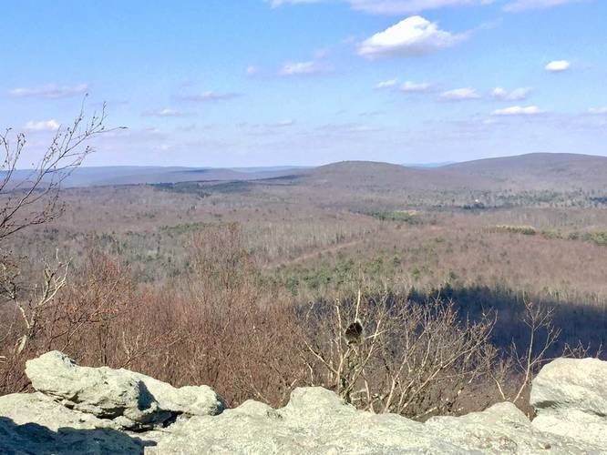
-
View Trail Map
Hiker: CoreyBHiked on: January 04, 2024Distance: 4.5 miles / 7.2 km
Hazards
Seasons
All
3 Trip Reports


Helpful Links
Find Hiking Trails Near Me:


Before you leave...
MyHikes is an indie web platform aimed to make exploring public trails easier for everyone. The site has no investors and is owned and operated by one person, Dave Miller (Founder & Admin). As the Founder, main contributor, and doer-of-all-things for MyHikes, I share my trips with over-detailed write-ups for fun on a volunteer basis and I believe that public trail information should be available to everyone.
It takes a lot of time 🕦, money 💰, and effort (including espresso shots ☕) to run MyHikes, including hiking , mapping , writing , and publishing new trails with high-quality content... along with building new features, moderating, site maintainance, and app development for iOS and Android . I simply ask that if you find MyHikes' trail guides helpful to please consider becoming a Supporter to help keep the site, iOS, and Android apps available to everyone.
Supporters unlock website and in-app perks with a one-time payment of $25 (you renew) 😎👍. Or you can simply make a Donation of your choice without a MyHikes user account. Otherwise, telling your friends about MyHikes is the next-best thing - both quick and free 🎉
Thanks for visiting MyHikes and have a great hike!️

Dave Miller
MyHikes Founder & Admin

