Catskill Mountain House Overlook
Distance:
0.5 Miles / 0.8 kmType:
Out-and-BackDifficulty:
EasyTime to Hike:
~15 minutesFeatures:
Surface Type:
DirtLoading...
Loading...
The Catskill Mountain House Overlook near Palenville, New York is an easy 0.5-mile out-and-back hike that leads to a cliff edge where a historical hotel once stood and features views of the Hudson River Valley and surrounding mountains.
Hike Description
This hike begins at the main trailhead for the Catskill Mountain house and follows the trail east as it heads toward the edge of the mountain. Along the way, hikers will find a couple of noteworthy things - including a junction with signage pointing the way, but also two stone pillars on each side of the trail - located around mile 0.15. It's assumed that these stone pillars were once part of the grand entrance to the Catskill Mountain House, which was built in 1824. All that remains of any structures are these two pillars.
Catskill Mountain House Site & Hudson Valley Overlook - Mile 0.27
Hikers will reach the historic Catskill Mountain House site around mile 0.27 where you'll find two different signs that include information about the old hotel. What you came out here for, however, are the stunning views of the Hudson River Valley and surrounding mountains, located at the end of this hike, located on the mountain's cliffs. Hikers will find stunning views from the ledge where, on a clear day, you can see into Massachusetts including the mountain ranges around Alander Mountain.
Catskill Mountain House History
It was built in 1824 as a way for folks to get away from the city and into clean mountain air, but eventually was burned down by the state in 1963 after the land was acquired by the state after several previous unsuccessful attempts to revitalize the building. Check out more information on wikipedia about the Catskill Mountain House.
Fees
As of September 2023, there's a $10 vehicle entry fee to enter this part of the park for day use and parking.
Parking
Hikers will find parking at the coordinates provided, located at the very end of the road.
Pets
Dogs are allowed if leashed and must be cleaned up after.
-
Parking
42.196189, -74.038632 -
Main Trailhead
42.196168, -74.038617 -
Catskill Mountain House entrance road stone pillars (circa 1824)
42.195489, -74.036125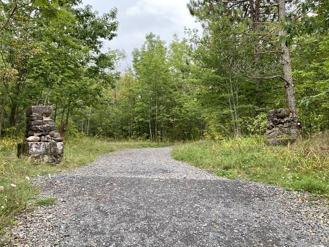
-
Catskill Mountain House historical information
42.194592, -74.034697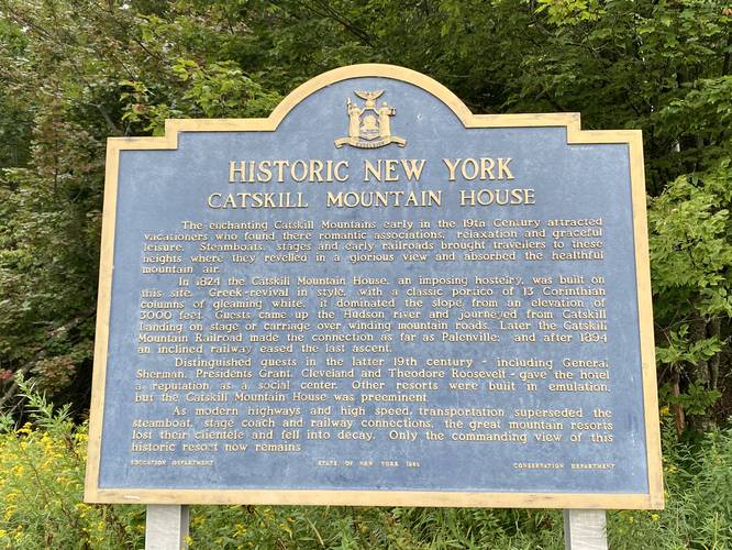
-
View of the Hudson River Valley from the mountainside cliff
42.194558, -74.034561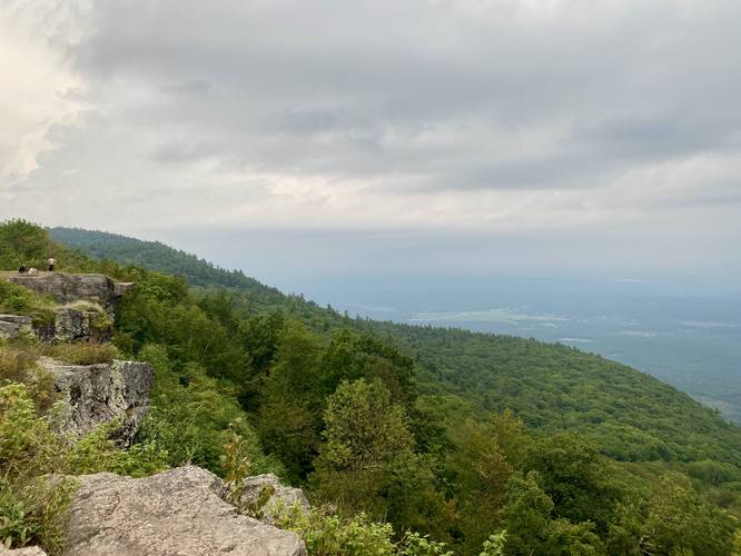
-
View of the Hudson River Valley from the mountainside cliff
42.194572, -74.034547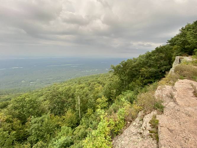
Hazards
Seasons
AllBlaze Color
1 Trip Report


Helpful Links
Find Hiking Trails Near Me:


Before you leave...
MyHikes is an indie web platform aimed to make exploring public trails easier for everyone. The site has no investors and is owned and operated by one person, Dave Miller (Founder & Admin). As the Founder, main contributor, and doer-of-all-things for MyHikes, I share my trips with over-detailed write-ups for fun on a volunteer basis and I believe that public trail information should be available to everyone.
It takes a lot of time 🕦, money 💰, and effort (including espresso shots ☕) to run MyHikes, including hiking , mapping , writing , and publishing new trails with high-quality content... along with building new features, moderating, site maintainance, and app development for iOS and Android . I simply ask that if you find MyHikes' trail guides helpful to please consider becoming a Supporter to help keep the site, iOS, and Android apps available to everyone.
Supporters unlock website and in-app perks with a one-time payment of $25 (you renew) 😎👍. Or you can simply make a Donation of your choice without a MyHikes user account. Otherwise, telling your friends about MyHikes is the next-best thing - both quick and free 🎉
Thanks for visiting MyHikes and have a great hike!️

Dave Miller
MyHikes Founder & Admin

