Basswood Run Waterfalls
Distance:
0.6 Miles / 1.0 kmType:
Out-and-BackDifficulty:
EasyTime to Hike:
~18 minutesFeatures:
Surface Type:
DirtLoading...
Loading...
Basswood Run Waterfalls at Tioga State Forest near Morris, Pennsylvania is an easy 0.8-mile out-and-back creek hike that features small but scenic 2 to 3-foot tall waterfalls cascading down Basswood Run.
Hike Description
This hike begins along PA-287 near the parking coordinates provided, located on a grassy turnout just off of the road. Note that to reach Basswood Run, hikers must carefully make their way south along the highway to reach the creek. This can be dangerous - hike at your own risk and watch out for 55+ MPH vehicles.
At Basswood Run, hikers can either choose to follow a long-lost logging grade that runs along the creek, located to the south of the creek itself, or you can hike up the creek. During early Spring 2023, Basswood Run was not very deep at all despite the water flowing heavily, so to view the small waterfalls, one must be in or next to the creek. This hike follows the creek upstream for about 0.3-miles before turning around.
Basswood Run Waterfalls
There are no large waterfalls along the way upstream, but hikers will a handful of 2 to 3-foot cascades that spill over large rocks to form small cascades. These waterfalls are likely pretty decent for brook trout fishing due to their churning pools. There are also several slide waterfalls too, albeit very small.
Hiking Out
If you choose to explore here, hiking out can be a lot easier if you hop on the old logging grade trail that runs up the mountain, adjacent to the creek, located to the south.
Parking
Hikers can park off the road on PA-287 near the
coordinates provided on the east side of the road; however, please be
careful when walking near or around the highway as cars travel about 55+
MPH here.
Pets
Dogs are allowed if leashed and cleaned up after.
Warning
Highway traffic:
Hikers must also walk south along PA-287 to reach Basswood Run which can be sketchy. Parking here can be kind of sketchy as well because there's no real parking area, but rather grassy roadside turnouts. Cars can easily fit off-road to park on the grass. Watch the traffic and hike at your own risk.
-
Parking
41.614645, -77.294041 -
Main Trailhead
41.614696, -77.294113 -
1 to 2-foot waterfalls along Basswood Run
41.613728, -77.294869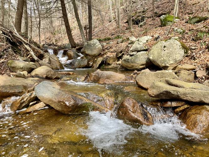
-
2-foot waterfall along Basswood Run
41.613697, -77.295114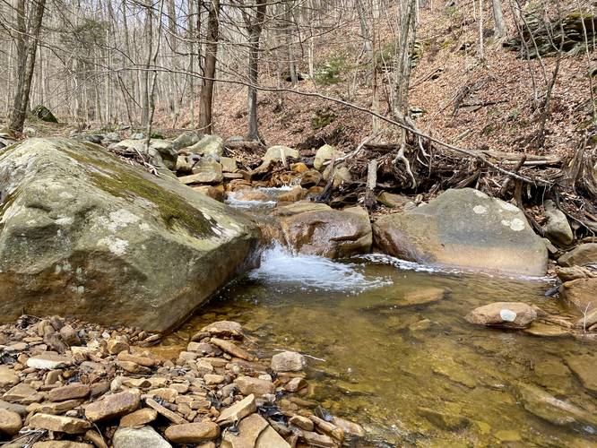
-
2-foot waterfalls along Basswood Run
41.61365, -77.295769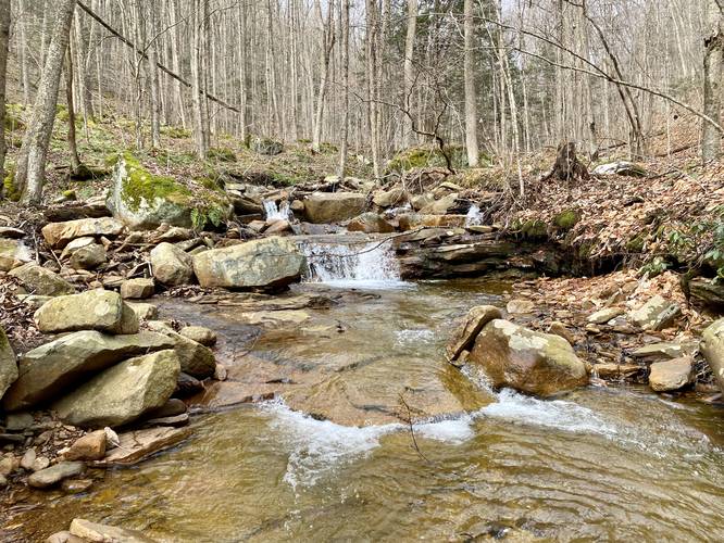
-
2-foot waterfalls along Basswood Run
41.613811, -77.297011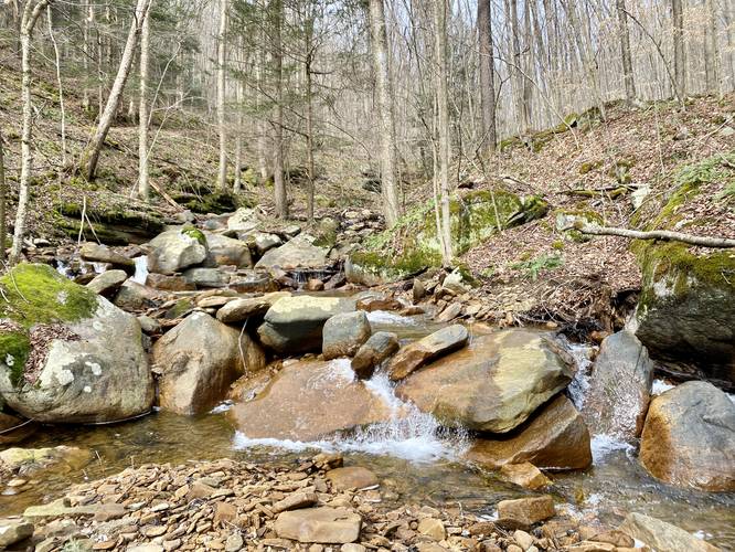
-
2-foot waterfalls along Basswood Run
41.6138, -77.29715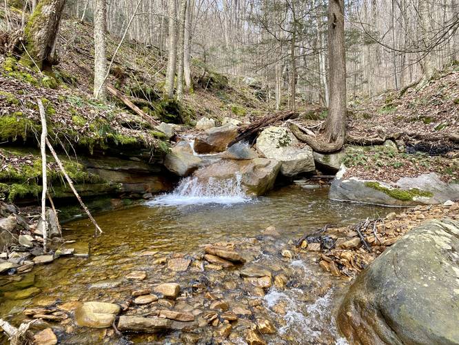
-
3-foot waterfall along Basswood Run
41.614011, -77.297669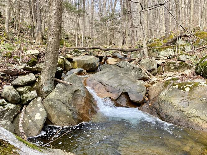
-
3-foot waterfall along Basswood Run
41.614033, -77.297736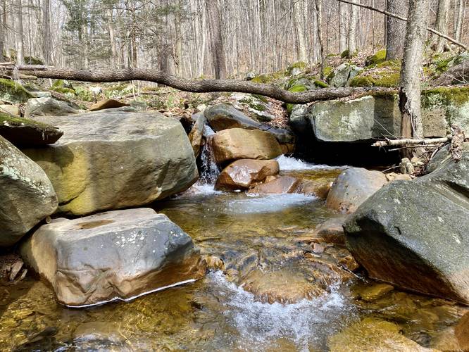
Hazards
Seasons
All
1 Trip Report


")


Before you leave...
MyHikes is an indie web platform aimed to make exploring public trails easier for everyone. The site has no investors and is owned and operated by one person, Dave Miller (Founder & Admin). As the Founder, main contributor, and doer-of-all-things for MyHikes, I share my trips with over-detailed write-ups for fun on a volunteer basis and I believe that public trail information should be available to everyone.
It takes a lot of time 🕦, money 💰, and effort (including espresso shots ☕) to run MyHikes, including hiking , mapping , writing , and publishing new trails with high-quality content... along with building new features, moderating, site maintainance, and app development for iOS and Android . I simply ask that if you find MyHikes' trail guides helpful to please consider becoming a Supporter to help keep the site, iOS, and Android apps available to everyone.
Supporters unlock website and in-app perks with a one-time payment of $25 (you renew) 😎👍. Or you can simply make a Donation of your choice without a MyHikes user account. Otherwise, telling your friends about MyHikes is the next-best thing - both quick and free 🎉
Thanks for visiting MyHikes and have a great hike!️

Dave Miller
MyHikes Founder & Admin

