Audubon Loop Trail
Distance:
0.2 Miles / 0.3 kmType:
LoopDifficulty:
EasyTime to Hike:
~6 minutesSurface Type:
DirtLoading...
Loading...
The Audubon Loop Trail at Raccoon Creek State Park's Wildflower Reserve in Clinton, Pennsylvania is an easy 0.2-mile loop trail that connects to the Audubon Trail and passed through the woods behind the visitor center.
Even though this trail is very short, in the early Spring the trail is covered in wildflower, which makes it look like the ground is covered in snow. When the leaves aren't on the trees, you'll also get views of the surrounding hills.
Wildflowers can be found along the trail generally after mid-April.
No dogs, biking, or even food along the wildflower reserve trails.
Hazards
Seasons
All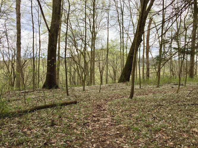
2 Trip Reports


Before you leave...
MyHikes is an indie web platform aimed to make exploring public trails easier for everyone. The site has no investors and is owned and operated by one person, Dave Miller (Founder & Admin). As the Founder, main contributor, and doer-of-all-things for MyHikes, I share my trips with over-detailed write-ups for fun on a volunteer basis and I believe that public trail information should be available to everyone.
It takes a lot of time 🕦, money 💰, and effort (including espresso shots ☕) to run MyHikes, including hiking , mapping , writing , and publishing new trails with high-quality content... along with building new features, moderating, site maintainance, and app development for iOS and Android . I simply ask that if you find MyHikes' trail guides helpful to please consider becoming a Supporter to help keep the site, iOS, and Android apps available to everyone.
Supporters unlock website and in-app perks with a one-time payment of $25 (you renew) 😎👍. Or you can simply make a Donation of your choice without a MyHikes user account. Otherwise, telling your friends about MyHikes is the next-best thing - both quick and free 🎉
Thanks for visiting MyHikes and have a great hike!️

Dave Miller
MyHikes Founder & Admin

