Scott Tower Trail
Distance:
1.8 Miles / 2.9 kmType:
Out-and-BackDifficulty:
EasyTime to Hike:
~54 minutesFeatures:
Surface Type:
DirtLoading...
Loading...
The Scott Tower Trail at Anniversary Hill Park in Holyoke, Massachusetts is an easy 1.8 mile out-and-back hike through a once-popular park. There are several loops and trail options to choose from, but this GPS recording starts off on the main access road before heading onto the outer-most trail in the northern section of the park. While this is and out-and-back hike, it's really a lollipop hike with a spur that leads to a loop.
Along the hike there are a few lookout points, an old stone bridge and staircase that date back to when the park first opened in 1940, and Scott Tower.
Note: The park is no longer maintained, so hike at your own risk. The park is moderately-trafficked, so you'll likely see other people here, but it can give off a strange vibe due to it not being maintained.
History: For more details about Anniversary Hill Park or Scott Tower, check out this article.
Hazards
Seasons
All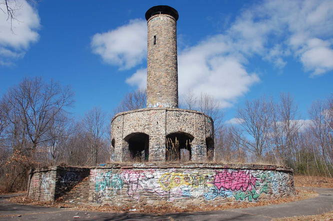

3 Trip Reports


Helpful Links
Find Hiking Trails Near Me:


")

Before you leave...
MyHikes is an indie web platform aimed to make exploring public trails easier for everyone. The site has no investors and is owned and operated by one person, Dave Miller (Founder & Admin). As the Founder, main contributor, and doer-of-all-things for MyHikes, I share my trips with over-detailed write-ups for fun on a volunteer basis and I believe that public trail information should be available to everyone.
It takes a lot of time 🕦, money 💰, and effort (including espresso shots ☕) to run MyHikes, including hiking , mapping , writing , and publishing new trails with high-quality content... along with building new features, moderating, site maintainance, and app development for iOS and Android . I simply ask that if you find MyHikes' trail guides helpful to please consider becoming a Supporter to help keep the site, iOS, and Android apps available to everyone.
Supporters unlock website and in-app perks with a one-time payment of $25 (you renew) 😎👍. Or you can simply make a Donation of your choice without a MyHikes user account. Otherwise, telling your friends about MyHikes is the next-best thing - both quick and free 🎉
Thanks for visiting MyHikes and have a great hike!️

Dave Miller
MyHikes Founder & Admin

