Yellow Loop
Distance:
0.5 Miles / 0.8 kmType:
LoopDifficulty:
ModerateTime to Hike:
~15 minutesFeatures:
Surface Type:
DirtLoading...
Loading...
The Yellow Loop at the West Glenwood Preserve in Scotts Valley, California is a moderate 0.5-mile loop trail that passes through an ancient old-growth redwood grove.
Hike Description
The Yellow Loop has several trailhead locations found along the Magenta Loop and Green Loop trails at the park. This recording begins at the middle junction and heads in a counter-clockwise direction. The redwood grove sits in the eastern section of the trail - hikers will not be able to miss their presence. Hikers can walk up to the base of most of these redwoods, but watch out for poison oak as it's almost everywhere off-trail.
Parking
Hikers will find a small parking lot at the coordinates provided. It's large enough to fit about 6 vehicles.
Pets
Dogs are allowed if leashed and their waste must be carried out by the hiker.
Warnings
Rattlesnakes, mountain lion, wasps, poison oak, and ticks may all be found within this park.
Prohibited
No camping, no plant/animal/mineral collecting, no motorized vehicles or horses. No smoking, no alcohol.
-
Parking
37.07299, -122.004824 -
Main Trailhead
37.078215, -122.004365 -
Redwood grove
37.079936, -122.004478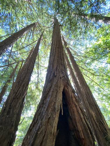
-
Redwood grove
37.079967, -122.004722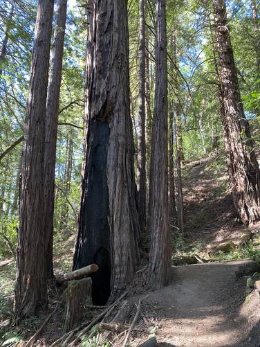
Hazards
Seasons
AllBlaze Color
1 Trip Report


Helpful Links
Find Hiking Trails Near Me:


Before you leave...
MyHikes is an indie web platform aimed to make exploring public trails easier for everyone. The site has no investors and is owned and operated by one person, Dave Miller (Founder & Admin). As the Founder, main contributor, and doer-of-all-things for MyHikes, I share my trips with over-detailed write-ups for fun on a volunteer basis and I believe that public trail information should be available to everyone.
It takes a lot of time 🕦, money 💰, and effort (including espresso shots ☕) to run MyHikes, including hiking , mapping , writing , and publishing new trails with high-quality content... along with building new features, moderating, site maintainance, and app development for iOS and Android . I simply ask that if you find MyHikes' trail guides helpful to please consider becoming a Supporter to help keep the site, iOS, and Android apps available to everyone.
Supporters unlock website and in-app perks with a one-time payment of $25 (you renew) 😎👍. Or you can simply make a Donation of your choice without a MyHikes user account. Otherwise, telling your friends about MyHikes is the next-best thing - both quick and free 🎉
Thanks for visiting MyHikes and have a great hike!️

Dave Miller
MyHikes Founder & Admin

