Wilmington-Ausable Dam
Distance:
0.1 Miles / 0.2 kmType:
Out-and-BackDifficulty:
EasyTime to Hike:
~5 minutesFeatures:
Surface Type:
DirtLoading...
Loading...
The Wilmington-Ausable Dam in Wilmington, New York is an easy 0.1-mile out-and-back walk that features views of the large human-made waterfall that spills over the dam.
This is not a hike but rather a short walk that leads along the scenic West Branch Ausable River. Along the trail are views of the river and surrounding mountains. At the end of the trail is the dam's spillway where the large waterfall cascades over the edge. Watch your step and stay back from the water's edge to ensure a safe walk here.
Parking
Visitors will find a small parking lot at the coordinates provided. The lot is large enough to fit a half-dozen vehicles as of January 2023.
Pets
Dogs are allowed if leashed and their waste must be carried out by the hiker.
-
Parking
44.389258, -73.81797 -
Main Trailhead
44.38935, -73.817809 -
Wilmington-Ausable Dam
44.389744, -73.816911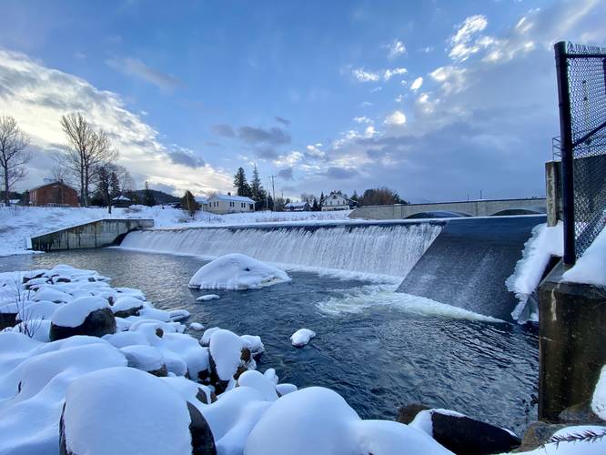
-
View from the trail of mountains in the background, bridge in foreground
44.389553, -73.817147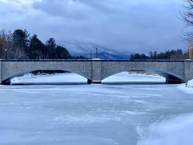
Hazards
Seasons
All
1 Trip Report


Helpful Links
Find Hiking Trails Near Me:


Before you leave...
MyHikes is an indie web platform aimed to make exploring public trails easier for everyone. The site has no investors and is owned and operated by one person, Dave Miller (Founder & Admin). As the Founder, main contributor, and doer-of-all-things for MyHikes, I share my trips with over-detailed write-ups for fun on a volunteer basis and I believe that public trail information should be available to everyone.
It takes a lot of time 🕦, money 💰, and effort (including espresso shots ☕) to run MyHikes, including hiking , mapping , writing , and publishing new trails with high-quality content... along with building new features, moderating, site maintainance, and app development for iOS and Android . I simply ask that if you find MyHikes' trail guides helpful to please consider becoming a Supporter to help keep the site, iOS, and Android apps available to everyone.
Supporters unlock website and in-app perks with a one-time payment of $25 (you renew) 😎👍. Or you can simply make a Donation of your choice without a MyHikes user account. Otherwise, telling your friends about MyHikes is the next-best thing - both quick and free 🎉
Thanks for visiting MyHikes and have a great hike!️

Dave Miller
MyHikes Founder & Admin

