Wildlife Trail
Distance:
3.0 Miles / 4.8 kmType:
Out-and-BackDifficulty:
EasyTime to Hike:
1 hour, ~30 minutesFeatures:
Surface Type:
DirtLoading...
Loading...
The Wildlife Trail (TR-560) at Dolly Sods Wilderness in West Virginia is an easy 3 mile out-and-back hike that connects FR-75 to the Rohrbaugh Plains Trail (TR-508). You can use this trail to reach Red Creek via Rohrbaugh Plains as well.
Just after the trailhead, you'll find a fork in the trail - stay right to keep on the Wildlife Trail; otherwise, you'll end up hiking through a field and into a dead end.
Further into the hike you'll pass another field, about 1 mile in, before the trail ends at the Rorhbaugh Plains Trail. You'll pass a few creeks that cross the trail and along the way as well, so you can filter this water if necessary.
Wildflowers can be found in the late Spring and throughout the Summer. Foliage during autumn is nice too, but there are no blueberry bushes along this trail like in the northern part of the Sods.
Muddy: This trail is abnormally muddy after a it rains. If it's been raining all week, plan for a messy muddy hike almost the entire distance.
Camping: While there is nowhere to camp along this trail, the trail does lead into more primitive backpacking sites within Dolly Sods.
-
Parking
38.986801, -79.329572 -
Main Trailhead
38.986743, -79.329538 -
Creek to filter water
38.995689, -79.343392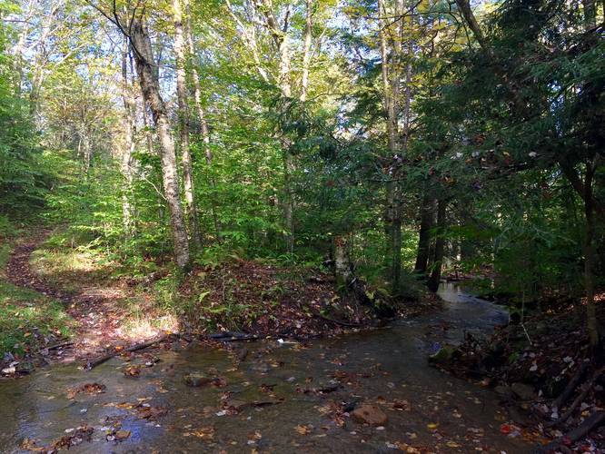
-
Rorhbaugh Plains Trail junction
38.995925, -79.348161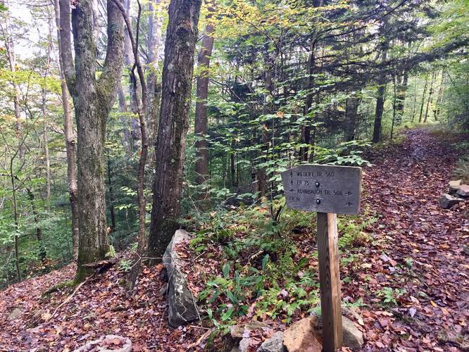
Hazards
Seasons
All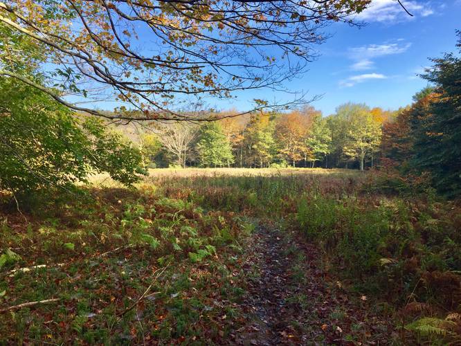
2 Trip Reports


")


Before you leave...
MyHikes is an indie web platform aimed to make exploring public trails easier for everyone. The site has no investors and is owned and operated by one person, Dave Miller (Founder & Admin). As the Founder, main contributor, and doer-of-all-things for MyHikes, I share my trips with over-detailed write-ups for fun on a volunteer basis and I believe that public trail information should be available to everyone.
It takes a lot of time 🕦, money 💰, and effort (including espresso shots ☕) to run MyHikes, including hiking , mapping , writing , and publishing new trails with high-quality content... along with building new features, moderating, site maintainance, and app development for iOS and Android . I simply ask that if you find MyHikes' trail guides helpful to please consider becoming a Supporter to help keep the site, iOS, and Android apps available to everyone.
Supporters unlock website and in-app perks with a one-time payment of $25 (you renew) 😎👍. Or you can simply make a Donation of your choice without a MyHikes user account. Otherwise, telling your friends about MyHikes is the next-best thing - both quick and free 🎉
Thanks for visiting MyHikes and have a great hike!️

Dave Miller
MyHikes Founder & Admin

