Weston College Land Loop Trail
Distance:
3.1 Miles / 5.0 kmType:
LoopDifficulty:
ModerateTime to Hike:
1 hour, ~33 minutesFeatures:
Surface Type:
DirtLoading...
Loading...
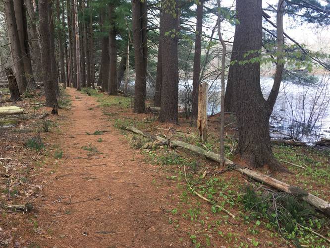
The Weston College Land Loop Trail in Weston, Massachusetts is a moderate 3.1-mile trail that runs along the perimeter of the park and eventually passes College Pond before ending along Concord Road.
The Weston College Lands feature several miles of well maintained trails through the woods and around College Pond on Cherry Brook. To follow this recording, stay along the outer-most trail at the park as you navigate the perimeter. You will be passing through old fields, stone walls, and other evidence of farming in years past. The metal rim of a wagon wheel lays beside one of the trails.
When you reach the end of the trail along Concord Road, you'll need to trek west towards the entrance road for the park and back to the parking lot. Plan for slightly more than 3.1-miles to complete the loop back to parking.
Please note this trail includes a loop and some short spurs. Bicycles, horses, and dogs are allowed on this trail.
Most of the trails are fairly easily passable. There are couple of the less frequented spurs that do not have bridges over streams.
Parking: The best place to park is at Burchard Field.
Hazards
Seasons
AllBlaze Color
1 Trip Report


Helpful Links
Find Hiking Trails Near Me:


")

Before you leave...
MyHikes is an indie web platform aimed to make exploring public trails easier for everyone. The site has no investors and is owned and operated by one person, Dave Miller (Founder & Admin). As the Founder, main contributor, and doer-of-all-things for MyHikes, I share my trips with over-detailed write-ups for fun on a volunteer basis and I believe that public trail information should be available to everyone.
It takes a lot of time 🕦, money 💰, and effort (including espresso shots ☕) to run MyHikes, including hiking , mapping , writing , and publishing new trails with high-quality content... along with building new features, moderating, site maintainance, and app development for iOS and Android . I simply ask that if you find MyHikes' trail guides helpful to please consider becoming a Supporter to help keep the site, iOS, and Android apps available to everyone.
Supporters unlock website and in-app perks with a one-time payment of $25 (you renew) 😎👍. Or you can simply make a Donation of your choice without a MyHikes user account. Otherwise, telling your friends about MyHikes is the next-best thing - both quick and free 🎉
Thanks for visiting MyHikes and have a great hike!️

Dave Miller
MyHikes Founder & Admin

