Webber Cabin Trail
Distance:
0.6 Miles / 1.0 kmType:
Out-and-BackDifficulty:
EasyTime to Hike:
~18 minutesFeatures:
Surface Type:
DirtLoading...
Loading...
The Webber Cabin Trail at the Pennsylvania Lumber Museum near Sweden Township, Pennsylvania is an easy 0.6-mile out-and-back hike that features the historic log cabin that was home to DCNR Forester Bob Webber and his wife Dotty for more than 54 years. The structure was originally located on a remote ridge top in the Pine Creek Valley, near the community of Slate Run and was relocated to the Pennsylvania Lumber Museum in 2018.
This walk takes in some of the other Pennsylvania Lumber Museum exhibits like an old CCC cabin at the trailhead.
TrailsThis explore makes a tour to find and then hike the Webber Cabin Trail. This trail is to easy-to-follow but nevertheless a-tad-hard-to-find at the PA Lumber Museum.
Hike Description
This hike begins at the northeast corner of main parking lot at the PA Lumber Museum and continues to the Webber Cabin and returns on the same route.
The Webber Cabin sits atop of a short well-maintained foot trail that begins near the picnic area pavilion that is about 200 feet from the CCC Log Cabin. The visitor can complete a hike on this footpath by walking along on the eastern edge of the parking area north past the CCC Log Cabin and then across the grassy lawn to the picnic area on the hillside bluff above and then continues to the Webber Cabin Trail beyond.
In essence this hike becomes a cabin-to-cabin hike that connects two historically important log cabins with Interpretive exhibits on the grounds of the PA Lumber Museum. Once on the Webber Cabin Trail, the hiker goes about 0.1 miles to the northeast and then switches back going mostly to the west for an additional 0.2 miles. It's a gradually-sloped climb on a crushed stone pathway, with rest benches placed along the trail - one at the switchback, another a the mid-point of the next leg, and a third placed at the Webber Cabin.
Vista Views
Noteworthy points of interest along the way include not only the rustic beauty of the log cabins in their natural settings here at the PA Lumberman Park, but also the splendid views from the Webber Cabin and at the open bluff at the picnic area pavilion where the trail starts. These vistas afford the hiker two beautiful vantage points of the neighboring mountains from the sunny side of the hill.
No real hiking is required to visit the Webber Cabin. Visitors must walk less than one-half of a mile from the visitors parking area. The walking surface starts as smoothly paved parking lot, and then becomes a grassy lawn, and then a gravelly pathway.
Restrooms
Although there are outhouses located at both cabins, neither are usable (for exhibit purposes only). The only restrooms on-site are located inside of the Lumber Museum's visitor center, which isn't always open to the public. The visitors center was closed on the day of this hike.
Parking
Hikers will find a large visitors parking area near by the coordinates provided. The main parking lot at the Lumber Museum is large and can hold dozens of vehicles. However, The PA Lumber Museum is a popular attraction visited by many a tourists throughout the year especially in the summer. So at certain times, parking in the main parking lot may be limited or even restricted particularly when special programs and events are being held. It might be best to check ahead of your arrival and visit the PA Lumber Museum's Event Page.
Pets
Generally, your pet can enjoy the grounds and outdoor exhibits with you if leashed and their waste is disposed of properly. Only service dogs are allowed inside the buildings.
Biking
Biking is not allowed along the Webber Cabin Trail. Additionally, horses are not allowed along this trail.
Camping and Backpacking
There are no camping opportunities at the Pennsylvania Lumber Museum. The Susquehannock Trail System aka STS is by far the best place to backpack in this area; but it would be best for the camper to park at another defined parking area for any extended hikes or overnight camping trips.
Hikers can find overnight parking for extended hiking trips at the Bureau of Forestry headquarters on US Route 6 on top of Denton Hill. The lot is large enough to hold dozens of vehicles with some amenities including maps and informational kiosks, and restrooms, and serves as the "Northern Gateway" which provides access to the northern portion of the STS loop.. See Duck Ponds Short Loop for extended trip parking coordinates and details to find the route to the STS.
Nearby Cherry Spring State Park offers rustic campsites within the park on a first come, first serve bases, and reservations are needed and can be made at www.visitPAparks.com.
Additional Cabin and Other Points of Interest
The Webber Cabin Trail is located just off of the US Route 6, and can be accessed from the northeast corner of main public parking lot at the Lumber Museum near by the CCC Log Cabin. The museum's CCC Log cabin was constructed in 1936 by the enrollees of Civilian Conservation Corps Camp S-135, Dyer Farm, Potter County, PA based on information listed on the PA Lumber Museum website. The original location of the CCC log Cabin was along Dyer Road off PA Route 44, and within 8 miles northwest (as the crow flights) from the town of Slate Run, and coincidentally in the same vicinity as the original location of the Webber Cabin.
Follow link for more information about the Civilian Conservation Corps which operated during the Great Depression. This site lists the CCC camps nationwide including camp name and location.
The PA Lumber Museum is one of Potter County's most visited attractions and is an educational experience visited by many a tourists motoring along US Route 6 throughout the year. Luckily, for outdoor enthusiasts, this destination has both indoor and outdoor exhibits.
Warning
Timber Rattlesnakes: There may be rattlesnakes out roaming the woods in this area, between the months of April and October. This trail does pass through woods on the sunny side of the mountain, though, the probability of seeing a rattlesnake on this hike are likely to be very slim.
-
Parking
41.779659, -77.825799 -
Main Trailhead
41.780264, -77.825568 -
CCC Cabin
41.779697, -77.825644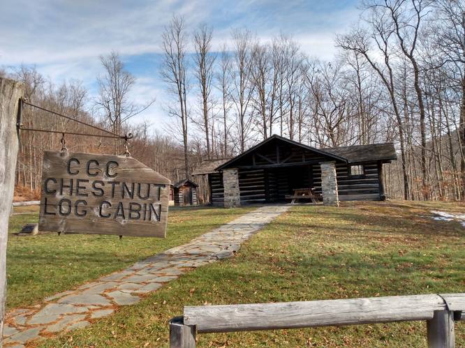
-
Trailhead Maker
41.780335, -77.825413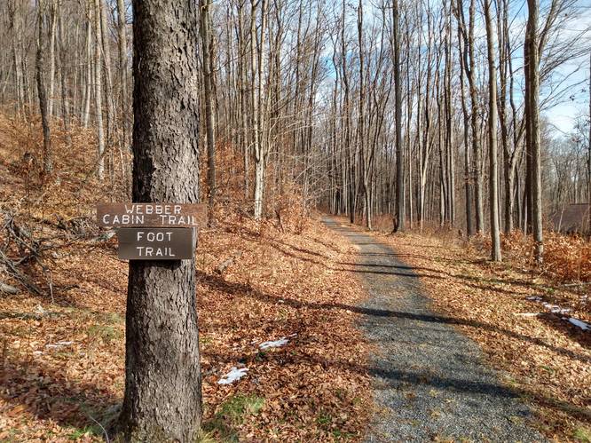
-
View From Trail Head
41.780168, -77.825668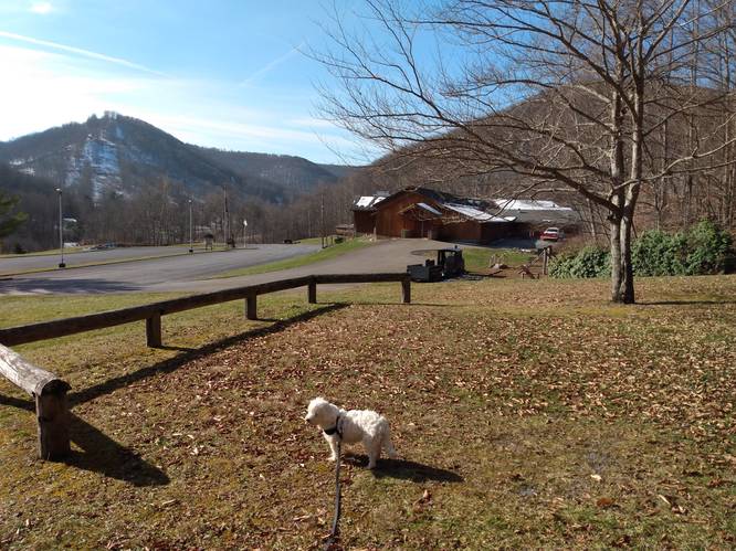
-
Vista View from Webber Cabin
41.780415, -77.827327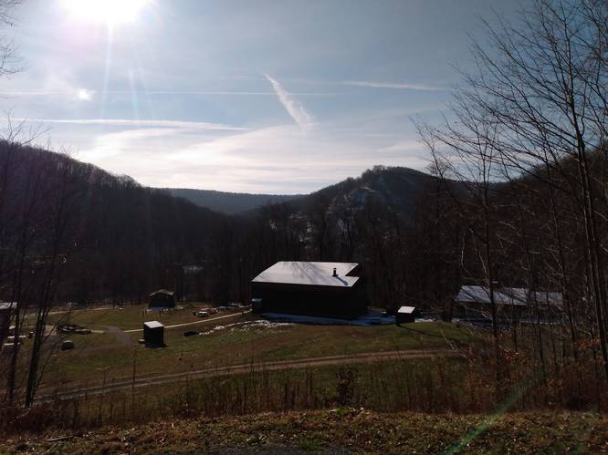
-
Webber Cabin
41.780461, -77.827372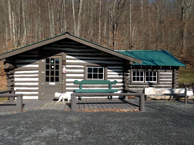
-
Vista at Picnic Pavilion near Trailhead
41.780415, -77.825307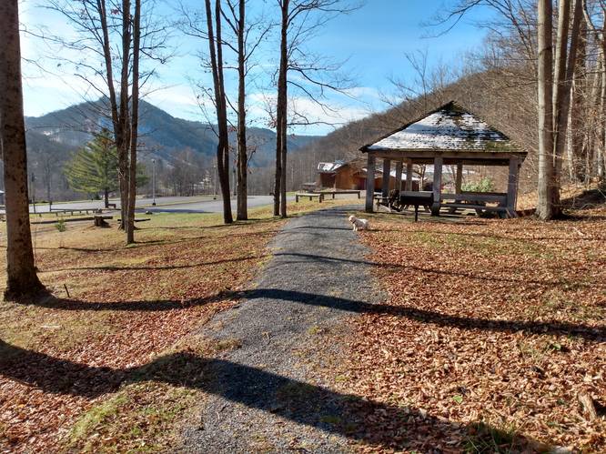
Hazards
Seasons
All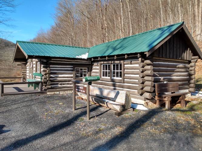
1 Trip Report


Helpful Links
Find Hiking Trails Near Me:


")
Before you leave...
MyHikes is an indie web platform aimed to make exploring public trails easier for everyone. The site has no investors and is owned and operated by one person, Dave Miller (Founder & Admin). As the Founder, main contributor, and doer-of-all-things for MyHikes, I share my trips with over-detailed write-ups for fun on a volunteer basis and I believe that public trail information should be available to everyone.
It takes a lot of time 🕦, money 💰, and effort (including espresso shots ☕) to run MyHikes, including hiking , mapping , writing , and publishing new trails with high-quality content... along with building new features, moderating, site maintainance, and app development for iOS and Android . I simply ask that if you find MyHikes' trail guides helpful to please consider becoming a Supporter to help keep the site, iOS, and Android apps available to everyone.
Supporters unlock website and in-app perks with a one-time payment of $25 (you renew) 😎👍. Or you can simply make a Donation of your choice without a MyHikes user account. Otherwise, telling your friends about MyHikes is the next-best thing - both quick and free 🎉
Thanks for visiting MyHikes and have a great hike!️

Dave Miller
MyHikes Founder & Admin

