Trillium Lake Road Trail
Distance:
4.0 Miles / 6.4 kmType:
Out-and-BackDifficulty:
ModerateTime to Hike:
2 hoursFeatures:
Surface Type:
DirtLoading...
Loading...
The Trillium Lake Road Trail is a seasonal 4 mile out-and-back hike from Mount Hood Highway down to Trillium Lake and the Trillium Lake Loop Trail. Starting in late autumn and lasting through the early Spring, the Trillium Lake Road is closed off due to snow; however, during those seasons, the road can be used for hiking, cross country skiing, and even snowmobiling.
The hike starts off by heading downhill for about 0.4 miles before leveling off a bit. The trail then shoots back uphill and then descends one more time before reaching the Trillium campground and Trillium Lake. Once you reach the 2 mile mark (one way) you'll be at the southeast corner of Trillium Lake - where you can hop on the Trillium Lake Loop Trail for another 2 miles before heading back to parking.
Traffic: This trail was tracked mid-week early in the day, but we still saw a decent amount of people. It's moderately trafficked in the late fall, but considering the 4 to 6 mile distance, most people are spread out throughout the trails, so you may not run into many people during the shoulder seasons.
Views/Lookout Points: Once you reach the end of this hike, you get to Trillium Lake with views of the lake and Mount Hood.
Seasons
Spring, Fall, Winter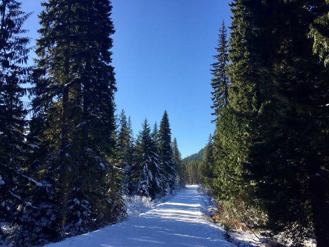
1 Trip Report


Helpful Links
Find Hiking Trails Near Me:


Before you leave...
MyHikes is an indie web platform aimed to make exploring public trails easier for everyone. The site has no investors and is owned and operated by one person, Dave Miller (Founder & Admin). As the Founder, main contributor, and doer-of-all-things for MyHikes, I share my trips with over-detailed write-ups for fun on a volunteer basis and I believe that public trail information should be available to everyone.
It takes a lot of time 🕦, money 💰, and effort (including espresso shots ☕) to run MyHikes, including hiking , mapping , writing , and publishing new trails with high-quality content... along with building new features, moderating, site maintainance, and app development for iOS and Android . I simply ask that if you find MyHikes' trail guides helpful to please consider becoming a Supporter to help keep the site, iOS, and Android apps available to everyone.
Supporters unlock website and in-app perks with a one-time payment of $25 (you renew) 😎👍. Or you can simply make a Donation of your choice without a MyHikes user account. Otherwise, telling your friends about MyHikes is the next-best thing - both quick and free 🎉
Thanks for visiting MyHikes and have a great hike!️

Dave Miller
MyHikes Founder & Admin

