Three Rivers Heritage Trail - Downtown
Distance:
3.0 Miles / 4.8 kmType:
Out-and-BackDifficulty:
EasyTime to Hike:
1 hour, ~30 minutesFeatures:
Surface Type:
Universal AccessTown:
Pittsburgh, PennsylvaniaLoading...
Loading...
The downtown portion of the Three Rivers Heritage Trail, in Pittsburgh, runs from the Strip District, through Point State Park, and along the Monongahela River before finally turning up into Frick Park.
This trail gives you views of the Allegheny, Ohio, and Monongahela Rivers, Pittsburgh's bridges, Heinz Stadium, PNC Field, and views of downtown. If you're visiting the city and have some time to kill, this trail is well worth a visit.
To continue on this trail heading north, check out the Strip District section of the TRHT. To continue on the TRHT heading south along the Monongahela River, check out the Eliza Furnace Trail.
Parking: Parking can be found at parking garages downtown or along the streets where metered parking is available.
Hazards
Season
Summer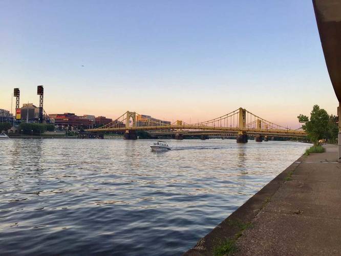
2 Trip Reports


Helpful Links
Find Hiking Trails Near Me:


")

Before you leave...
MyHikes is an indie web platform aimed to make exploring public trails easier for everyone. The site has no investors and is owned and operated by one person, Dave Miller (Founder & Admin). As the Founder, main contributor, and doer-of-all-things for MyHikes, I share my trips with over-detailed write-ups for fun on a volunteer basis and I believe that public trail information should be available to everyone.
It takes a lot of time 🕦, money 💰, and effort (including espresso shots ☕) to run MyHikes, including hiking , mapping , writing , and publishing new trails with high-quality content... along with building new features, moderating, site maintainance, and app development for iOS and Android . I simply ask that if you find MyHikes' trail guides helpful to please consider becoming a Supporter to help keep the site, iOS, and Android apps available to everyone.
Supporters unlock website and in-app perks with a one-time payment of $25 (you renew) 😎👍. Or you can simply make a Donation of your choice without a MyHikes user account. Otherwise, telling your friends about MyHikes is the next-best thing - both quick and free 🎉
Thanks for visiting MyHikes and have a great hike!️

Dave Miller
MyHikes Founder & Admin

