Taylor Notch via M & M trail
Distance:
4.4 Miles / 7.1 kmType:
Out-and-BackDifficulty:
ModerateTime to Hike:
2 hours, ~12 minutesFeatures:
Surface Type:
DirtLoading...
Loading...
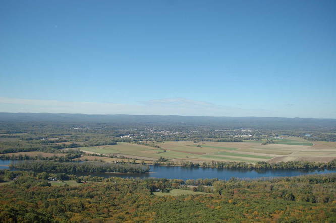
This is the starting point of the Metacomet - Monadnock Trail on the east side of the Connecticut River, which leads up to Mount Holyoke, Taylor Notch, and Mount Holyoke for a 4.4 mile out-and-back hike. This portion follows along the ridge leading to the Summit House atop Mount Holyoke. Stunning views of Springfield, Hartford, Holyoke, The Holyoke Range, Northampton and Amherst are available all the way to the Summit House. Taylor Notch is a short hike past the Summit House where the M & M trail intersects with the road to the top of the mountain.
This section of the M & M Trail, in its entirety, spans the Seven Sisters and ends at the Notch Visitors Center at the base of Bare Mountain.
Hazards
Seasons
AllBlaze Color
Blaze Dot
1 Trip Report


Helpful Links
Find Hiking Trails Near Me:


Before you leave...
MyHikes is an indie web platform aimed to make exploring public trails easier for everyone. The site has no investors and is owned and operated by one person, Dave Miller (Founder & Admin). As the Founder, main contributor, and doer-of-all-things for MyHikes, I share my trips with over-detailed write-ups for fun on a volunteer basis and I believe that public trail information should be available to everyone.
It takes a lot of time 🕦, money 💰, and effort (including espresso shots ☕) to run MyHikes, including hiking , mapping , writing , and publishing new trails with high-quality content... along with building new features, moderating, site maintainance, and app development for iOS and Android . I simply ask that if you find MyHikes' trail guides helpful to please consider becoming a Supporter to help keep the site, iOS, and Android apps available to everyone.
Supporters unlock website and in-app perks with a one-time payment of $25 (you renew) 😎👍. Or you can simply make a Donation of your choice without a MyHikes user account. Otherwise, telling your friends about MyHikes is the next-best thing - both quick and free 🎉
Thanks for visiting MyHikes and have a great hike!️

Dave Miller
MyHikes Founder & Admin

