Tannery Creek Falls
Distance:
0.1 Miles / 0.2 kmType:
Out-and-BackDifficulty:
EasyTime to Hike:
~5 minutesFeatures:
Surface Type:
DirtLoading...
Loading...
Tannery Creek Falls near Canton, New York is an easy 0.1-mile out-and-back walk that leads to the 6-foot tall waterfall, Tannery Creek Falls.
This is not a hike but rather a very short roadside walk to reach the base of Tannery Creek Falls. After parking, visitors will find the trailhead on the south side of Tannery Creek Road, located directly across from the parking turnout. Hop over the guardrail to find a small gravel trail that leads downhill to the base of the waterfall. The trail and bedrock surrounding the base of Tannery Creek Falls can be slippery, watch out. Once at the base of Tannery Creek Falls, visitors will find a nice deep pool of water in the creek below -- likely good for fishing. The waterfall itself is approximately 6-feet tall and ~20-feet wide. It spills down the creek's bedrock alongside hemlock trees and a small rock ledge. I've personally drive by this scenic waterfall numerous times without stopping, but it was well-worth the short visit once I did on Jan 1, 2024.
Parking
Visitors will find a small parking turnout at the coordinates provided, located on the north side of Tannery Creek Road in Canton approximately 500-feet East of Davis Road. The turnout is large enough to fit a couple of vehicles. Careful, the turnout sits on a blind curve.
Pets
Dogs are allowed only if leashed and must be cleaned up after.
-
Parking
42.043423, -77.110577 -
Main Trailhead
42.043436, -77.110477 -
Tannery Creek Falls, approx. 6-feet tall
42.04314, -77.110423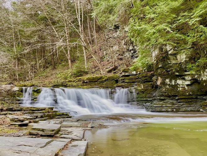
Hazards
Seasons
All
2 Trip Reports


")
Before you leave...
MyHikes is an indie web platform aimed to make exploring public trails easier for everyone. The site has no investors and is owned and operated by one person, Dave Miller (Founder & Admin). As the Founder, main contributor, and doer-of-all-things for MyHikes, I share my trips with over-detailed write-ups for fun on a volunteer basis and I believe that public trail information should be available to everyone.
It takes a lot of time 🕦, money 💰, and effort (including espresso shots ☕) to run MyHikes, including hiking , mapping , writing , and publishing new trails with high-quality content... along with building new features, moderating, site maintainance, and app development for iOS and Android . I simply ask that if you find MyHikes' trail guides helpful to please consider becoming a Supporter to help keep the site, iOS, and Android apps available to everyone.
Supporters unlock website and in-app perks with a one-time payment of $25 (you renew) 😎👍. Or you can simply make a Donation of your choice without a MyHikes user account. Otherwise, telling your friends about MyHikes is the next-best thing - both quick and free 🎉
Thanks for visiting MyHikes and have a great hike!️

Dave Miller
MyHikes Founder & Admin

