Switchback Trail
Distance:
0.2 Miles / 0.3 kmType:
One-WayDifficulty:
ModerateTime to Hike:
~6 minutesFeatures:
Surface Type:
DirtLoading...
Loading...
The Switchback Trail at Boyce Mayview Park in Upper Saint Clair, Pennsylvania is a moderate 0.2-mile one-way trail that leads the hiker from a ridge down to the creek valley below.
Hike Description
This track begins at the top of the ridge at the Sylvan Ridge Trail and heads downhill along a skinny path that hits switchbacks on the way down. There’s not much to note along this trail other than the Spring-time wildflowers. Hikers heading uphill along this trail will find the hike moderate, hence the difficulty. At the top of the trail, hikers will find a labeled point-of-interest labeled Earth Spirit Point.
Earth Spirit Point
At the top of the ridge near the trailhead is a point-of-interest labeled Earth Spirit Point. There were no signs for this POI, but there was a large “scar” cut out
in the earth, built up with what looked like small rock walls. This cut
in the earth is no larger than 6-feet long and 2-feet wide. I assume
this is what Earth Spirit Point is, or maybe it’s simply a
reference to what potentially used to be a vista or overlook here as
there's an obstructed view through the trees.
Pets
Dogs are allowed on this trail.
Parking
Hikers will find parking at the coordinates provided, right off of Morton Road in Upper St. Clair.
Biking
Biking is allowed along this trail.
Wildflowers
During the Spring (approx. mid-April) this trail usually has some nice wildflowers like Trout Lily and Trillium.
Connecting Trails
This trail connects with the Sylvan Ridge Trail, Curved Bridge Trail, and the Trillium Trail.
Hazards
Seasons
All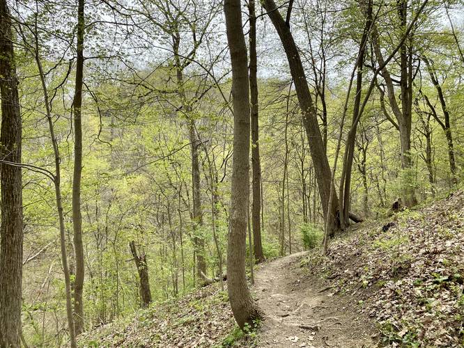
2 Trip Reports


Helpful Links
Find Hiking Trails Near Me:


Before you leave...
MyHikes is an indie web platform aimed to make exploring public trails easier for everyone. The site has no investors and is owned and operated by one person, Dave Miller (Founder & Admin). As the Founder, main contributor, and doer-of-all-things for MyHikes, I share my trips with over-detailed write-ups for fun on a volunteer basis and I believe that public trail information should be available to everyone.
It takes a lot of time 🕦, money 💰, and effort (including espresso shots ☕) to run MyHikes, including hiking , mapping , writing , and publishing new trails with high-quality content... along with building new features, moderating, site maintainance, and app development for iOS and Android . I simply ask that if you find MyHikes' trail guides helpful to please consider becoming a Supporter to help keep the site, iOS, and Android apps available to everyone.
Supporters unlock website and in-app perks with a one-time payment of $25 (you renew) 😎👍. Or you can simply make a Donation of your choice without a MyHikes user account. Otherwise, telling your friends about MyHikes is the next-best thing - both quick and free 🎉
Thanks for visiting MyHikes and have a great hike!️

Dave Miller
MyHikes Founder & Admin

