Sugar Run Trail to Jonathan Run Falls
Distance:
4.0 Miles / 6.4 kmType:
Out-and-BackDifficulty:
ModerateTime to Hike:
2 hoursFeatures:
Surface Type:
DirtLoading...
Loading...
The Sugar Run Trail to Jonathan Run Falls is a moderate 4 mile out-and-back hike in the northern section of Ohiopyle out to two waterfalls: Jonathan Run Falls and Fetcher Run Falls. Please note that a bridge between the Jonathan Run trailhead and the intersection with the Sugar Run Trail is out, hence the need to hike into Jonathan Run Falls via the Sugar Run Trail instead.
The hike starts out at the large parking lot along Sugar Run Rd and follows the road in the woods for about a half mile before the trail heads downhill to the first creek crossing - Sugar Run. You'll cross two small wooden bridges, first crossing Sugar Run, then you'll cross a tributary creek that feeds Sugar Run.
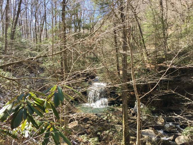
Hike for another 1 mile or so before you reach another creek crossing - this is Fetcher Run. When you reach Fetcher Run, take a small detour towards Jonathan Run and hike down into the gorge a bit where you'll find Fetcher Run Falls - a roughly 8-foot waterfall that cascades down these massive rocks and spills into Jonathan Run below. In this GPS track, Fetcher Run Falls can be found in the elevation data on the hike out.
Continuing on from Fetcher Run Falls, you'll hike for another 0.2 miles before reaching the Jonathan Run Trail. Take a left at the intersection and cross the bridge over Jonathan Run. Follow the trail downhill for another 0.4 miles before you start to hear a loud rushing of water - this is Jonathan Run Falls.
Jonathan Run Falls is about 20-feet tall and cascades down two tiers within Jonathan Run. The first tier is about 5-feet, while the 2nd tier is about 15-feet. Please note that getting down and closer to Jonathan Falls is very dangerous. The trail that heads downhill is extremely steep with plenty of mud, leaves, and roots to slip and trip on. Since the grade is so steep, you need to essentially crawl downhill to get to the falls. There's a make-shift rope that someone tied to some trees here that you can use to get down easier; however, it's still extremely sketchy, hence why the pictures I took were not directly next to Jonathan Falls. You can also enjoy a nice view of the falls from the trail if you visit when there are no leaves on the trees.
Dogs and biking are both allowed on this trail. Hunting is also permitted on this trail, so it's smart to wear blaze-orange.
As of March 2019, the hike to Jonathan Run Falls follows red blazes from the parking lot all the way to the falls (and likely beyond).
-
Parking
39.913268, -79.501108 -
Main Trailhead
39.913163, -79.50095 -
Jonathan Run Falls
39.902922, -79.490311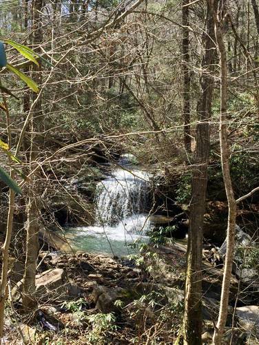
-
Fetcher Run Falls
39.90095, -79.4935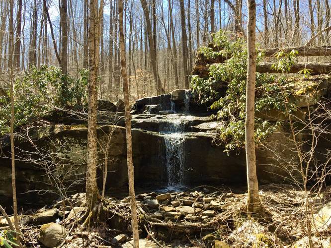
Hazards
Seasons
AllBlaze Color
2 Trip Reports


Helpful Links
Find Hiking Trails Near Me:


Before you leave...
MyHikes is an indie web platform aimed to make exploring public trails easier for everyone. The site has no investors and is owned and operated by one person, Dave Miller (Founder & Admin). As the Founder, main contributor, and doer-of-all-things for MyHikes, I share my trips with over-detailed write-ups for fun on a volunteer basis and I believe that public trail information should be available to everyone.
It takes a lot of time 🕦, money 💰, and effort (including espresso shots ☕) to run MyHikes, including hiking , mapping , writing , and publishing new trails with high-quality content... along with building new features, moderating, site maintainance, and app development for iOS and Android . I simply ask that if you find MyHikes' trail guides helpful to please consider becoming a Supporter to help keep the site, iOS, and Android apps available to everyone.
Supporters unlock website and in-app perks with a one-time payment of $25 (you renew) 😎👍. Or you can simply make a Donation of your choice without a MyHikes user account. Otherwise, telling your friends about MyHikes is the next-best thing - both quick and free 🎉
Thanks for visiting MyHikes and have a great hike!️

Dave Miller
MyHikes Founder & Admin

