Sue Reichert Discovery Trail
Distance:
0.4 Miles / 0.6 kmType:
LoopDifficulty:
EasyTime to Hike:
~15 minutesFeatures:
Surface Type:
DirtLoading...
Loading...
The Sue Reichert Discovery Trail at the Matthaei Botanical Gardens in Ann Arbor, Michigan is an easy 0.4-mile loop trail that encompasses Willow Pond and includes opportunities for bird watching and wildlife observation.
Hike Description
While this trail is less of a hike and more of a nice nature walk, it begins just across the street from the main parking lot at the botanical garden. This track leads in a clockwise direction, by taking a left-hand turn at the trailhead. The trail is mostly undefined along the southern side of Willow Pond as it meanders its way west. Just before the trail turns north, there's a small out-and-back pond "island" walk that you can follow that provides more views of Willow Pond; however, this track skips that short trail. The trail will then head north and curve around a bend as it begins to head east. The trail will cross a bridge that spans a small stream that flows out from Willow Pond, around mile 0.25. Just after that is a small hillside view above Willow Pond. The trail then heads alongside the entrance road, heading south, to reach the trailhead.
Parking & Fees
Hikers will find parking at the coordinates provided at the main lot for the Matthaei Botanical Garden. There's a small fee of $5 for the day or $1.50/hour to park - rates may change, please check their website before visiting. Note that there are technically no fees to walk the grounds or enter the botanical garden.
Pets
Dogs are not allowed on any trails at the Matthaei Botanical Garden.
Wildlife Viewing
Visitors will find the best wildlife viewing along this trail because Willow Pond provides habitats for heron, turtles, fish, and other species of birds. Upon our visit we found two heron resting and several turtles sunning on a downed tree in the pond.
Water Source
The botanical garden has a free water fountain inside the main building that hikers can use to refill their water bottles.
Restrooms
There are restrooms inside the botanical garden's main building.
Warning
Rattlesnakes: This area is known to inhabit rattlesnakes. They tend to sun themselves on trails, rocky spots, or bare areas with gravel or rocks. These rattlesnakes could be anywhere during warm months (April - October), so be on the lookout and give any rattlers you find plenty of space.
-
Parking
42.299999, -83.661831 -
Main Trailhead
42.300114, -83.661918 -
View of Willow Pond
42.300156, -83.662658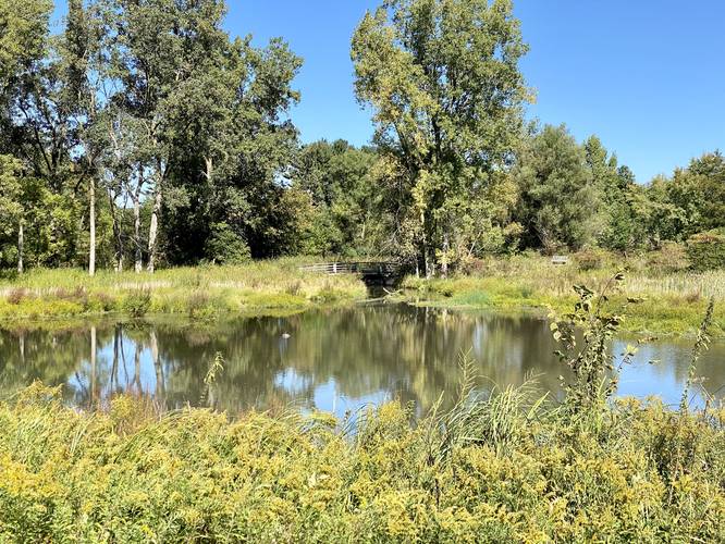
-
View of Willow Pond from the bridge
42.3012, -83.662675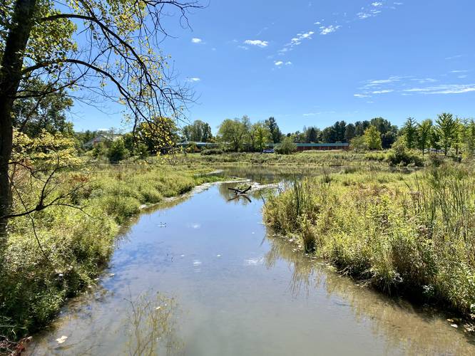
-
Willow Pond
42.300775, -83.661597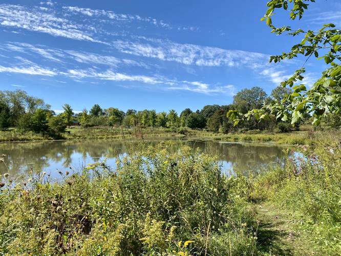
-
Heron on log in Willow Pond
42.300769, -83.661644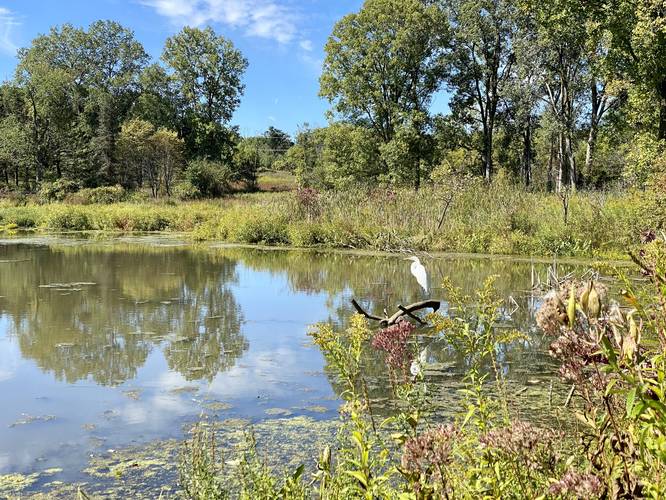
Hazards
Seasons
All
2 Trip Reports


Helpful Links
Find Hiking Trails Near Me:


")


Before you leave...
MyHikes is an indie web platform aimed to make exploring public trails easier for everyone. The site has no investors and is owned and operated by one person, Dave Miller (Founder & Admin). As the Founder, main contributor, and doer-of-all-things for MyHikes, I share my trips with over-detailed write-ups for fun on a volunteer basis and I believe that public trail information should be available to everyone.
It takes a lot of time 🕦, money 💰, and effort (including espresso shots ☕) to run MyHikes, including hiking , mapping , writing , and publishing new trails with high-quality content... along with building new features, moderating, site maintainance, and app development for iOS and Android . I simply ask that if you find MyHikes' trail guides helpful to please consider becoming a Supporter to help keep the site, iOS, and Android apps available to everyone.
Supporters unlock website and in-app perks with a one-time payment of $25 (you renew) 😎👍. Or you can simply make a Donation of your choice without a MyHikes user account. Otherwise, telling your friends about MyHikes is the next-best thing - both quick and free 🎉
Thanks for visiting MyHikes and have a great hike!️

Dave Miller
MyHikes Founder & Admin

