Station Square Trail
Distance:
3.8 Miles / 6.1 kmType:
Out-and-BackDifficulty:
EasyTime to Hike:
1 hour, ~54 minutesFeatures:
Surface Type:
Universal AccessLoading...
Loading...
The Station Square Trail in Pittsburgh, Pennsylvania is a popular and easy 3.8 mile trail that runs along the south shores of the Monongahela River with views of downtown and Mount Washington. The trail is technically part of the Three Rivers Heritage Trail system and continues beyond the end of this section to run along the South Side portion of the TRHT before connecting to the Great Allegheny Passage trail. This track starts at the parking lot for the Duquesne Incline and ends just beyond where the South Side trail starts near S 4th Street.
Just before reaching the Smithfield Street Bridge, the trail passes Clinton Furnace - Pittsburgh's first successful pig iron furnace. Operations began in 1859 near this area, using Connellsville coke as fuel. The furnace's technology lead to more advanced technologies, like the blast furnace, capable of producing huge amounts of iron. Clinton Furnace played an important role in establishing Pittsburgh's dominance in iron and steel production, but its operations ended in 1927.
Sights: Downtown Pittsburgh, Mount Washington, Smithfield Street Bridge, Liberty Bridge, Liberty Tunnel, Clinton Furnace.
Important Detour Note: Near the portion of the trail where you reach Smithfield Street Bridge the trail is blocked off and rerouted due to construction. Once you reach the bridge, climb the stairs and walk down the street towards West Carson Street. Cross the street and continue walking through the main parking lot. Follow signs with arrows that say "River Trail Detour" until you reach S 4th Street. Follow S 4th Street all the way to the water where the trail picks back up again and turns into the South Side portion of the Three Rivers Heritage Trail. Once construction has been completed, this GPS track will be updated to include the proper trail in this section and not the detour.
Parking & Fees: Parking can be found at various points along this trail, but parking is not free. 0 - 2 hours is $5 with extra charges for additional hours. For more parking areas, check out this TRHT trail map PDF.
-
Parking
40.440787, -80.018767 -
Main Trailhead
40.440302, -80.017333 -
View of downtown Pittsburgh, PA
40.439022, -80.014625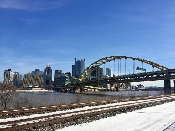
-
View of downtown Pittsburgh, PA
40.435356, -80.006631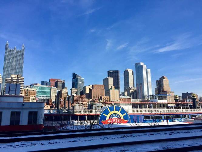
-
Clinton Furnace
40.434303, -80.004708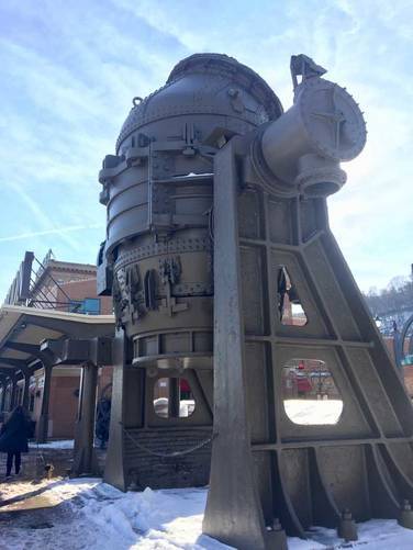
-
View of downtown Pittsburgh, PA
40.431339, -79.995025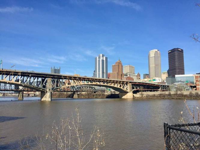
-
Beginning of South Side TRHT
40.431286, -79.993431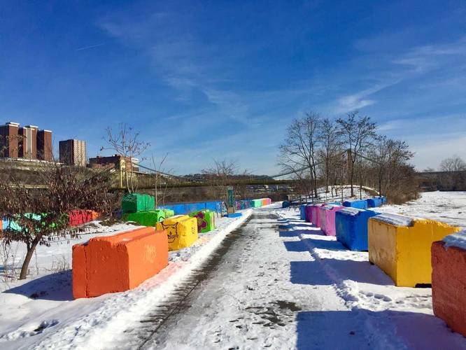
-
Mural
40.429669, -79.996528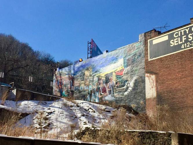
-
Smithfield Street Bridge
40.433753, -80.003708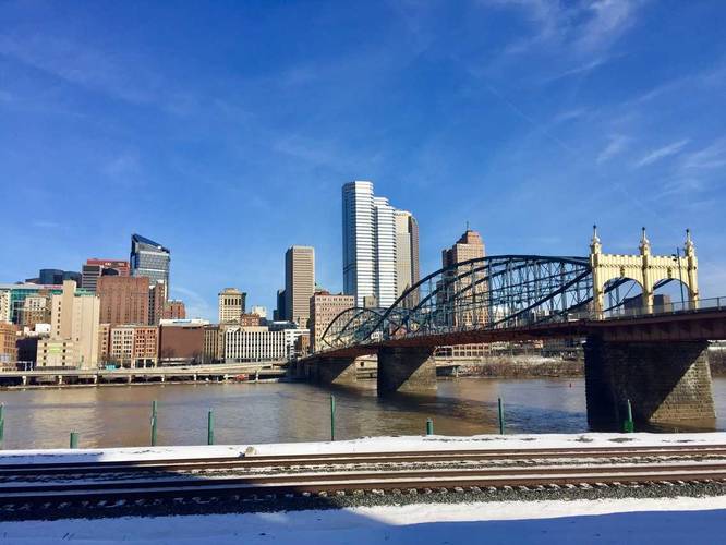
Hazards
Seasons
All
2 Trip Reports


Helpful Links
Find Hiking Trails Near Me:


")

Before you leave...
MyHikes is an indie web platform aimed to make exploring public trails easier for everyone. The site has no investors and is owned and operated by one person, Dave Miller (Founder & Admin). As the Founder, main contributor, and doer-of-all-things for MyHikes, I share my trips with over-detailed write-ups for fun on a volunteer basis and I believe that public trail information should be available to everyone.
It takes a lot of time 🕦, money 💰, and effort (including espresso shots ☕) to run MyHikes, including hiking , mapping , writing , and publishing new trails with high-quality content... along with building new features, moderating, site maintainance, and app development for iOS and Android . I simply ask that if you find MyHikes' trail guides helpful to please consider becoming a Supporter to help keep the site, iOS, and Android apps available to everyone.
Supporters unlock website and in-app perks with a one-time payment of $25 (you renew) 😎👍. Or you can simply make a Donation of your choice without a MyHikes user account. Otherwise, telling your friends about MyHikes is the next-best thing - both quick and free 🎉
Thanks for visiting MyHikes and have a great hike!️

Dave Miller
MyHikes Founder & Admin

