South Hill Loop
Distance:
2.8 Miles / 4.5 kmType:
LoopDifficulty:
ModerateTime to Hike:
1 hour, ~24 minutesFeatures:
Surface Type:
DirtLoading...
Loading...
The South Hill Loop at Tioga State Forest near Middlebury Township, Pennsylvania is a moderate 2.8-mile loop trail that passes through a pine forest at the summit of South Hill and is generally a peaceful hike through the woods.
Hike Description
This trail begins near the junction of Norris Brook Rd and Baldwin Run Rd and follows a red blazed trail for about 0.5-miles. Around mile 0.5, hikers will reach a junction - here, this GPS recording stays to the right-hand side to first hit the summit of South Hill. At this junction, the trail will begin to follow yellow blazes until the hiker loops back to this spot. Note that there are no views on this hike; however, during the winter at the yellow-blazed junction, hikers may notice the mountains in the distance through the trees (see the view POI on the map).
South Hill Summit - Mile 0.7
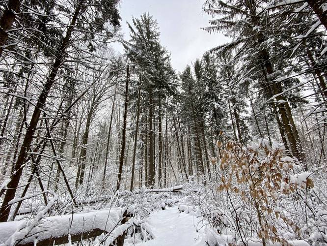
Around mile 0.7, hikers will finally reach the summit of South Hill; however, the summit is located just off-trail within a beautiful red pine and hemlock grove. I'd argue the highlight of this hike is near the summit - especially if snowshoeing in the winter after a recent snowfall.
Hiking the Loop
After passing the summit, the trail will wind its way slightly uphill before finally descending South Hill to reach a service road. Along the way, hikers may reach a very wet swampy area - here I managed to hike around this by hiking approximately 30-feet off-trail and around. Once at the service road, hike down the road until you reach a grove of hemlock and pine trees - here, take a left-hand turn to head up the mountain once again. One the way up the mountain, the trail will cross a couple of small creeks as it follows the yellow blazes back to the red blaze trail that leads to parking.
Parking
Hikers will find parking at the coordinates provided along Sand Rd.
Pets
Dogs are allowed if leashed and their waste should be carried out by the hiker.
Blaze Color
This trail follows red blazes for the out-and-back section before following yellow blazes for the loop portion.
Camping and Backpacking
While there were no campsites along this trail, backpackers and campers can camp off-trail here. Please follow all rules and regulations when dispersed / backcountry / primitive camping.
Pine Creek Pinnacles (PCP20)
This hike is part of the Pine Creek Pinnacles hiking challenge. For more information, details, and FAQs, please visit our Pine Creek Pinnacles (PCP20) page.
-
Parking
41.841015, -77.421388 -
Main Trailhead
41.840905, -77.421545 -
South Hill summit
41.837708, -77.42675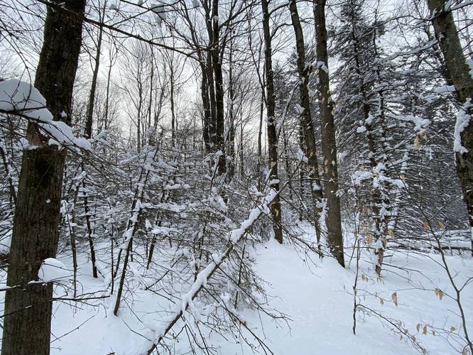
-
Obstructed view with mountains in the background (winter-only)
41.838253, -77.424439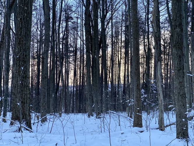
-
View Trail Map
Hiker: IronfootHiked on: December 26, 2023Distance: 4.2 miles / 6.8 km
-
View Trail Map
Hiker: outsidezion (Nate Snavely)Hiked on: June 05, 2022Distance: 2.6 miles / 4.2 km
Hazards
Seasons
AllBlaze Color


11 Trip Reports


Helpful Links
Find Hiking Trails Near Me:


Before you leave...
MyHikes is an indie web platform aimed to make exploring public trails easier for everyone. The site has no investors and is owned and operated by one person, Dave Miller (Founder & Admin). As the Founder, main contributor, and doer-of-all-things for MyHikes, I share my trips with over-detailed write-ups for fun on a volunteer basis and I believe that public trail information should be available to everyone.
It takes a lot of time 🕦, money 💰, and effort (including espresso shots ☕) to run MyHikes, including hiking , mapping , writing , and publishing new trails with high-quality content... along with building new features, moderating, site maintainance, and app development for iOS and Android . I simply ask that if you find MyHikes' trail guides helpful to please consider becoming a Supporter to help keep the site, iOS, and Android apps available to everyone.
Supporters unlock website and in-app perks with a one-time payment of $25 (you renew) 😎👍. Or you can simply make a Donation of your choice without a MyHikes user account. Otherwise, telling your friends about MyHikes is the next-best thing - both quick and free 🎉
Thanks for visiting MyHikes and have a great hike!️

Dave Miller
MyHikes Founder & Admin

