Laurel Falls Trail
Distance:
2.5 Miles / 4.0 kmType:
Out-and-BackDifficulty:
ModerateTime to Hike:
1 hour, ~15 minutesFeatures:
Surface Type:
PavedLoading...
Loading...
The Laurel Falls Trail at the Great Smoky Mountains National Park near Gatlinburg, TN is a moderate heavily-trafficked 2.5 mile out-and-back hike from Fighting Creek Gap rd to Laurel Falls - one of the Smoky's most iconic waterfalls.
The hike is very dangerous as there are many places along the trail where there are 50 to 70 foot cliffs. Some of them are right by the waterfall itself where traffic tends to pile up, so be careful. On our hike out, a group of people did not move over for us and blocked the trail in multiple dangerous places - do not be these people. Trail etiquette and space is highly recommended because people have died hiking this trail.
All dangers aside, this is one of the best day hikes in the Great Smoky Mountains because it's not a difficult hike. The entire trail is paved up to Laurel Falls, but has fallen apart in certain areas, so watch your step.
Prepare for a ton of people here. This is one of the most popular hikes at the Smokys, so the trail is often littered with people. If you like hikes with less people, Spruce Flat Falls is a much better option and quite honestly is just as good as Laurel Falls.
Dogs and biking are not allowed here.
-
Parking
35.671843, -83.580483 -
Main Trailhead
35.672135, -83.580835 -
Vista of neighboring mountains
35.672242, -83.591042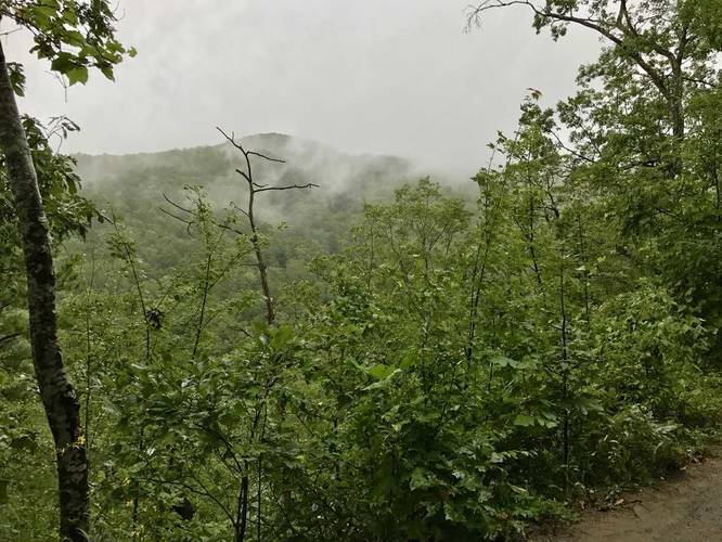
-
Laurel Falls
35.677464, -83.593164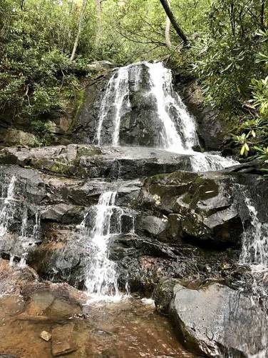
-
Laurel Falls
35.677519, -83.593192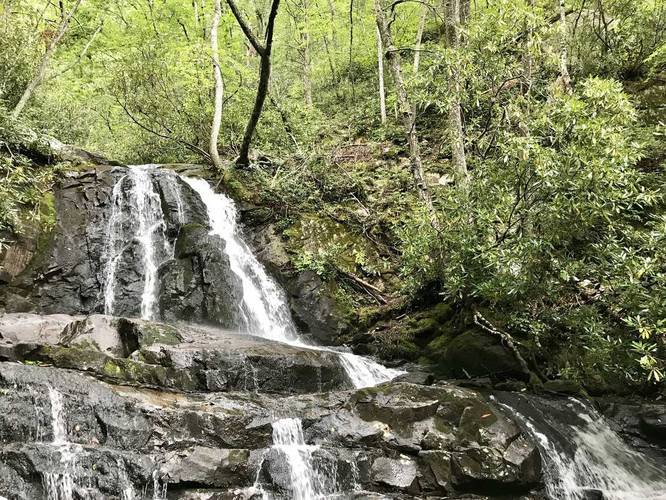
-
Laurel Falls spilling further downhill
35.677494, -83.593186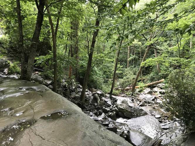
-
Laurel Falls
35.677494, -83.593186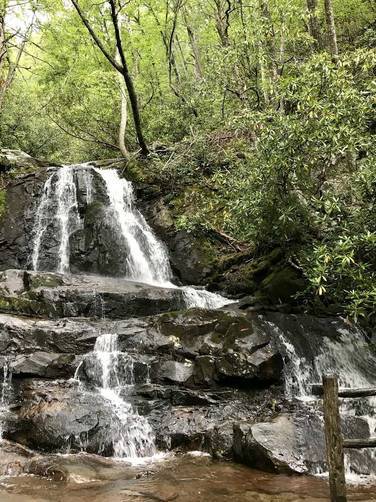
-
Laurel Falls spilling further downhill
35.677544, -83.593331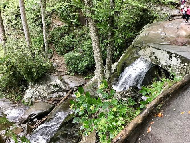
-
Vista of neighboring mountains
35.674094, -83.592347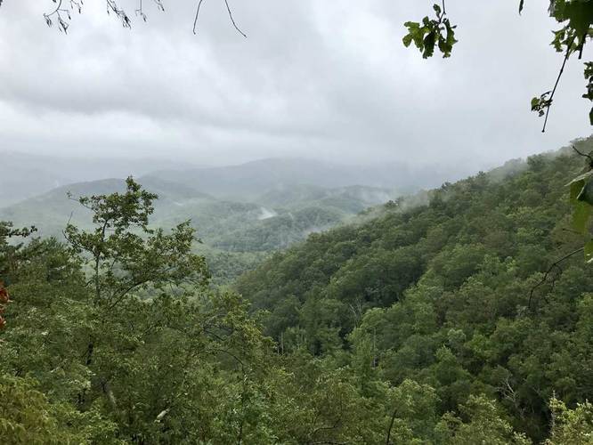
Season
Summer
3 Trip Reports


Helpful Links
Find Hiking Trails Near Me:


Before you leave...
MyHikes is an indie web platform aimed to make exploring public trails easier for everyone. The site has no investors and is owned and operated by one person, Dave Miller (Founder & Admin). As the Founder, main contributor, and doer-of-all-things for MyHikes, I share my trips with over-detailed write-ups for fun on a volunteer basis and I believe that public trail information should be available to everyone.
It takes a lot of time 🕦, money 💰, and effort (including espresso shots ☕) to run MyHikes, including hiking , mapping , writing , and publishing new trails with high-quality content... along with building new features, moderating, site maintainance, and app development for iOS and Android . I simply ask that if you find MyHikes' trail guides helpful to please consider becoming a Supporter to help keep the site, iOS, and Android apps available to everyone.
Supporters unlock website and in-app perks with a one-time payment of $25 (you renew) 😎👍. Or you can simply make a Donation of your choice without a MyHikes user account. Otherwise, telling your friends about MyHikes is the next-best thing - both quick and free 🎉
Thanks for visiting MyHikes and have a great hike!️

Dave Miller
MyHikes Founder & Admin

