Salt River Overlook Trail
Distance:
0.5 Miles / 0.8 kmType:
Out-and-BackDifficulty:
EasyTime to Hike:
~15 minutesFeatures:
Surface Type:
DirtLoading...
Loading...
The Salt River Overlook Trail at Tonto National Forest in Fort McDowell, Arizona is an easy 0.5 mile out-and-back hike from the Salt River Recreation area over to a lookout point along the Salt River.
The trail starts out at the southwest corner of the main parking lot and heads south before quickly heading back north towards the river. Shortly after taking a right-hand turn to head north, the trail will then head west and run along the Salt River to a lookout point.
Wild horses: This trail can also be used to search for wild
horses as the horses use this trail to drink from the river; however,
it's not guaranteed you'll see a wild horse. The best time of day to see
them is within the first couple of hours after sunrise or the first
couple of hours before sunset.
-
Parking
33.553171, -111.622352 -
Main Trailhead
33.552929, -111.622538 -
View of the Salt River and neighboring mountains
33.553333, -111.625144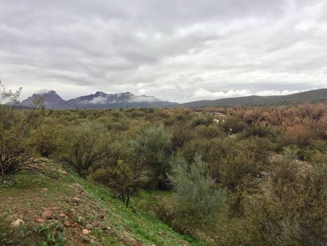
Hazards
Seasons
All
2 Trip Reports


Helpful Links
Find Hiking Trails Near Me:


Before you leave...
MyHikes is an indie web platform aimed to make exploring public trails easier for everyone. The site has no investors and is owned and operated by one person, Dave Miller (Founder & Admin). As the Founder, main contributor, and doer-of-all-things for MyHikes, I share my trips with over-detailed write-ups for fun on a volunteer basis and I believe that public trail information should be available to everyone.
It takes a lot of time 🕦, money 💰, and effort (including espresso shots ☕) to run MyHikes, including hiking , mapping , writing , and publishing new trails with high-quality content... along with building new features, moderating, site maintainance, and app development for iOS and Android . I simply ask that if you find MyHikes' trail guides helpful to please consider becoming a Supporter to help keep the site, iOS, and Android apps available to everyone.
Supporters unlock website and in-app perks with a one-time payment of $25 (you renew) 😎👍. Or you can simply make a Donation of your choice without a MyHikes user account. Otherwise, telling your friends about MyHikes is the next-best thing - both quick and free 🎉
Thanks for visiting MyHikes and have a great hike!️

Dave Miller
MyHikes Founder & Admin

