Robert Frost Trail to Mount Orient
Distance:
4.1 Miles / 6.6 kmType:
Out-and-BackDifficulty:
EasyTime to Hike:
2 hours, ~5 minutesFeatures:
Surface Type:
DirtLoading...
Loading...
The Robert Frost Trail to Mount Orient is a 4.1-mile out-and-back hike in Amherst, Massachusetts that passes through the Amethyst Brook Conservation Area.
From the top of Mount Orient, on a clear day, you'll get views of UMass and downtown Amherst. The trail is mostly a gradual incline but the last section goes up a sharper ridge than expected. The lookout is roughly 100-feet from the summit and the summit itself has no views.
Along the trail you'll also notice that there's been increased logging just beyond the
conservation area leading up the mountain. While it does open up a lot
of the area to sunlight and other features, it is a little
disappointing.
Dogs are allowed on this trail.
-
Parking
42.376403, -72.486117 -
Main Trailhead
42.376827, -72.486092 -
View / Overlook / Vista
42.386376, -72.4639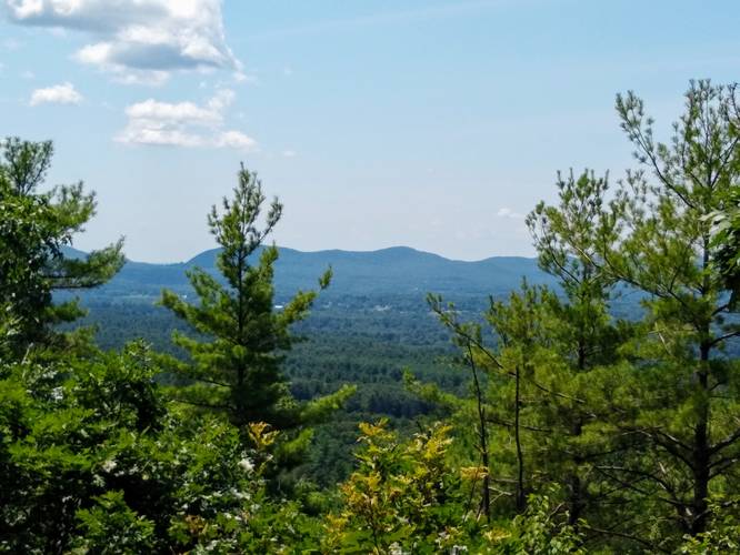
Hazards
Seasons
AllBlaze Color


Helpful Links
Find Hiking Trails Near Me:


Before you leave...
MyHikes is an indie web platform aimed to make exploring public trails easier for everyone. The site has no investors and is owned and operated by one person, Dave Miller (Founder & Admin). As the Founder, main contributor, and doer-of-all-things for MyHikes, I share my trips with over-detailed write-ups for fun on a volunteer basis and I believe that public trail information should be available to everyone.
It takes a lot of time 🕦, money 💰, and effort (including espresso shots ☕) to run MyHikes, including hiking , mapping , writing , and publishing new trails with high-quality content... along with building new features, moderating, site maintainance, and app development for iOS and Android . I simply ask that if you find MyHikes' trail guides helpful to please consider becoming a Supporter to help keep the site, iOS, and Android apps available to everyone.
Supporters unlock website and in-app perks with a one-time payment of $25 (you renew) 😎👍. Or you can simply make a Donation of your choice without a MyHikes user account. Otherwise, telling your friends about MyHikes is the next-best thing - both quick and free 🎉
Thanks for visiting MyHikes and have a great hike!️

Dave Miller
MyHikes Founder & Admin

