Roaring Plains Trail
Distance:
4.7 Miles / 7.6 kmType:
Out-and-BackDifficulty:
ModerateTime to Hike:
2 hours, ~21 minutesFeatures:
Surface Type:
DirtLoading...
Loading...
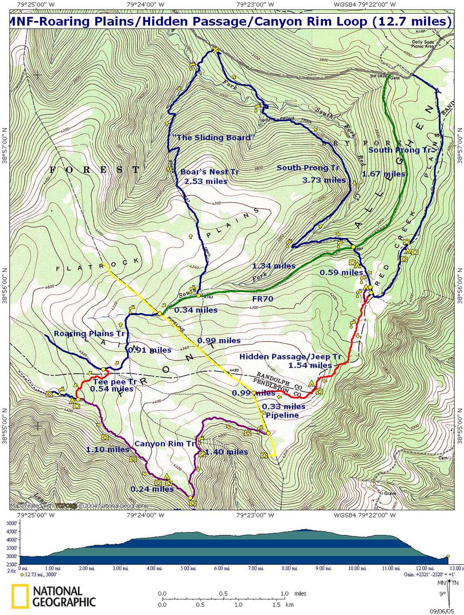
This section of the Roaring Plains Trail at the Roaring Plains Wilderness in Randolph County, West Virginia is a moderate 4.7-mile out-and-back hike to the Flatrock Plateau, a campsite with a lookout point, and amazing views of West Virginia's mountains from the Allegheny Front.
This portion of the Roaring Plains Trail ends at the campsite and lookout point 2.35-miles in from the eastern trailhead. The hike includes a great lookout point at the end and plenty of blueberries to eat along the way during June and July.
The eastern trailhead can be found along the pipeline at the end of the Roaring Plains FR-70 Trail as this is where we started our hike; however, there's a trailhead along the Flatrock Run Trail to the west as well. To reach the eastern trailhead, you first need to hike in 3.4-miles one-way along the Roaring Plains FR-70 Trail.
The woods in the beginning of the trail feel more like a jungle during the Summer, with massive ferns to the side of the trail and moss-covered everything. Shortly after, you'll start gaining elevation and you'll leave the forest behind as you start to climb up to the Flatrock Plateau.
Eventually the trail evens out and you'll be gradually hiking uphill towards the lookout points to the west. Once on the plateau, and in spots before it, you'll find plenty of blueberry bushes to snack on. There's also an amazing view of the plateau if you keep an eye out for it - stop every now and then to check your surroundings as the rocky terrain causes you to pay attention to the ground more than the scenery.
Note: The trail itself can be annoying for a couple of reasons. First, the
terrain is very rocky, which slows you down. Second, if it recently
rained, you'll find sections where you have to hop from rock to rock.
Plan on hiking slower on this trail because of the rocks.
Lookout Point: Around mile 2.1 you'll notice the rocks go away and you're hiking in the woods again. At mile 2.3 or 2.4, as the trail starts to curve to the right-hand side again, you'll notice a large clearing where you'll find 2 campsites. Just behind the campsites is a lookout point. There are likely more lookout points than this one, but we did not explore the trail any further.
Campsites: There's at least one small campsite around mile 1.5 and another close by, but there's only room for about 1 tent - or maybe a couple of hammocks.
Mileage: Please note that if you plan to reach the lookout point at mile 2.4, this will be a grand total of a 12 mile day hike as you need to hike out and you need to hike out-and-back on the Roaring Plains FR-70 Trail.
Be sure to checkout MidAtlanticHikes Roaring Plains trail map PDF.
-
Parking
38.958282, -79.362929 -
Main Trailhead
38.930091, -79.398052 -
View from Flatrock Plateau
38.924172, -79.408478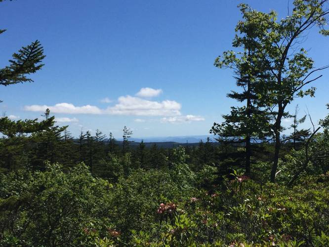
-
Campsite
38.927672, -79.415231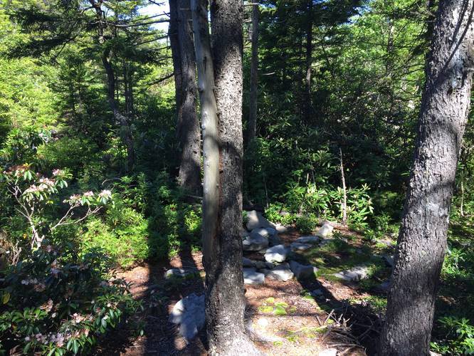
-
Campsite
38.927672, -79.415253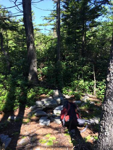
-
Lookout point behind 2 campsites
38.928792, -79.428842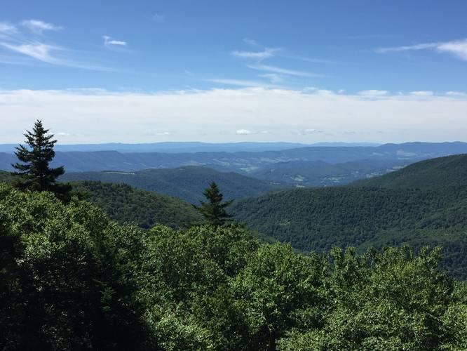
Hazards
Seasons
AllBlaze Color
1 Trip Report


Before you leave...
MyHikes is an indie web platform aimed to make exploring public trails easier for everyone. The site has no investors and is owned and operated by one person, Dave Miller (Founder & Admin). As the Founder, main contributor, and doer-of-all-things for MyHikes, I share my trips with over-detailed write-ups for fun on a volunteer basis and I believe that public trail information should be available to everyone.
It takes a lot of time 🕦, money 💰, and effort (including espresso shots ☕) to run MyHikes, including hiking , mapping , writing , and publishing new trails with high-quality content... along with building new features, moderating, site maintainance, and app development for iOS and Android . I simply ask that if you find MyHikes' trail guides helpful to please consider becoming a Supporter to help keep the site, iOS, and Android apps available to everyone.
Supporters unlock website and in-app perks with a one-time payment of $25 (you renew) 😎👍. Or you can simply make a Donation of your choice without a MyHikes user account. Otherwise, telling your friends about MyHikes is the next-best thing - both quick and free 🎉
Thanks for visiting MyHikes and have a great hike!️

Dave Miller
MyHikes Founder & Admin

