Roadside Trail
Distance:
0.4 Miles / 0.6 kmType:
One-WayDifficulty:
EasyTime to Hike:
~12 minutesFeatures:
Surface Type:
DirtLoading...
Loading...
This section of the Roadside Trail at Two Mile Run County Park in Franklin, Pennsylvania is an easy 0.4 mile one-way trail that runs along Beach Rd.
Please note that this trail continues further north along Beach Rd and ends at the fishing pier at the north shore of Justus Lake; however, this trail is generally used to hike back from the Seneca Trail.
The Roadside Trail is blazed blue and passed through a coniferous forest before reaching the the Beachside shelter at the end of Beach Rd.
Parking: Parking can be found at the end of Beach Rd at the main parking lot or at the fishing pier along Beach Rd at the north section of Justus Lake.
Dogs and biking are both allowed on this trail.
-
Parking
41.476084, -79.769679 -
Main Trailhead
41.4817, -79.769915 -
View above Two Mile Run Reservoir
41.480014, -79.769828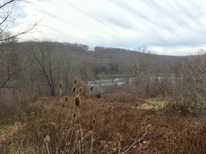
Hazards
Seasons
AllBlaze Color
1 Trip Report


Helpful Links
Find Hiking Trails Near Me:


")

Before you leave...
MyHikes is an indie web platform aimed to make exploring public trails easier for everyone. The site has no investors and is owned and operated by one person, Dave Miller (Founder & Admin). As the Founder, main contributor, and doer-of-all-things for MyHikes, I share my trips with over-detailed write-ups for fun on a volunteer basis and I believe that public trail information should be available to everyone.
It takes a lot of time 🕦, money 💰, and effort (including espresso shots ☕) to run MyHikes, including hiking , mapping , writing , and publishing new trails with high-quality content... along with building new features, moderating, site maintainance, and app development for iOS and Android . I simply ask that if you find MyHikes' trail guides helpful to please consider becoming a Supporter to help keep the site, iOS, and Android apps available to everyone.
Supporters unlock website and in-app perks with a one-time payment of $25 (you renew) 😎👍. Or you can simply make a Donation of your choice without a MyHikes user account. Otherwise, telling your friends about MyHikes is the next-best thing - both quick and free 🎉
Thanks for visiting MyHikes and have a great hike!️

Dave Miller
MyHikes Founder & Admin

