Reservation Road Trail
Distance:
0.7 Miles / 1.1 kmType:
One-WayDifficulty:
EasyTime to Hike:
~21 minutesFeatures:
Surface Type:
DirtLoading...
Loading...
The Reservation Road Trail at the Mount Tom State Reservation in Holyoke, Massachusetts is the main road that cuts through the park, but also a great walking and hiking trail.
While this road is mainly for driving across the park, it is an enjoyable walk as well. This particular sections offers beautiful views of some smaller cliffs along a brook with small waterfalls. The road also gains access to several trails including the T Bag Trail and Link Trail.
Parking: Parking can be found at the trailhead and parking marker provided. Follow the road north and finally west to reach the small waterfalls and other trails at the park.
Pets
Dogs are allowed if leashed and their waste must be carried out by the hiker.
Hazards
Seasons
All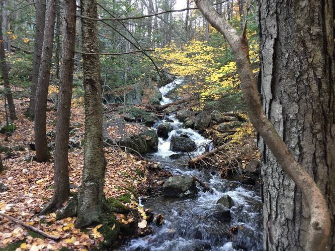
1 Trip Report


Helpful Links
Find Hiking Trails Near Me:


Before you leave...
MyHikes is an indie web platform aimed to make exploring public trails easier for everyone. The site has no investors and is owned and operated by one person, Dave Miller (Founder & Admin). As the Founder, main contributor, and doer-of-all-things for MyHikes, I share my trips with over-detailed write-ups for fun on a volunteer basis and I believe that public trail information should be available to everyone.
It takes a lot of time 🕦, money 💰, and effort (including espresso shots ☕) to run MyHikes, including hiking , mapping , writing , and publishing new trails with high-quality content... along with building new features, moderating, site maintainance, and app development for iOS and Android . I simply ask that if you find MyHikes' trail guides helpful to please consider becoming a Supporter to help keep the site, iOS, and Android apps available to everyone.
Supporters unlock website and in-app perks with a one-time payment of $25 (you renew) 😎👍. Or you can simply make a Donation of your choice without a MyHikes user account. Otherwise, telling your friends about MyHikes is the next-best thing - both quick and free 🎉
Thanks for visiting MyHikes and have a great hike!️

Dave Miller
MyHikes Founder & Admin

