Pine Trail
Distance:
0.4 Miles / 0.6 kmType:
Out-and-BackDifficulty:
EasyTime to Hike:
~12 minutesFeatures:
Surface Type:
DirtLoading...
Loading...
The Pine Trail at Tioga State Forest near Morris, Pennsylvania is an easy 0.4-mile out-and-back trail that connects the West Rim Trail (WRT) to West Rim Rd.
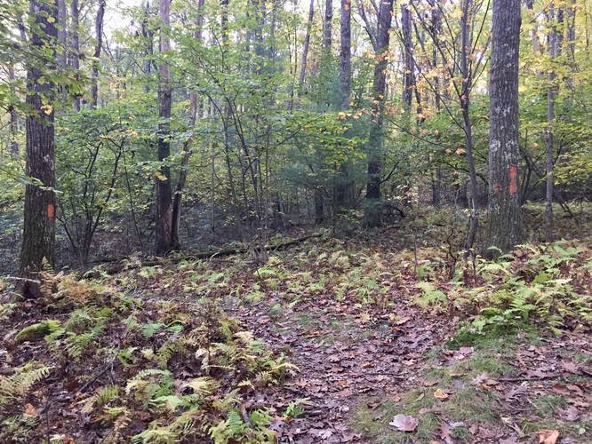
This short trail does not have anything to see or any interesting features, but it's an easy hike to connect into this section of the WRT. The trail follows yellow blazes until it reaches its eastern terminus where the blazes turn to orange along the WRT.
Camping
Backpackers can technically camp along this trail, but there are no designated campsites. Follow the rules and regulations of the state forest when camping near trails.
Parking
The parking area for this trail is not really existent, but cars can pull over on West Rim Rd to allow other vehicles to pass, since there's enough room to park alongside the road. Do not block the gate to the trail.
Pets
Dogs are allowed if leashed and their waste must be carried out by the hiker.
Winter Road Conditions
Tioga State Forest does not maintain this road during the
winter. Do not attempt driving on this road without proper equipment
including snow tires and/or chains unless the road is clear. High wind
storms may also cause trees to fall across the road, making the road
impassible. If you plan to visit during the winter, plan accordingly.
Hazards
Seasons
AllBlaze Color
2 Trip Reports


Before you leave...
MyHikes is an indie web platform aimed to make exploring public trails easier for everyone. The site has no investors and is owned and operated by one person, Dave Miller (Founder & Admin). As the Founder, main contributor, and doer-of-all-things for MyHikes, I share my trips with over-detailed write-ups for fun on a volunteer basis and I believe that public trail information should be available to everyone.
It takes a lot of time 🕦, money 💰, and effort (including espresso shots ☕) to run MyHikes, including hiking , mapping , writing , and publishing new trails with high-quality content... along with building new features, moderating, site maintainance, and app development for iOS and Android . I simply ask that if you find MyHikes' trail guides helpful to please consider becoming a Supporter to help keep the site, iOS, and Android apps available to everyone.
Supporters unlock website and in-app perks with a one-time payment of $25 (you renew) 😎👍. Or you can simply make a Donation of your choice without a MyHikes user account. Otherwise, telling your friends about MyHikes is the next-best thing - both quick and free 🎉
Thanks for visiting MyHikes and have a great hike!️

Dave Miller
MyHikes Founder & Admin

