Picnic Point Loop
Distance:
0.4 Miles / 0.6 kmType:
LoopDifficulty:
EasyTime to Hike:
~12 minutesFeatures:
Surface Type:
DirtLoading...
Loading...
The Picnic Point Loop on Peaks Island, Maine is an easy 0.4-mile loop / lollipop walk that features views of Portland, Catnip Island, Cushing Island, Whitehead Passage, and Hadlock Cove.
Walk Description
This short hike leads out to Picnic Point, passing rocky beaches along the way on each cove. To the east, walkers will find views of Hadlock Cove. To the west cove, located in Casco Bay, are views of downtown Portland along with a funny-named island named Catnip Island. If you walk around the bend, assuming during low tide, you'll find tide pools within the bedrock along with views of Whitehead Passage. The trail then continues back on the upper land of Picnic Point, passing through the forest along a skinny path. There are more views from here, including views of Hadlock Cove. The trail then passes both rocky beaches and reaches the trailhead for a 0.4-mile walk.
During high tide, this walk is a bit shorter since you can't meander around on the bedrock as much.
Parking
If driving, there are some small parking
turnouts near the coordinates provided on Hadlock Point Road. The parking turnouts are mostly
for golf carts, which can be rented on the island.
Pets
Dogs are allowed if leashed and should be cleaned up after.
Getting to and Getting Around Peaks Island
To access Peaks Island, travelers must buy a ticket from Casco Bay Lines
to hitch a ride on the ferry in Portland. Peaks Island ferry runs on a
different schedule each season and year. Please use this Casco Bay Lines link
to find out more about when the ferry leaves Portland and/or Peaks
Island to plan your trip. As of July 2023, the price for a ticket to
Peaks Island cost $7 for one adult and there's no return fee as the trip
from Peaks Island to Portland is free. Visitors can pay more money to
bring their cars, however, folks that bring vehicles to Peaks Island are
generally locals. Instead, visitors can either plan to walk/hike the
island or they can rent golf carts for a moderate hourly fee on the
island. Each golf cart rental business, as of July 2023, is located
right off of the dock where the ferry drops passengers off on the
island. On our trip we used Mike's Carts
which cost $50/hour to rent the golf cart for up to 5 hours max. Mike's
Carts, as of July 2023, did not require prior reservations, however,
any first-come first-serve carts might sell out by late morning. There's
another company called Peaks Island Golf Carts
which require a reservation in advance. Last, weekends on Peaks Island -
especially during the Summer - can be very very busy. If you wish to
explore Peaks Island without a massive crowd, plan on a quiet weekday.
-
Parking
43.652283, -70.194936 -
Main Trailhead
43.652283, -70.194936 -
Hadlock Cove view
43.652142, -70.195053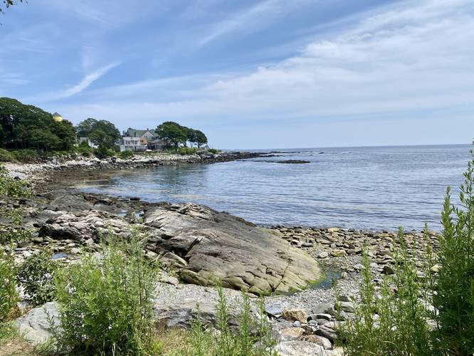
-
View of Portland from Picnic Point
43.651158, -70.195039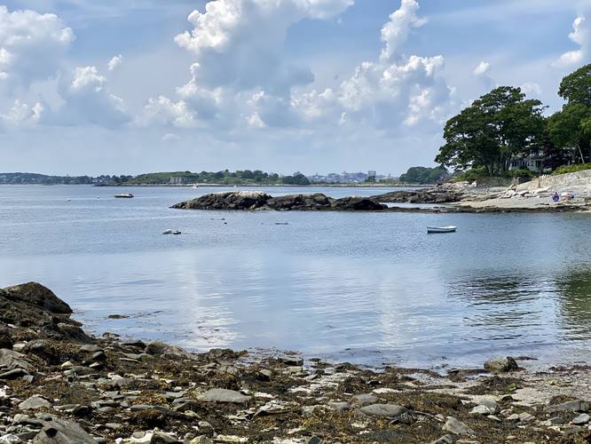
-
Picnic Point tide pool
43.650558, -70.194297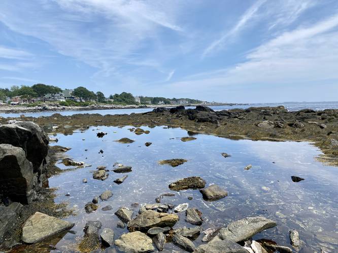
-
View of Catnip Island from Picnic Point
43.650794, -70.194581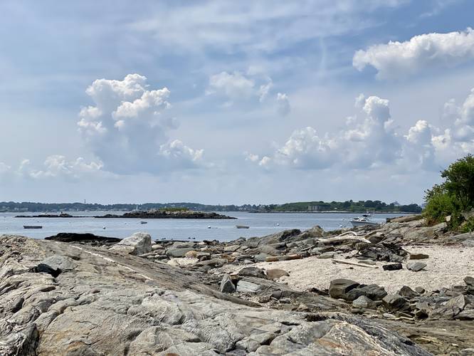
-
Hadlock Cove View from Picnic Point
43.6511, -70.194619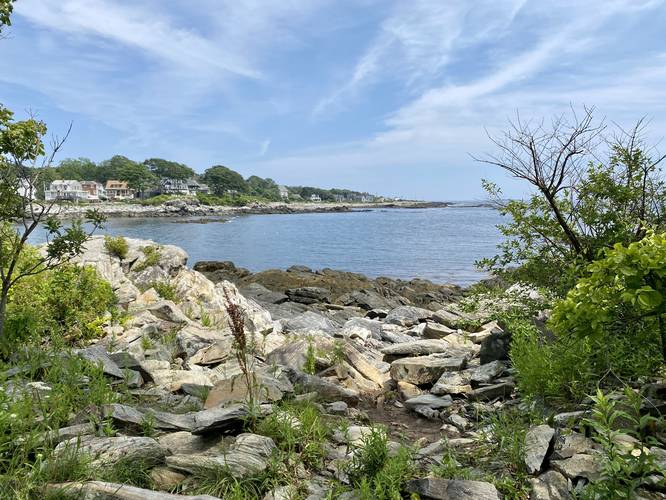
Hazards
Seasons
All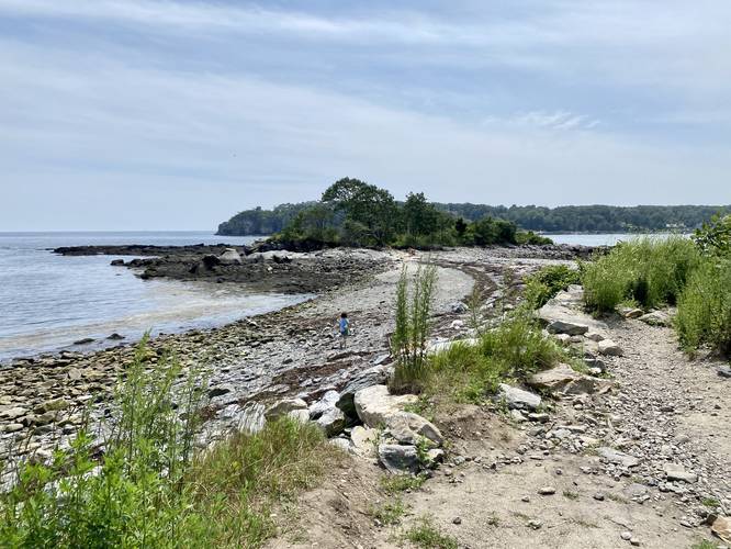
2 Trip Reports


Helpful Links
Find Hiking Trails Near Me:


Before you leave...
MyHikes is an indie web platform aimed to make exploring public trails easier for everyone. The site has no investors and is owned and operated by one person, Dave Miller (Founder & Admin). As the Founder, main contributor, and doer-of-all-things for MyHikes, I share my trips with over-detailed write-ups for fun on a volunteer basis and I believe that public trail information should be available to everyone.
It takes a lot of time 🕦, money 💰, and effort (including espresso shots ☕) to run MyHikes, including hiking , mapping , writing , and publishing new trails with high-quality content... along with building new features, moderating, site maintainance, and app development for iOS and Android . I simply ask that if you find MyHikes' trail guides helpful to please consider becoming a Supporter to help keep the site, iOS, and Android apps available to everyone.
Supporters unlock website and in-app perks with a one-time payment of $25 (you renew) 😎👍. Or you can simply make a Donation of your choice without a MyHikes user account. Otherwise, telling your friends about MyHikes is the next-best thing - both quick and free 🎉
Thanks for visiting MyHikes and have a great hike!️

Dave Miller
MyHikes Founder & Admin

