Orange Trail
Distance:
0.4 Miles / 0.6 kmType:
One-WayDifficulty:
EasyTime to Hike:
~12 minutesFeatures:
Surface Type:
DirtLoading...
Loading...
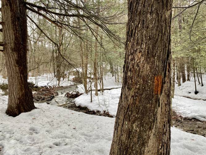
The Orange Trail at Two Rivers State Park near Waverly, New York is an easy 0.4-mile one-way trail that runs along a tributary creek that leads into Dry Brook creek.
This recording begins at the eastern-most (or bottom-of-the-hill) trailhead - along the Yellow Trail. The Orange Trail follows the same path as the Red Trail at the park, but instead of crossing the tributary creek to follow the red blazes, hikers will stay along the high banks next to the creek as the trail makes its way back uphill.
The trail follows the banks of the creek almost the entire way back uphill until it connects back to the Yellow Trail. This trail is rated as easy because of the low elevation grade and distance.
Hikers can also connect to the Blue Trail near either trailhead to continue exploring the park.
Parking
Hikers will find a large parking lot at the coordinates provided. The lot is large enough to fit over a dozen vehicles.
Restrooms
Public restrooms can be found at the trailhead.
Pets
Dogs are allowed if leashed and their waste must be carried out by the hiker.
Biking
Mountain biking does appear to be permitted along this trail.
Hazards
Seasons
AllBlaze Color
2 Trip Reports


Before you leave...
MyHikes is an indie web platform aimed to make exploring public trails easier for everyone. The site has no investors and is owned and operated by one person, Dave Miller (Founder & Admin). As the Founder, main contributor, and doer-of-all-things for MyHikes, I share my trips with over-detailed write-ups for fun on a volunteer basis and I believe that public trail information should be available to everyone.
It takes a lot of time 🕦, money 💰, and effort (including espresso shots ☕) to run MyHikes, including hiking , mapping , writing , and publishing new trails with high-quality content... along with building new features, moderating, site maintainance, and app development for iOS and Android . I simply ask that if you find MyHikes' trail guides helpful to please consider becoming a Supporter to help keep the site, iOS, and Android apps available to everyone.
Supporters unlock website and in-app perks with a one-time payment of $25 (you renew) 😎👍. Or you can simply make a Donation of your choice without a MyHikes user account. Otherwise, telling your friends about MyHikes is the next-best thing - both quick and free 🎉
Thanks for visiting MyHikes and have a great hike!️

Dave Miller
MyHikes Founder & Admin

