Old Supply Trail
Distance:
7.3 Miles / 11.7 kmType:
Out-and-BackDifficulty:
EasyTime to Hike:
3 hours, ~39 minutesFeatures:
Surface Type:
DirtLoading...
Loading...
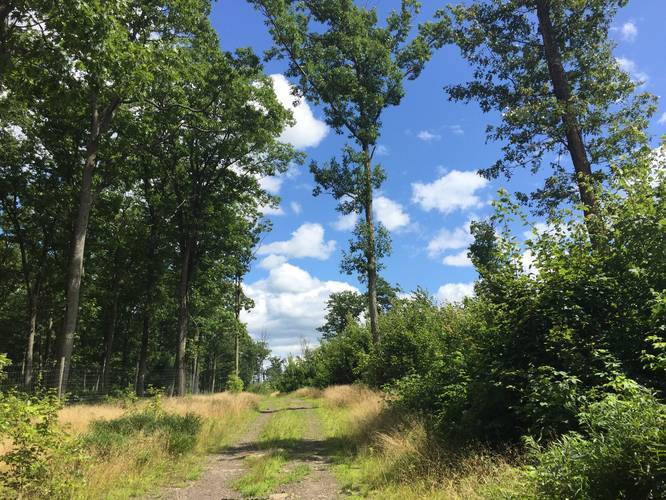
The Old Supply Trail at Tioga State Forest in Gaines, Pennsylvania is an easy 7.3-mile out-and-back trail that runs along a mountain ridge between Gaines and Ansonia.
This trail is a drive-able (for forest service vehicles), so the trail itself is easy to follow and generally is not overgrown, even in the Summer. This recording begins at the western trailhead and follows the red blazes (and red/orange arrows) east along the Old Supply Trail to where the trail terminates along Goodall Road.
There is not much to see on the trail except for a large clear-cut area which can be found roughly 1-mile from the western trailhead. This clear-cut area was likely used for logging, but it left the top of the mountain with an interesting landscape.
You'll also find a couple of fenced off areas where the state forest has blocked off access to. There was no signage for why these fences are up, but likely to help the forest regrow after previous logging.
Trail Blazes
Please note that this trail follows newly painted red blazes. It also uses red/orange arrows to help point the way - this is because the trail has a couple of forks which head to the same place. It's best to follow the arrows rather than the blazes, since the arrows will bring you along the well-maintained portion of the trail. If you ignore the arrows and only follow the blazes, you'll end up hiking through some overgrowth.
Bugs
This trail can be buggy, so plan to bring bug spray.
Parking
Parking can be found at the coordinates provided, along Left Asaph Road. You can also park at the eastern trailhead, but the parking lot is only large enough for one vehicle. The parking lot at the western trailhead has room for about three vehicles.
Pets
Dogs are allowed if leashed and their waste must be carried out by the hiker.
Biking
Biking is allowed on this trail.
Camping
While camping is technically allowed in this section of Tioga State Forest, there aren't any obvious places to camp along this trail; however, there are likely plenty of places to setup a tent if you look hard enough. All backpackers and campers must follow the Tioga State Forest dispersed/primitive/backcountry camping rules.
Winter Road Conditions
Tioga State Forest does not maintain this road during the
winter. Do not attempt driving on this road without proper equipment
including snow tires and/or chains unless the road is clear. High wind
storms may also cause trees to fall across the road, making the road
impassible. If you plan to visit during the winter, plan accordingly.
Hazards
Seasons
AllBlaze Color
2 Trip Reports


Before you leave...
MyHikes is an indie web platform aimed to make exploring public trails easier for everyone. The site has no investors and is owned and operated by one person, Dave Miller (Founder & Admin). As the Founder, main contributor, and doer-of-all-things for MyHikes, I share my trips with over-detailed write-ups for fun on a volunteer basis and I believe that public trail information should be available to everyone.
It takes a lot of time 🕦, money 💰, and effort (including espresso shots ☕) to run MyHikes, including hiking , mapping , writing , and publishing new trails with high-quality content... along with building new features, moderating, site maintainance, and app development for iOS and Android . I simply ask that if you find MyHikes' trail guides helpful to please consider becoming a Supporter to help keep the site, iOS, and Android apps available to everyone.
Supporters unlock website and in-app perks with a one-time payment of $25 (you renew) 😎👍. Or you can simply make a Donation of your choice without a MyHikes user account. Otherwise, telling your friends about MyHikes is the next-best thing - both quick and free 🎉
Thanks for visiting MyHikes and have a great hike!️

Dave Miller
MyHikes Founder & Admin

